National Register of Historic Places listings in Montgomery County, Tennessee
This is a list of the National Register of Historic Places listings in Montgomery County, Tennessee.
Location of Montgomery County in Tennessee
This is intended to be a complete list of the properties and districts on the National Register of Historic Places in Montgomery County, Tennessee, United States. Latitude and longitude coordinates are provided for many National Register properties and districts; these locations may be seen together in a map.[1]
There are 53 properties and districts listed on the National Register in the county. Another 4 properties were once listed but have been removed.
| Anderson – Bedford – Benton – Bledsoe – Blount – Bradley – Campbell – Cannon – Carroll – Carter – Cheatham – Chester – Claiborne – Clay – Cocke – Coffee – Crockett – Cumberland – Davidson – Decatur – DeKalb – Dickson – Dyer – Fayette – Fentress – Franklin – Gibson – Giles – Grainger – Greene – Grundy – Hamblen – Hamilton – Hancock – Hardeman – Hardin – Hawkins – Haywood – Henderson – Henry – Hickman – Houston – Humphreys – Jackson – Jefferson – Johnson – Knox – Lake – Lauderdale – Lawrence – Lewis – Lincoln – Loudon – Macon – Madison – Marion – Marshall – Maury – McMinn – McNairy – Meigs – Monroe – Montgomery – Moore – Morgan – Obion – Overton – Perry – Pickett – Polk – Putnam – Rhea – Roane – Robertson – Rutherford – Scott – Sequatchie – Sevier – Shelby – Smith – Stewart – Sullivan – Sumner – Tipton – Trousdale – Unicoi – Union – Van Buren – Warren – Washington – Wayne – Weakley – White – Williamson – Wilson |
- This National Park Service list is complete through NPS recent listings posted January 29, 2021.[2]
Current listings
| [3] | Name on the Register[4] | Image | Date listed[5] | Location | City or town | Description |
|---|---|---|---|---|---|---|
| 1 | Allen House | October 3, 1978 (#78002619) |
North of Clarksville on Allen-Griffey Rd.; also 2401 and 2409 Allen Griffey Rd. 36°36′12″N 87°22′16″W |
Clarksville | Second set of addresses represents a boundary increase of March 27, 2013 | |
| 2 | Bethlehem Methodist Church and Cemetery | .jpg.webp) Bethlehem Methodist Church and Cemetery |
June 10, 1994 (#94000576) |
Western side of Gholson Rd. about 0.5 miles (0.80 km) south of its junction with Grafton Rd. 36°27′52″N 87°16′33″W |
Clarksville | |
| 3 | Catholic Church and Rectory | 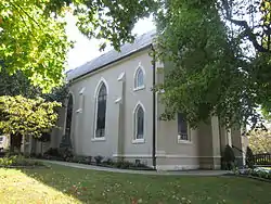 Catholic Church and Rectory |
August 2, 1982 (#82004032) |
716 Franklin St. 36°31′44″N 87°21′03″W |
Clarksville | |
| 4 | Clarksville Architectural District | 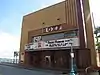 Clarksville Architectural District |
May 13, 1976 (#76001791) |
Public Sq., Legion, 3rd, Franklin, and Commerce Sts. 36°31′38″N 87°21′36″W |
Clarksville | |
| 5 | Clarksville Federal Building |  Clarksville Federal Building |
June 13, 1972 (#72001246) |
200 S. 2nd St.[6] 36°31′34″N 87°21′30″W |
Clarksville | Now used as the Customs House Museum & Cultural Center |
| 6 | Clarksville Foundry and Machine Works Office | 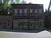 Clarksville Foundry and Machine Works Office |
November 25, 1987 (#87002007) |
96 Commerce St. 36°31′32″N 87°21′40″W |
Clarksville | |
| 7 | Clarksville High School | 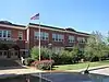 Clarksville High School |
December 8, 1983 (#83004281) |
Greenwood Ave. 36°31′31″N 87°20′56″W |
Clarksville | |
| 8 | Clarksville Industrial District | 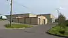 Clarksville Industrial District |
April 30, 1976 (#76002295) |
Bounded by Washington St., Crossland Ave., the Illinois Central railroad line, and the Cumberland River 36°31′24″N 87°21′44″W |
Clarksville | |
| 9 | Clarksville Methodist Church | 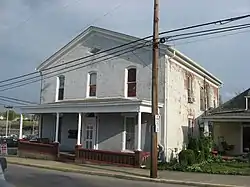 Clarksville Methodist Church |
April 6, 1982 (#82004033) |
334 Main St. 36°31′46″N 87°21′24″W |
Clarksville | |
| 10 | Cloverlands | .jpg.webp) Cloverlands |
January 8, 1979 (#79002451) |
North of St. Bethlehem on Clarksville-Trenton Rd. 36°38′20″N 87°19′35″W |
St. Bethlehem | |
| 11 | Country Woman's Club | .jpg.webp) Country Woman's Club |
July 5, 2006 (#06000549) |
2216 Old Russellville Pike 36°34′00″N 87°18′07″W |
Clarksville | |
| 12 | Dog Hill Architectural District | 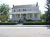 Dog Hill Architectural District |
May 9, 1980 (#80003849) |
Munford Ave., 1st, Union, Madison, and 2nd Sts. 36°31′26″N 87°21′34″W |
Clarksville | |
| 13 | Dunlop Milling Company | February 12, 1999 (#99000213) |
1138 Franklin St. 36°31′54″N 87°20′31″W |
Clarksville | ||
| 14 | Emerald Hill | 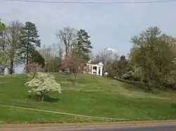 Emerald Hill |
July 14, 1971 (#71000826) |
N. 2nd St. 36°32′22″N 87°21′41″W |
Clarksville | |
| 15 | First Presbyterian Church | 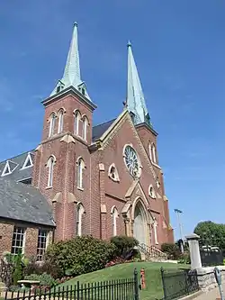 First Presbyterian Church |
April 30, 1976 (#76001793) |
213 Main St. 36°31′45″N 87°21′31″W |
Clarksville | |
| 16 | First Presbyterian Church Manse | 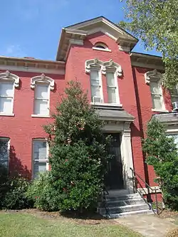 First Presbyterian Church Manse |
August 31, 2001 (#01000929) |
305 Main St. 36°31′45″N 87°21′28″W |
Clarksville | |
| 17 | Forbes-Mabry House | 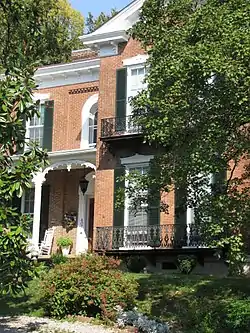 Forbes-Mabry House |
January 12, 1995 (#94001544) |
607 N. 2nd St. 36°32′07″N 87°21′38″W |
Clarksville | |
| 18 | Fort Defiance CSA/Fort Bruce USA | .jpg.webp) Fort Defiance CSA/Fort Bruce USA |
February 4, 1982 (#82004036) |
120 Duncan St.[7] 36°32′28″N 87°22′25″W |
New Providence | |
| 19 | Glenwood Historic District | 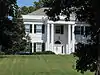 Glenwood Historic District |
November 29, 1996 (#96001405) |
101-109 Glenwood Dr., 110-182 E. Glenwood Dr., and 111-179 W. Glenwood Dr. 36°31′33″N 87°20′21″W |
Clarksville | |
| 20 | Golden Hill Cemetery | November 21, 2001 (#01001261) |
Seven Mile Ferry Rd. 36°30′11″N 87°20′30″W |
Clarksville | ||
| 21 | Gracey-Woodward Furnace (40MT378) | November 25, 1987 (#87002003) |
Address Restricted |
Clarksville | ||
| 22 | Guildfield Missionary Baptist Church | March 24, 2003 (#03000151) |
Guildfield Church Rd. 36°38′25″N 87°10′19″W |
South Guthrie | ||
| 23 | Johnson-Hach House |  Johnson-Hach House |
December 10, 1998 (#98001507) |
403 Greenwood Ave. 36°31′28″N 87°20′49″W |
Clarksville | |
| 24 | Lafayette Furnace (40MT372) | November 25, 1987 (#87002000) |
Address Restricted |
Southside | ||
| 25 | Louisa Furnace (40MT379) | January 12, 1988 (#87002004) |
Address Restricted |
Slayden | ||
| 26 | Madison Street Historic District | 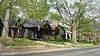 Madison Street Historic District |
November 22, 1999 (#99001393) |
Along Madison St.[8] 36°31′29″N 87°20′32″W |
Clarksville | |
| 27 | Madison Street Methodist Church | 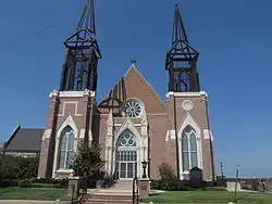 Madison Street Methodist Church |
May 13, 1976 (#76001794) |
319 Madison St. 36°31′33″N 87°21′22″W |
Clarksville | |
| 28 | McCauley Hill Farm | March 30, 1995 (#95000268) |
1535 Harville Rd. 36°27′21″N 87°16′29″W |
Clarksville | ||
| 29 | Mt. Olive Cemetery |  Mt. Olive Cemetery |
November 16, 2020 (#100005789) |
951 Cumberland Dr. 36°30′39″N 87°21′18″W |
Clarksville | |
| 30 | Northington-Beach House | 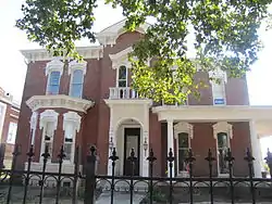 Northington-Beach House |
July 19, 2001 (#01000758) |
512 Madison St. 36°31′33″N 87°21′13″W |
Clarksville | |
| 31 | Oak Top | 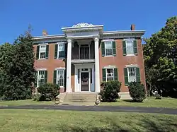 Oak Top |
July 8, 1980 (#80003850) |
107 Madison Terrace 36°31′21″N 87°20′15″W |
Clarksville | |
| 32 | Old Post House | 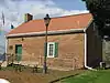 Old Post House |
March 8, 1978 (#78002621) |
North of Clarksville on U.S. Route 41A 36°38′06″N 87°26′09″W |
Clarksville | |
| 33 | Poplar Spring Furnace (40MT376) | January 12, 1988 (#87002002) |
Address Restricted |
Needmore | ||
| 34 | Port Royal Road |  Port Royal Road |
December 12, 2006 (#06001131) |
North of the Red River junction west of State Route 238, adjacent to the modern Port Royal Rd. 36°33′25″N 87°08′33″W |
Port Royal | |
| 35 | Poston Block | .jpg.webp) Poston Block |
June 13, 1972 (#72001247) |
Main St. and Public Square 36°31′41″N 87°21′43″W |
Clarksville | |
| 36 | Samuel Rexinger House | 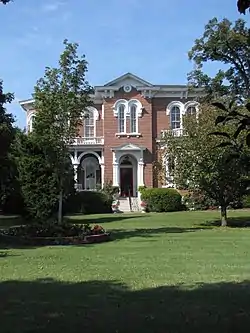 Samuel Rexinger House |
April 13, 1977 (#77001284) |
703 E. College St. 36°31′57″N 87°21′06″W |
Clarksville | |
| 37 | Riverview | March 26, 1979 (#79002450) |
West of Clarksville on Cumberland Heights Rd. 36°30′13″N 87°22′51″W |
Clarksville | ||
| 38 | RiverView Mounds Archeological Site | March 4, 2009 (#09000116) |
1715 Boyd Rinehart Rd. 36°27′11″N 87°17′50″W |
Clarksville | The site is a multi-mound complex with two platform mounds and associated cemetery and village areas. Although not a large site, it is important for its informational value because of its preservation. The site is currently part of the "RiverView Mounds Family Fun Farm" and is available for public viewing and tours.[9] | |
| 39 | Alfred A. Robb House | 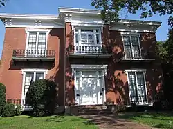 Alfred A. Robb House |
September 22, 2000 (#00001162) |
529 York St. 36°32′10″N 87°21′35″W |
Clarksville | |
| 40 | Sailor's Rest Furnace (40MT375) | November 25, 1987 (#87002001) |
Address Restricted |
Shiloh | ||
| 41 | St. Peter African Methodist Church | 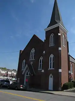 St. Peter African Methodist Church |
April 6, 1982 (#82004034) |
518 Franklin St. 36°31′42″N 87°21′14″W |
Clarksville | |
| 42 | Sevier Station | May 6, 1971 (#71000827) |
Walker St., south of B St. 36°32′38″N 87°22′29″W |
Clarksville | ||
| 43 | Christopher H. Smith House | March 8, 1988 (#88000173) |
Spring and McClure Sts. 36°32′04″N 87°21′50″W |
Clarksville | ||
| 44 | Smith-Hoffman House | August 22, 1977 (#77001285) |
Beech and A Sts. 36°32′33″N 87°22′42″W |
Clarksville | ||
| 45 | Sulphur Fork Bridge | 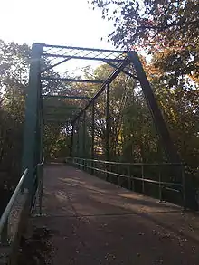 Sulphur Fork Bridge |
July 20, 2020 (#100005366) |
3300 Old Clarksville Hwy. over the Sulphur Fork of the Red River (Port Royal State Park) 36°33′15″N 87°08′25″W |
Adams | |
| 46 | Tennessee Furnace (40MT383) | November 25, 1987 (#87002006) |
Address Restricted |
McAllisters Crossroad | ||
| 47 | Tip Top | 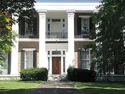 Tip Top |
July 15, 1998 (#97001566) |
15 Trahern Terrace 36°31′29″N 87°20′13″W |
Clarksville | |
| 48 | Trinity Church and Rectory | 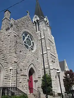 Trinity Church and Rectory |
April 6, 1982 (#82004035) |
317 Franklin St. 36°31′41″N 87°21′26″W |
Clarksville | |
| 49 | Washington Furnace and Forge (40MT382) | January 12, 1988 (#87002005) |
Address Restricted |
Excell | ||
| 50 | White Chapel | .JPG.webp) White Chapel |
June 26, 1986 (#86001395) |
Rossview Rd. 36°33′43″N 87°13′40″W |
Rossview | |
| 51 | Whitehall | January 31, 1978 (#78002622) |
Northwest of Clarksville off State Route 12 on Mill Rd. 36°35′49″N 87°24′58″W |
Clarksville | ||
| 52 | Sanford Wilson House | .jpg.webp) Sanford Wilson House |
September 13, 1978 (#78002623) |
Old Ashland City Highway 36°26′22″N 87°13′08″W |
Fredonia | |
| 53 | Yellow Creek Furnace and Forge (40MT371) | January 12, 1988 (#87001999) |
Address Restricted |
Needmore |
Former listings
| [3] | Name on the Register | Image | Date listed | Date removed | Location | City or town | Summary |
|---|---|---|---|---|---|---|---|
| 1 | Drane-Foust House | July 7, 1988 (#88001023) | January 29, 2013 | 319 Home Ave. |
Clarksville | ||
| 2 | Home Infirmary | August 24, 1978 (#78002620) | July 24, 2008 | Riverside Dr. and Current St. |
Clarksville | ||
| 3 | Minglewood Farm | October 15, 1987 (#87001856) | March 10, 2009 | 1650 Hopkinsville Highway 36°34′41″N 87°24′43″W |
Clarksville | ||
| 4 | Ringgold Mill Complex | July 8, 1980 (#80003851) | December 18, 2013 | Northwest of Clarksville on Mill Rd. 36°35′59″N 87°25′13″W |
Clarksville |
See also
| Wikimedia Commons has media related to National Register of Historic Places in Montgomery County, Tennessee. |
References
- The latitude and longitude information provided in this table was derived originally from the National Register Information System, which has been found to be fairly accurate for about 99% of listings. Some locations in this table may have been corrected to current GPS standards.
- "National Register of Historic Places: Weekly List Actions". National Park Service, United States Department of the Interior. Retrieved on January 29, 2021.
- Numbers represent an alphabetical ordering by significant words. Various colorings, defined here, differentiate National Historic Landmarks and historic districts from other NRHP buildings, structures, sites or objects.
- "National Register Information System". National Register of Historic Places. National Park Service. April 24, 2008.
- The eight-digit number below each date is the number assigned to each location in the National Register Information System database, which can be viewed by clicking the number.
- "Our History". Customs House Museum & Cultural Center. Retrieved April 10, 2016.
- "[pqasb.pqarchiver.com/theleafchronicle/doc/1034540623.html Fort Defiance to Host Living History Weekend]". The Leaf Chronicle 2012-08-21. Accessed 2014-04-26.
- Location derived from its name and coordinates; the NRIS lists it as "Address Restricted" but provides the coordinates
- "RiverView Mounds:Mississippian Mounds". Archived from the original on 2013-01-04. Retrieved 2012-11-22.
Further reading
- Beach, Ursula S. Montgomery County. Tennessee County History Series: Robert B. Jones, ed. Memphis: Memphis State UP, 1988.
| Topics | |
|---|---|
| Lists by state |
|
| Lists by insular areas | |
| Lists by associated state | |
| Other areas | |
| Related | |
| |
Municipalities and communities of Montgomery County, Tennessee, United States | ||
|---|---|---|
| City | Montgomery County map | |
| Unincorporated communities | ||
| Military base | ||
| Ghost town | ||
| ||
This article is issued from Wikipedia. The text is licensed under Creative Commons - Attribution - Sharealike. Additional terms may apply for the media files.