National Register of Historic Places listings in Williamson County, Tennessee
This is a list of the National Register of Historic Places listings in Williamson County, Tennessee.
Location of Williamson County in Tennessee
This is intended to be a complete list of the properties and districts on the National Register of Historic Places in Williamson County, Tennessee, United States. Latitude and longitude coordinates are provided for many National Register properties and districts; these locations may be seen together in a map.[1]
There are 134 properties and districts listed on the National Register in the county, including 2 National Historic Landmarks. Another 14 properties were once listed but have been removed.
| Anderson – Bedford – Benton – Bledsoe – Blount – Bradley – Campbell – Cannon – Carroll – Carter – Cheatham – Chester – Claiborne – Clay – Cocke – Coffee – Crockett – Cumberland – Davidson – Decatur – DeKalb – Dickson – Dyer – Fayette – Fentress – Franklin – Gibson – Giles – Grainger – Greene – Grundy – Hamblen – Hamilton – Hancock – Hardeman – Hardin – Hawkins – Haywood – Henderson – Henry – Hickman – Houston – Humphreys – Jackson – Jefferson – Johnson – Knox – Lake – Lauderdale – Lawrence – Lewis – Lincoln – Loudon – Macon – Madison – Marion – Marshall – Maury – McMinn – McNairy – Meigs – Monroe – Montgomery – Moore – Morgan – Obion – Overton – Perry – Pickett – Polk – Putnam – Rhea – Roane – Robertson – Rutherford – Scott – Sequatchie – Sevier – Shelby – Smith – Stewart – Sullivan – Sumner – Tipton – Trousdale – Unicoi – Union – Van Buren – Warren – Washington – Wayne – Weakley – White – Williamson – Wilson |
- This National Park Service list is complete through NPS recent listings posted January 29, 2021.[2]
Current listings
| [3] | Name on the Register[4] | Image | Date listed[5] | Location | City or town | Description |
|---|---|---|---|---|---|---|
| 1 | Adams Street Historic District | March 15, 2000 (#00000233) |
1112-1400 Adams, 1251-1327 Adams St., and 304-308 Stewart St. 35°45′48″N 86°41′25″W |
Franklin | Historic district with 37 buildings including bungalows, American Craftsman, and Victorian architecture | |
| 2 | William Allison House | 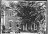 William Allison House |
April 13, 1988 (#88000288) |
U.S. Route 31A, 2 miles (3.2 km) south of College Grove 35°45′48″N 86°41′25″W |
College Grove | Historic Federal-style house with a central passage plan |
| 3 | Anderson Site | June 14, 1990 (#90000913) |
Address Restricted |
Franklin | ||
| 4 | The Bank of College Grove | 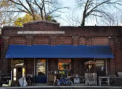 The Bank of College Grove |
April 13, 1988 (#88000289) |
U.S. Route 31A 35°47′10″N 86°40′35″W |
College Grove | |
| 5 | Bank of Nolensville | 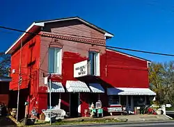 Bank of Nolensville |
April 13, 1988 (#88000287) |
U.S. Route 41A 35°57′11″N 86°40′12″W |
Nolensville | |
| 6 | Beasley-Parham House | 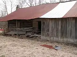 Beasley-Parham House |
April 13, 1988 (#88000286) |
Lick Creek Rd., 1 mile (1.6 km) north of Natchez Trace 35°50′19″N 87°06′48″W |
Greenbrier | |
| 7 | Bostick Female Academy | 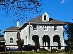 Bostick Female Academy |
April 15, 1982 (#82004070) |
U.S. Route 41A 35°51′10″N 86°39′36″W |
College Grove | |
| 8 | Boyd Mill Ruins | 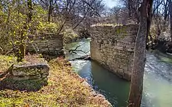 Boyd Mill Ruins |
April 13, 1988 (#88000285) |
Eastern bank of the West Harpeth River, 0.1 miles (0.16 km) south of Boxley Valley Rd. and Boyd Mill Pike 35°55′15″N 86°58′01″W |
Franklin | |
| 9 | William Boyd House | 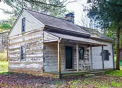 William Boyd House |
April 13, 1988 (#88000284) |
Boyd Mill Pike, 0.1 miles (0.16 km) north of Boxley Valley Rd. 35°55′27″N 86°57′55″W |
Franklin | |
| 10 | Boyd-Wilson Farm | 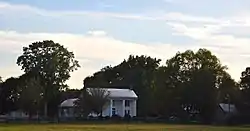 Boyd-Wilson Farm |
July 5, 1996 (#96000748) |
3209 Boxley Valley Rd. 35°54′52″N 86°58′05″W |
Franklin | |
| 11 | William S. Campbell House | 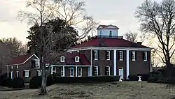 William S. Campbell House |
October 29, 1975 (#75001798) |
State Route 96 35°55′27″N 86°53′08″W |
Franklin | |
| 12 | Carnton | 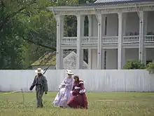 Carnton |
January 18, 1973 (#73001857) |
Confederate Cemetery Lane 35°54′11″N 86°51′30″W |
Franklin | Part of the Franklin Battlefield[6] |
| 13 | John Henry Carothers House | 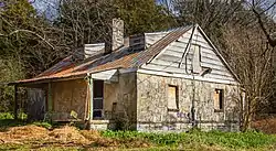 John Henry Carothers House |
November 27, 1989 (#89002028) |
1343 Huffines Ridge Dr 35°55′41″N 86°49′07″W |
Franklin | |
| 14 | Cedarmont | July 12, 1984 (#84003747) |
Off State Route 96 35°53′24″N 86°48′05″W |
Franklin | ||
| 15 | Coats-Hines Archaeological Site |  Coats-Hines Archaeological Site |
July 12, 2011 (#11000422) |
Southern side of a Spencer Creek tributary, west of the Nashville Golf and Athletic Club[7] 35°57′38″N 86°47′41″W |
Franklin | One of only a very few sites in Eastern North America that contains direct evidence of mastodon hunting by Paleoindians during the late Pleistocene. |
| 16 | College Grove Methodist Church | 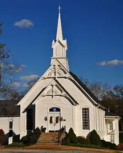 College Grove Methodist Church |
April 13, 1988 (#88000345) |
U.S. Route 31A 35°47′16″N 86°40′25″W |
College Grove | |
| 17 | Cox House | 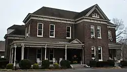 Cox House |
February 28, 1980 (#80003881) |
150 Franklin Rd. 35°55′43″N 86°51′54″W |
Franklin | |
| 18 | John Crafton House | John Crafton House |
April 13, 1988 (#88000347) |
N. Chapel Rd., 2 miles (3.2 km) east of Arno Rd. 35°52′44″N 86°46′10″W |
Franklin | |
| 19 | Craig-Beasley House |  Craig-Beasley House |
December 23, 2003 (#03001342) |
503 Boyd Mill Ave. 35°55′22″N 86°52′54″W |
Franklin | |
| 20 | Jacob Critz House | April 13, 1988 (#88000343) |
Evergreen Rd., 1.5 miles (2.4 km) east of Pope Chapel Rd. 35°47′56″N 86°56′44″W |
Thompson's Station | ||
| 21 | Thomas L. Critz House |  Thomas L. Critz House |
April 13, 1988 (#88000342) |
Critz Ln., 1 mile (1.6 km) east of Columbia Pike/U.S. Route 31 35°48′38″N 86°52′50″W |
Thompson's Station | |
| 22 | Andrew Crockett House |  Andrew Crockett House |
April 13, 1988 (#88000302) |
8230 Wikle Ln. 35°59′01″N 86°47′02″W |
Brentwood | |
| 23 | Samuel Crockett House | 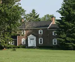 Samuel Crockett House |
April 14, 1988 (#88000296) |
Crockett Rd. and Wilson Pike 35°58′30″N 86°46′30″W |
Brentwood | |
| 24 | Dortch Stove Works | 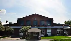 Dortch Stove Works |
November 13, 1997 (#97001438) |
230 N. Franklin Rd. 35°55′58″N 86°47′36″W |
Franklin | |
| 25 | Douglass-Reams House | April 13, 1988 (#88000293) |
Henpeck Ln., 0.25 miles (0.40 km) west of Lewisburg Pike 35°52′28″N 86°50′59″W |
Franklin | ||
| 26 | Joseph Elliston House | April 13, 1988 (#88000291) |
Hillsboro Rd./U.S. Route 431, just north of Sunnyside Rd. 36°01′34″N 86°52′39″W |
Brentwood | c.1817 two-story frame house with large exterior end chimneys | |
| 27 | Fewkes Group Archaeological Site | 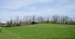 Fewkes Group Archaeological Site |
April 21, 1980 (#80003880) |
Located in Primm Historic Park on the grounds of Boiling Spring Academy; also 8400 Moores Ln. 35°58′00″N 86°46′35″W |
Brentwood | A Mississippian culture archaeological site located in the city of Brentwood. The 15-acre site consists of the remains of a mound complex and village roughly dating to 1050-1475.[8] Part of the Mississippian Cultural Resources of the Central Basin (AD 900-1450) Multiple Property Submission. Second set of boundaries represents a boundary increase of March 12, 2012. |
| 28 | Forest Hills School | 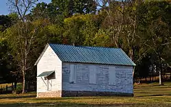 Forest Hills School |
April 13, 1988 (#88000290) |
Carters Creek Pike 0.2 miles (0.32 km) south of Bear Creek Rd. 35°51′51″N 86°57′15″W |
Franklin | |
| 29 | Fort Granger |  Fort Granger |
January 8, 1973 (#73001858) |
Off Liberty Pike 35°55′33″N 86°51′38″W |
Franklin | |
| 30 | Franklin Battlefield | Franklin Battlefield |
October 15, 1966 (#66000734) |
South of Franklin on U.S. Route 31 35°54′13″N 86°51′58″W |
Franklin | |
| 31 | Franklin City Cemetery |  Franklin City Cemetery |
November 14, 2012 (#12000946) |
N. Margin St. between 3rd & 4th Aves. N. 35°55′41″N 86°52′18″W |
Franklin | |
| 32 | Franklin Historic District | 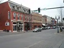 Franklin Historic District |
October 5, 1972 (#72001254) |
Centered around Main St. (State Route 96) and 3rd Ave. (U.S. Route 31); also 3rd Ave. S. between S. Margin St. and the railroad line; also the 300 block of 4th Ave., S. 35°55′30″N 86°52′09″W |
Franklin | Second and third sets of boundaries represent boundary increases of April 13, 1988 and March 15, 2000 |
| 33 | John Frost House | 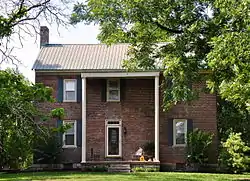 John Frost House |
April 13, 1988 (#88000308) |
Old Smyrna Rd., 1.5 miles (2.4 km) east of Wilson Pike 36°01′06″N 86°45′27″W |
Brentwood | |
| 34 | James Giddens House | April 13, 1988 (#88000301) |
Farm Ln. at the northern boundary of Thompson's Station 35°48′02″N 86°55′16″W |
Thompson's Station | ||
| 35 | Samuel F. Glass House | April 13, 1988 (#88000309) |
State Route 96 at Boyd Mill Pike 35°56′13″N 86°55′39″W |
Franklin | ||
| 36 | Glass Mounds Discontiguous Archeological District | June 4, 2015 (#15000333) |
4000 Golf Club Ln. 35°56′02″N 86°56′10″W |
Franklin | On the grounds of Westhaven Golf Club | |
| 37 | Glen Echo |  Glen Echo |
November 7, 1976 (#76001808) |
North of Franklin off U.S. Route 31 on Spencer Creek Rd. 35°57′00″N 86°51′29″W |
Franklin | |
| 38 | Abram Glenn House |  Abram Glenn House |
April 13, 1988 (#88000310) |
McCanless Rd., 1.5 miles (2.4 km) east of U.S. Route 41A 35°53′00″N 86°38′02″W |
Triune | |
| 39 | Henry P. Gray House | 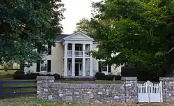 Henry P. Gray House |
April 13, 1988 (#88000313) |
Old Hillsboro Rd. at Boyd Mill Rd. 35°55′30″N 86°58′21″W |
Franklin | |
| 40 | Sherwood Green House |  Sherwood Green House |
April 13, 1988 (#88000311) |
Rocky Fork Rd., 0.5 miles (0.80 km) east of Nolensville 35°57′12″N 86°39′30″W |
Nolensville | |
| 41 | Denny P. Hadley House | April 14, 1988 (#88000283) |
Off U.S. Route 31/Franklin Rd. south of Brentwood 36°00′36″N 86°47′34″W |
Brentwood | ||
| 42 | Hamilton-Brown House |  Hamilton-Brown House |
August 2, 2006 (#06000668) |
845 Old Charlotte Pike 35°56′15″N 86°55′07″W |
Franklin | |
| 43 | Franklin Hardeman House |  Franklin Hardeman House |
April 13, 1988 (#88000280) |
Lewisburg Pike, 1 mile (1.6 km) south of Goose Creek Bypass 35°50′46″N 86°50′43″W |
Franklin | |
| 44 | Harlinsdale Farm | Harlinsdale Farm |
May 3, 2006 (#06000344) |
239 Franklin Rd. 35°56′36″N 86°51′57″W |
Franklin | |
| 45 | Harpeth Furnace (40WM83) | April 11, 1988 (#88000253) |
Address Restricted |
Fernvale | ||
| 46 | Harrison House |  Harrison House |
June 18, 1975 (#75001799) |
South of Franklin on Columbia Pike 35°52′56″N 86°52′51″W |
Franklin | |
| 47 | John Herbert House | 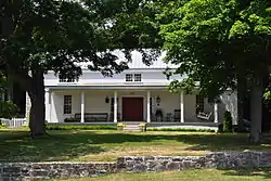 John Herbert House |
April 13, 1988 (#88000278) |
Clovercroft Rd., 0.75 miles (1.21 km) east of Wilson Pike 35°55′51″N 86°45′21″W |
Franklin | |
| 48 | Hincheyville Historic District | April 15, 1982 (#82004071) |
W. Main, Fair, 6th, 7th, 8th, 9th, and 10th Sts. 35°55′21″N 86°52′34″W |
Franklin | Boundary increase/decrease approved March 27, 2020. | |
| 49 | Hiram Masonic Lodge No. 7 | 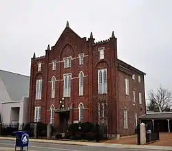 Hiram Masonic Lodge No. 7 |
November 7, 1973 (#73001859) |
S. 2nd Ave. 35°55′32″N 86°52′14″W |
Franklin | |
| 50 | Robert Hodge House | 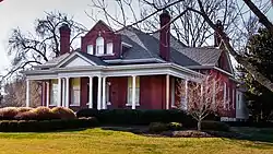 Robert Hodge House |
November 9, 2005 (#05001224) |
409 Madison Court 35°53′26″N 86°51′12″W |
Franklin | |
| 51 | Thomas Holt House | April 14, 1988 (#88000274) |
Crockett Rd., 1 mile (1.6 km) east of Wilson Pike 35°58′30″N 86°45′50″W |
Brentwood | ||
| 52 | Homestead Manor | 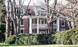 Homestead Manor |
April 29, 1977 (#77001300) |
North of Thompson's Station on U.S. Route 31 35°48′23″N 86°54′09″W |
Thompson's Station | |
| 53 | Huff Store | 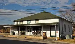 Huff Store |
April 13, 1988 (#88000321) |
Carters Creek Pike 35°48′44″N 86°58′59″W |
Burwood | |
| 54 | John Hunter House | April 13, 1988 (#88000319) |
Old State Route 96 at Carl Rd. 35°52′48″N 86°58′33″W |
Franklin | ||
| 55 | Hartwell B. Hyde House | April 13, 1988 (#88000318) |
State Route 96, 1 mile (1.6 km) east of U.S. Route 41A 35°51′18″N 86°37′57″W |
Triune | ||
| 56 | James P. Johnson House | 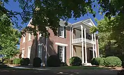 James P. Johnson House |
April 13, 1988 (#88000316) |
U.S. Route 31, 0.3 miles (0.48 km) south of W. Harpeth Rd. 35°50′29″N 86°52′58″W |
Thompson's Station | |
| 57 | William W. Johnson House | 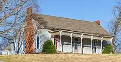 William W. Johnson House |
April 13, 1988 (#88000314) |
Farm Ln., 0.5 miles (0.80 km) south of Clovercroft Rd. and 0.5 miles (0.80 km) east of Pleasant Hill Rd. 35°55′43″N 86°42′35″W |
Franklin | |
| 58 | James Johnston House | 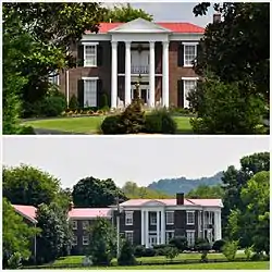 James Johnston House |
March 26, 1976 (#76001807) |
South of Brentwood on U.S. Route 31 35°59′47″N 86°48′34″W |
Brentwood | |
| 59 | Newton Jordan House | 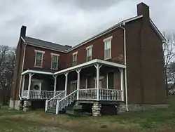 Newton Jordan House |
April 13, 1988 (#88000298) |
New Rd., 1 mile (1.6 km) east of U.S. Route 41A 35°48′58″N 86°38′42″W |
Triune | |
| 60 | Jordan-Williams House | 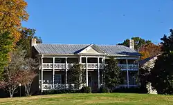 Jordan-Williams House |
April 13, 1988 (#88000341) |
Rocky Fork Rd., 2 miles (3.2 km) east of Nolensville 35°56′36″N 86°37′14″W |
Nolensville | |
| 61 | Claiborne Kinnard House |  Claiborne Kinnard House |
April 13, 1988 (#88000355) |
Carters Creek Pike, 0.5 miles (0.80 km) north of Bear Creek Rd. 35°52′20″N 86°56′31″W |
Franklin | |
| 62 | Knight-Moran House | April 13, 1988 (#88000295) |
Off the Old Natchez Trace, 0.1 miles (0.16 km) south of Moran Rd. 36°00′55″N 86°56′18″W |
Franklin | ||
| 63 | Knights of Pythias Pavilion |  Knights of Pythias Pavilion |
April 14, 1988 (#88000292) |
State Route 96 35°55′57″N 86°54′30″W |
Franklin | |
| 64 | William Leaton House | 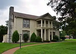 William Leaton House |
April 13, 1988 (#88000357) |
Hillsboro Rd./U.S. Route 431 at Manely Ln. 36°00′40″N 86°53′21″W |
Franklin | |
| 65 | Samuel B. Lee House | April 13, 1988 (#88000300) |
Duplex Rd., 0.5 miles (0.80 km) west of Lewisburg Pike; also 3085 Duplex-Spring Hill Rd. 35°44′35″N 86°50′44″W |
Duplex | Second address represents a boundary increase of January 12, 1993, Maplewood Farm | |
| 66 | Leipers Fork Historic District | 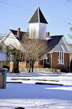 Leipers Fork Historic District |
July 1, 1998 (#98000818) |
Roughly bounded by Joseph St., Old State Route 96, Old Hillsboro Rd., and Sycamore St. 35°53′46″N 86°59′57″W |
Leiper's Fork | |
| 67 | Lewisburg Avenue Historic District | April 13, 1988 (#88000312) |
Roughly bounded by S. Margin St., Lewisburg Ave., and Adams St. 35°55′04″N 86°52′10″W |
Franklin | ||
| 68 | Liberty Hill School | April 13, 1988 (#88000315) |
Crow Cut Rd. 35°58′41″N 87°10′53″W |
Liberty Hill | ||
| 69 | Lotz House |  Lotz House |
December 12, 1976 (#76001809) |
1111 Columbia Ave. 35°55′04″N 86°52′22″W |
Franklin | |
| 70 | Maney-Sidway House | 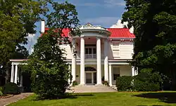 Maney-Sidway House |
April 13, 1988 (#88000333) |
Myles Manor Ct., west of Franklin Rd./U.S. Route 31 35°56′01″N 86°51′58″W |
Franklin | |
| 71 | William Martin House | 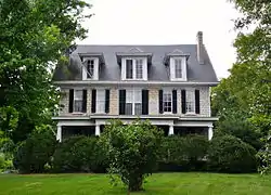 William Martin House |
April 13, 1988 (#88000334) |
5215 Seward Rd. 36°01′34″N 86°48′23″W |
Brentwood | |
| 72 | H.G.W. Mayberry House |  H.G.W. Mayberry House |
April 13, 1988 (#88000363) |
Bear Creek Rd., 0.5 miles (0.80 km) west of Carters Creek Pike 35°52′09″N 86°58′07″W |
Franklin | |
| 73 | Henry H. Mayberry House | 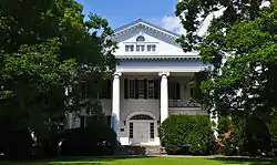 Henry H. Mayberry House |
April 13, 1988 (#88000335) |
U.S. Route 31, just across the Harpeth River north of Franklin 35°55′46″N 86°52′02″W |
Franklin | |
| 74 | David McEwen House | April 13, 1988 (#88000360) |
Off the eastern side of Franklin Rd./U.S. Route 31, 0.2 miles (0.32 km) north of Spencer Creek Rd. 35°56′41″N 86°50′14″W |
Franklin | ||
| 75 | McGavock-Gaines House | April 13, 1988 (#88000329) |
Caruthers Rd., 1 mile (1.6 km) east of Lewisburg Pike 35°54′01″N 86°50′25″W |
Franklin | ||
| 76 | McLemore House |  McLemore House |
November 18, 1999 (#99001372) |
447 11th Ave., N. 35°55′31″N 86°52′47″W |
Franklin | |
| 77 | Daniel McMahan House |  Daniel McMahan House |
April 13, 1988 (#88000331) |
Spencer Creek Rd., 0.5 miles (0.80 km) west of Franklin Rd. 35°56′42″N 86°51′37″W |
Franklin | |
| 78 | Meeting-of-the-Waters |  Meeting-of-the-Waters |
August 26, 1982 (#82004072) |
Northwest of Franklin on Del Rio Pike 35°58′11″N 86°55′12″W |
Franklin | |
| 79 | Montpier |  Montpier |
August 26, 1982 (#82004073) |
Northwest of Franklin off Old Hillsboro Pike 35°58′59″N 86°56′01″W |
Franklin | |
| 80 | Mooreland | 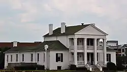 Mooreland |
July 24, 1975 (#75001797) |
Off U.S. Route 31 36°01′46″N 86°47′18″W |
Brentwood | |
| 81 | Samuel S. Morton House | April 13, 1988 (#88000365) |
Carters Creek Pike, 0.3 miles (0.48 km) north of Bear Creek Rd. 35°52′19″N 86°58′30″W |
Franklin | ||
| 82 | John Motheral House | 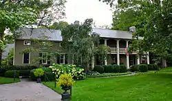 John Motheral House |
April 13, 1988 (#88000339) |
Moran Rd. at the Harpeth River 36°01′01″N 86°53′56″W |
Franklin | |
| 83 | Mountview | November 20, 1986 (#86003293) |
913 Franklin Rd. 36°00′19″N 86°47′45″W |
Brentwood | ||
| 84 | Natchez Street Historic District | February 11, 2004 (#04000030) |
Roughly bounded by Columbia Ave., Granbury St., and W. Main St. 35°55′05″N 86°52′40″W |
Franklin | ||
| 85 | John Neely House | April 13, 1988 (#88000366) |
Sedberry Rd., 2 miles (3.2 km) south of W. Harpeth Rd. 35°49′07″N 86°55′00″W |
Thompson's Station | ||
| 86 | Nolensville School |  Nolensville School |
March 20, 2012 (#12000138) |
7248 Nolensville Rd. 35°57′27″N 86°40′16″W |
Nolensville | |
| 87 | Oak Hall | .JPG.webp) Oak Hall |
March 13, 1986 (#86000393) |
1704 Wilson Pike 35°57′46″N 86°46′10″W |
Brentwood | |
| 88 | Dr. Hezekiah Oden House | April 13, 1988 (#88000322) |
Lewisburg Pike, 0.5 miles (0.80 km) south of Henpeck Ln. 35°51′57″N 86°50′47″W |
Franklin | ||
| 89 | William Ogilvie House | April 14, 1988 (#88000323) |
Western side of U.S. Route 31A, 1 mile (1.6 km) south of College Grove 35°46′22″N 86°41′17″W |
College Grove | ||
| 90 | Old Natchez Trace |  Old Natchez Trace |
May 30, 1975 (#75002125) |
From the Alabama/Tennessee border to State Route 100 in Davidson County Coordinates missing |
Franklin | Extends into Davidson, Hickman, Lawrence, Lewis, Maury, and Wayne counties |
| 91 | Old Town |  Old Town |
April 14, 1988 (#88000324) |
Old Natchez Trace, 1.5 miles (2.4 km) south of Moran Rd. 35°59′37″N 86°56′10″W |
Franklin | Also known as the Thomas Brown House |
| 92 | Old Town Archeological Site (40WM2) |  Old Town Archeological Site (40WM2) |
September 16, 1989 (#89000159) |
Western side of the Big Harpeth River, 6 miles (9.7 km) northwest of Franklin[9] 35°59′38″N 86°56′12″W |
Franklin | Native American village and mound complex of the Mississippian culture, an archeological site |
| 93 | Old Town Bridge |  Old Town Bridge |
April 13, 1988 (#88000325) |
Over Brown's Creek just west of Old Natchez Trace Rd. 35°59′45″N 86°56′10″W |
Franklin | Site of historic bridge bringing Natchez Trace branch over the Harpeth River |
| 94 | Owen Chapel Church of Christ |  Owen Chapel Church of Christ |
October 23, 1986 (#86002914) |
1101 Franklin Rd. 36°00′00″N 86°49′14″W |
Brentwood | |
| 95 | Dr. Urban Owen House | 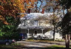 Dr. Urban Owen House |
April 13, 1988 (#88000326) |
U.S. Route 31A 35°47′08″N 86°40′33″W |
College Grove | |
| 96 | Owen-Cox House | 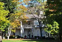 Owen-Cox House |
April 13, 1988 (#88000327) |
Moores Ln., 1 mile (1.6 km) east of Interstate 65 35°57′55″N 86°47′18″W |
Brentwood | |
| 97 | Owen-Primm House | 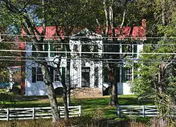 Owen-Primm House |
April 13, 1988 (#88000328) |
Moores Ln. at Wilson Pike 35°58′01″N 86°46′46″W |
Brentwood | |
| 98 | Parks Place | 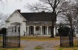 Parks Place |
September 27, 1984 (#84003753) |
Cox Rd. 35°48′53″N 86°40′11″W |
College Grove | |
| 99 | Nicholas Tate Perkins House | 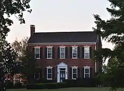 Nicholas Tate Perkins House |
April 13, 1988 (#88000330) |
Del Rio Pike, 0.2 miles (0.32 km) west of Cotton Rd. 35°57′35″N 86°54′30″W |
Franklin | |
| 100 | George Pollard House | April 13, 1988 (#88000336) |
Wilson Pike, 1.2 miles (1.9 km) south of Peytonsville Rd. 35°53′36″N 86°43′46″W |
Franklin | ||
| 101 | John Pope House | .JPG.webp) John Pope House |
April 13, 1988 (#88000338) |
Pope Chapel Rd. 35°47′56″N 86°58′41″W |
Burwood | |
| 102 | Mordecai Puryear House | April 13, 1988 (#88000340) |
Lewisburg Pike, 0.2 miles (0.32 km) north of Henpeck Ln. 35°52′25″N 86°50′35″W |
Franklin | ||
| 103 | Rainey House | 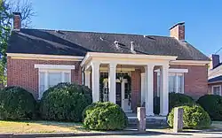 Rainey House |
July 8, 1970 (#70000621) |
244 1st Ave. 35°53′23″N 86°51′55″W |
Franklin | |
| 104 | Ravenswood | 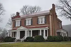 Ravenswood |
July 7, 1983 (#83003073) |
Wilson Pike 35°56′45″N 86°46′13″W |
Brentwood | |
| 105 | Rest Haven Cemetery | 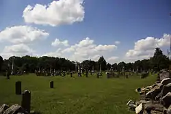 Rest Haven Cemetery |
November 14, 2012 (#12000947) |
N. Margin St. between 4th & 5th Aves. N. 35°55′38″N 86°52′23″W |
Franklin | |
| 106 | Y.M. Rizer House | 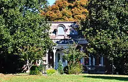 Y.M. Rizer House |
April 13, 1988 (#88000348) |
Del Rio Pike, 0.75 miles (1.21 km) west of Hillsboro Rd. 35°56′16″N 86°53′12″W |
Franklin | |
| 107 | Roper's Knob Fortifications | April 6, 2000 (#00000353) |
Off Liberty Pike 35°56′32″N 86°50′33″W |
Franklin | ||
| 108 | St. Paul's Episcopal Church | .jpg.webp) St. Paul's Episcopal Church |
February 23, 1972 (#72001255) |
510 Main St. 35°55′25″N 86°52′21″W |
Franklin | |
| 109 | James Scales House |  James Scales House |
April 13, 1988 (#88000350) |
U.S. Route 31A 35°48′18″N 86°39′42″W |
Kirkland | |
| 110 | Joseph Scales House | April 13, 1988 (#88000351) |
Off Cox Rd., 1 mile (1.6 km) west of U.S. Route 41A 35°49′24″N 86°40′27″W |
Triune | ||
| 111 | John Seward House | 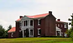 John Seward House |
April 13, 1988 (#88000352) |
Liberty Pike, 0.75 miles (1.21 km) west of Wilson Pike 35°55′41″N 86°46′57″W |
Franklin | |
| 112 | Thomas Shute House | 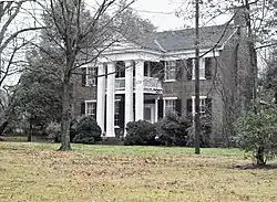 Thomas Shute House |
April 13, 1988 (#88000367) |
U.S. Route 31/Franklin Rd. at Spencer Creek Rd. 35°57′11″N 86°51′11″W |
Franklin | |
| 113 | Alexander Smith House | 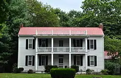 Alexander Smith House |
March 17, 2005 (#05000186) |
1304 Wilson Pike 35°59′15″N 86°46′36″W |
Brentwood | |
| 114 | Nathaniel Smithson House | 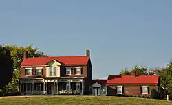 Nathaniel Smithson House |
April 13, 1988 (#88000353) |
Peytonsville-Bethesda Rd. 35°49′06″N 86°46′37″W |
Peytonsville | |
| 115 | Smithson-McCall Farm | March 15, 2007 (#07000158) |
6779 Comstock Rd. 35°44′43″N 86°47′13″W |
Bethesda | Working family farm with intact agricultural landscape and c.1830 farmhouse[10] | |
| 116 | Constantine Sneed House | April 13, 1988 (#88000354) |
9135 Old Smyrna Rd. 36°00′56″N 86°46′16″W |
Brentwood | ||
| 117 | Sparkman-Skelley Farm | March 27, 2000 (#00000234) |
5540 Leiper's Creek Rd. 35°51′11″N 87°02′15″W |
Boston | ||
| 118 | William Steele House | 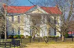 William Steele House |
April 13, 1988 (#88000356) |
Bethesda-Arno Rd., 0.5 miles (0.80 km) east of Bethesda 35°46′05″N 86°47′15″W |
Franklin | |
| 119 | Thompson Station Bank | 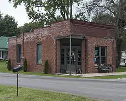 Thompson Station Bank |
April 13, 1988 (#88000358) |
Thompson Station Rd. 35°47′59″N 86°54′36″W |
Thompson's Station | |
| 120 | Beverly Toon House | 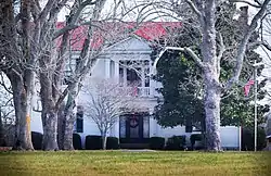 Beverly Toon House |
April 14, 1988 (#88000361) |
Arno Rd., 0.5 miles (0.80 km) west of Peytonsville Rd. 35°52′21″N 86°47′17″W |
Franklin | |
| 121 | Toussaint L'Overture County Cemetery | 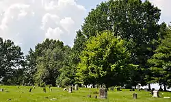 Toussaint L'Overture County Cemetery |
December 13, 1995 (#95001435) |
Del Rio Pike at its junction with Hillsboro Rd. 35°55′50″N 86°52′37″W |
Franklin | |
| 122 | Triangle School | Triangle School |
July 3, 2007 (#07000663) |
Fairview Boulevard 35°56′29″N 87°08′58″W |
Fairview | |
| 123 | Trinity United Methodist Church | 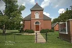 Trinity United Methodist Church |
April 13, 1988 (#88000362) |
Wilson Pike, 1.5 miles (2.4 km) south of Clovercroft Rd. 35°54′38″N 86°45′11″W |
Franklin | |
| 124 | Triune Fortification | February 5, 1999 (#99000137) |
Address Restricted |
Arrington | ||
| 125 | Alpheus Truett House | 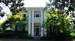 Alpheus Truett House |
April 13, 1988 (#88000364) |
U.S. Route 31/Franklin Rd., 0.3 miles (0.48 km) north of Franklin Sq. 35°55′54″N 86°51′45″W |
Franklin | |
| 126 | Andrew C. Vaughn House | April 13, 1988 (#88000368) |
501 Murfreesboro Rd. 35°55′09″N 86°51′36″W |
Franklin | ||
| 127 | Warner Park Historic Park | 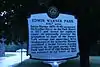 Warner Park Historic Park |
January 20, 1984 (#84003528) |
Roughly bounded by the Little Harpeth River, Belle Meade Boulevard, State Route 100, and Chickering Rd. 36°03′47″N 86°53′30″W |
Nashville | Extends into Davidson County |
| 128 | James Webb House | April 13, 1988 (#88000369) |
U.S. Route 31A at Taliaferro Rd. 35°49′03″N 86°39′53″W |
Triune | ||
| 129 | James Wilhoite House |  James Wilhoite House |
April 13, 1988 (#88000370) |
U.S. Route 31A 35°45′19″N 86°40′54″W |
Allisona | |
| 130 | Winstead Hill | Winstead Hill |
November 29, 1974 (#74001930) |
2 miles (3.2 km) south of Franklin on U.S. Route 31 35°53′17″N 86°52′45″W |
Franklin | Part of the Franklin Battlefield.[6] |
| 131 | Winstead House | .JPG.webp) Winstead House |
April 18, 1979 (#79002486) |
S. Margin St. 35°55′13″N 86°52′07″W |
Franklin | |
| 132 | John M. Winstead Houses |  John M. Winstead Houses |
April 13, 1988 (#88000373) |
Concord Rd., 1 mile (1.6 km) east of Edmondson Pike 35°58′44″N 86°44′09″W |
Brentwood | Three buildings, the oldest of which dates to c. 1800, on an area of 10.5 acres (4.2 ha).[4] Architectural plans include the single-pen and I-house forms. |
| 133 | WSM Radio Transmission Complex | 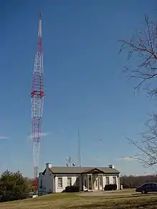 WSM Radio Transmission Complex |
March 15, 2011 (#11000087) |
8012 Concord Rd. 35°59′54″N 86°47′29″W |
Brentwood | |
| 134 | Wyatt Hall | July 2, 1980 (#80003882) |
U.S. Route 31 35°56′22″N 86°51′23″W |
Franklin |
Former listings
| [3] | Name on the Register | Image | Date listed | Date removed | Location | City or town | Summary |
|---|---|---|---|---|---|---|---|
| 1 | Spencer Buford House | 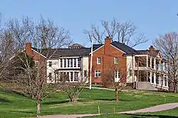 Spencer Buford House |
April 13, 1988 (#88000346) | November 19, 2015 | U.S. Route 31, 0.5 miles (0.80 km) south of Critz Ln. 35°48′32″N 86°53′50″W |
Thompson's Station | |
| 2 | Newton Cannon House | April 19, 1984 (#84003741) | February 9, 1987 | Taliaferro Rd. |
College Grove vicinity | Home of Newton Cannon, a U.S. Congressman and Governor of Tennessee; destroyed by arson. | |
| 3 | Cool Springs Farm | November 10, 1983[11] (#83004314) | October 20, 1993 | Jordan Road, south of Moore's Lane |
Franklin | ||
| 4 | James E. Collins House | April 13, 1988[12] (#88000344) | January 17, 1995 | Hillsboro Rd./U.S. Route 431, ½ mile south of Spencer Creek Road |
Franklin vicinity | Williamson County MRA | |
| 5 | Stokely Davis House | April 13, 1988 (#88000294) | July 15, 2015 | Old Natchez Trace 1 mile (1.6 km) south of Moran Rd. 36°00′02″N 86°56′13″W |
Franklin vicinity | Also known as Fairmount; Burned down on January 29, 2014 | |
| 6 | William King House | April 13, 1988 (#88000297) | June 14, 1996 | State Route 96, 1½ miles west of U.S. Route 41A |
Franklin vicinity | Williamson County MRA | |
| 7 | Lamb-Stephens House | April 13, 1988 (#88000299) | November 18, 2011 | Burke Hollow Rd., 1½ mile east of Wilson Pike 35°53′59″N 86°42′32″W |
Franklin vicinity | Williamson County MRA | |
| 8 | Liberty School | June 22, 1988 (#88000317) | November 15, 2006 | Liberty Church Rd., ¼ mile north of Concord Rd. |
Franklin | Williamson County MRA | |
| 9 | Christopher McEwen House | April 13, 1988 (#88000320) | March 23, 1995 | Franklin Rd., 1/5 mile south of Berry's Chapel Rd. |
Franklin vicinity | Williamson County MRA | |
| 10 | George W. Morton House | April 13, 1988 (#88000337) | July 20, 2020 | U.S. Route 41A, 0.5 miles (0.80 km) north of Sunset Rd. 35°57′58″N 86°40′33″W |
Nolensville | ||
| 11 | Henry Pointer House | April 13, 1988 (#88000332) | April 4, 2006 | U.S. Route 31, south of Thompsons Station |
Thompson's Station vicinity | Williamson County MRA | |
| 12 | John S. Russwurm House | April 13, 1988 (#88000299) | November 18, 2011 | Spann Town Rd., 0.5 miles (0.80 km) east of U.S. Route 41A 35°51′45″N 86°38′37″W |
Triune vicinity | Williamson County MRA | |
| 13 | Thompson Store | April 13, 1988 (#88000359) | November 25, 2009 | Duplex Rd. and Lewisburg Pike 35°44′46″N 86°50′16″W |
Duplex | Williamson County MRA | |
| 14 | Joseph Wilson House |  Joseph Wilson House |
April 13, 1988 (#88000372) | November 13, 2017 | Clovercroft Rd., 0.2 miles (0.32 km) west of Wilson Pike 35°55′20″N 86°46′08″W |
Franklin |
See also
| Wikimedia Commons has media related to National Register of Historic Places in Williamson County, Tennessee. |
References
- The latitude and longitude information provided in this table was derived originally from the National Register Information System, which has been found to be fairly accurate for about 99% of listings. Some locations in this table may have been corrected to current GPS standards.
- "National Register of Historic Places: Weekly List Actions". National Park Service, United States Department of the Interior. Retrieved on January 29, 2021.
- Numbers represent an alphabetical ordering by significant words. Various colorings, defined here, differentiate National Historic Landmarks and historic districts from other NRHP buildings, structures, sites or objects.
- "National Register Information System". National Register of Historic Places. National Park Service. April 24, 2008.
- The eight-digit number below each date is the number assigned to each location in the National Register Information System database, which can be viewed by clicking the number.
- Historic Resources of Williamson County
- Deter-Wolf, Aaron, et al. "Excavations and Dating of Late Pleistocene and Paleoindian Deposits at the Coats-Hines Site, Williamson County, Tennessee". Tennessee Archaeology 5.2 (2011): 142-156: 143.
- Hutt, Sherry. "Notice of Inventory Completion: Tennessee Department of Environment and Conservation, Division of Archaeology, Nashville, Tennessee". Federal Register. Retrieved 2011-04-11.
- Smith, Kevin E. "Archaeology at Old Town [40Wm2]: A Mississippian Mound-Village Center in Williamson County, Tennessee". Tennessee Anthropologist 18.1 (1993): 27-44: 33.
- Dr. Carroll Van West and Elizabeth H. Moore (November 16, 2006). "NRHP Inventory-Nomination: Smithson-McCall Farm / Smithson-Fisher Farm; Happy Hills Farm; WM. 1043; Fisher Farm; Bag End Farm" (PDF). National Park Service.
- Weekly Register List 1993
- Weekly Register List 1995
| Topics | |
|---|---|
| Lists by state |
|
| Lists by insular areas | |
| Lists by associated state | |
| Other areas | |
| Related | |
| |
Municipalities and communities of Williamson County, Tennessee, United States | ||
|---|---|---|
| Cities | Williamson County map | |
| Towns | ||
| Unincorporated communities | ||
| Footnotes | ‡This populated place also has portions in an adjacent county or counties | |
| ||
This article is issued from Wikipedia. The text is licensed under Creative Commons - Attribution - Sharealike. Additional terms may apply for the media files.