Éguzon-Chantôme
Éguzon-Chantôme (Limousin: Aguson e Chantòsma) is a commune in the Indre department in central France.
Éguzon-Chantôme | |
|---|---|
.jpg.webp) The town hall in Éguzon-Chantôme | |
.svg.png.webp) Coat of arms | |
Location of Éguzon-Chantôme 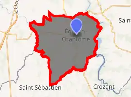
| |
 Éguzon-Chantôme  Éguzon-Chantôme | |
| Coordinates: 46°26′35″N 1°35′01″E | |
| Country | France |
| Region | Centre-Val de Loire |
| Department | Indre |
| Arrondissement | Châteauroux |
| Canton | Argenton-sur-Creuse |
| Government | |
| • Mayor (2008–2014) | Jean-Claude Blin |
| Area 1 | 36.44 km2 (14.07 sq mi) |
| Population (2017-01-01)[1] | 1,384 |
| • Density | 38/km2 (98/sq mi) |
| Time zone | UTC+01:00 (CET) |
| • Summer (DST) | UTC+02:00 (CEST) |
| INSEE/Postal code | 36070 /36270 |
| Elevation | 142–319 m (466–1,047 ft) (avg. 240 m or 790 ft) |
| 1 French Land Register data, which excludes lakes, ponds, glaciers > 1 km2 (0.386 sq mi or 247 acres) and river estuaries. | |
It is situated on the river Creuse. A nearby hydroelectric dam (the Éguzon Dam), opened in 1923, provides electricity and also creates a lake (Lac de Chambon) that is used for leisure and watersports.
Geography
The river Abloux forms all of the commune's western border and the Creuse, with the Chambon Lake, forms all of its eastern border.
Population
|
|
See also
References
- "Populations légales 2017". INSEE. Retrieved 6 January 2020.
| Wikimedia Commons has media related to Éguzon-Chantôme. |
| Authority control |
|
|---|
This article is issued from Wikipedia. The text is licensed under Creative Commons - Attribution - Sharealike. Additional terms may apply for the media files.