Thevet-Saint-Julien
Thevet-Saint-Julien is a commune in the Indre department in central France.
Thevet-Saint-Julien | |
|---|---|
_-_Mairie.jpg.webp) The town hall in Thevet-Saint-Julien | |
Location of Thevet-Saint-Julien 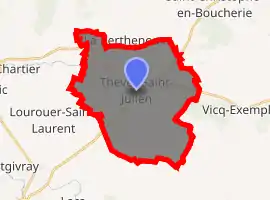
| |
 Thevet-Saint-Julien  Thevet-Saint-Julien | |
| Coordinates: 46°38′17″N 2°04′11″E | |
| Country | France |
| Region | Centre-Val de Loire |
| Department | Indre |
| Arrondissement | La Châtre |
| Canton | La Châtre |
| Government | |
| • Mayor (2008–2014) | René Lory |
| Area 1 | 30.94 km2 (11.95 sq mi) |
| Population (2017-01-01)[1] | 389 |
| • Density | 13/km2 (33/sq mi) |
| Time zone | UTC+01:00 (CET) |
| • Summer (DST) | UTC+02:00 (CEST) |
| INSEE/Postal code | 36221 /36400 |
| Elevation | 187–263 m (614–863 ft) (avg. 213 m or 699 ft) |
| 1 French Land Register data, which excludes lakes, ponds, glaciers > 1 km2 (0.386 sq mi or 247 acres) and river estuaries. | |
Population
|
|
See also
References
- "Populations légales 2017". INSEE. Retrieved 6 January 2020.
| Wikimedia Commons has media related to Thevet-Saint-Julien. |
| Authority control |
|---|
This article is issued from Wikipedia. The text is licensed under Creative Commons - Attribution - Sharealike. Additional terms may apply for the media files.