Luzeret
Luzeret is a commune in the Indre department in central France.
Luzeret | |
|---|---|
_-_Eglise_et_ch%C3%A2teau.JPG.webp) The church and the château, in Luzeret | |
Location of Luzeret 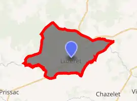
| |
 Luzeret  Luzeret | |
| Coordinates: 46°32′33″N 1°23′35″E | |
| Country | France |
| Region | Centre-Val de Loire |
| Department | Indre |
| Arrondissement | Le Blanc |
| Canton | Saint-Gaultier |
| Intercommunality | Brenne Val de Creuse |
| Government | |
| • Mayor (2008–2014) | Didier Rollet |
| Area 1 | 26.78 km2 (10.34 sq mi) |
| Population (2017-01-01)[1] | 153 |
| • Density | 5.7/km2 (15/sq mi) |
| Time zone | UTC+01:00 (CET) |
| • Summer (DST) | UTC+02:00 (CEST) |
| INSEE/Postal code | 36106 /36800 |
| Elevation | 128–192 m (420–630 ft) (avg. 155 m or 509 ft) |
| 1 French Land Register data, which excludes lakes, ponds, glaciers > 1 km2 (0.386 sq mi or 247 acres) and river estuaries. | |
Geography
The commune is located in the parc naturel régional de la Brenne.
Population
| Year | Pop. | ±% |
|---|---|---|
| 1793 | 315 | — |
| 1800 | 271 | −14.0% |
| 1806 | 288 | +6.3% |
| 1821 | 337 | +17.0% |
| 1831 | 382 | +13.4% |
| 1836 | 415 | +8.6% |
| 1841 | 412 | −0.7% |
| 1846 | 434 | +5.3% |
| 1851 | 437 | +0.7% |
| 1856 | 412 | −5.7% |
| 1861 | 436 | +5.8% |
| 1866 | 444 | +1.8% |
| 1872 | 421 | −5.2% |
| 1876 | 401 | −4.8% |
| 1881 | 428 | +6.7% |
| 1886 | 446 | +4.2% |
| 1891 | 447 | +0.2% |
| 1896 | 489 | +9.4% |
| 1901 | 472 | −3.5% |
| 1906 | 474 | +0.4% |
| 1911 | 472 | −0.4% |
| 1921 | 406 | −14.0% |
| 1926 | 408 | +0.5% |
| 1931 | 396 | −2.9% |
| 1936 | 392 | −1.0% |
| 1946 | 341 | −13.0% |
| 1954 | 322 | −5.6% |
| 1962 | 317 | −1.6% |
| 1968 | 306 | −3.5% |
| 1975 | 250 | −18.3% |
| 1982 | 214 | −14.4% |
| 1990 | 161 | −24.8% |
| 1999 | 160 | −0.6% |
| 2009 | 147 | −8.1% |
See also
References
- "Populations légales 2017". INSEE. Retrieved 6 January 2020.
| Wikimedia Commons has media related to Luzeret. |
| Authority control |
|---|
This article is issued from Wikipedia. The text is licensed under Creative Commons - Attribution - Sharealike. Additional terms may apply for the media files.