Préaux, Indre
Préaux is a commune in the Indre department in central France.
Préaux | |
|---|---|
 The town hall in Préaux | |
Location of Préaux 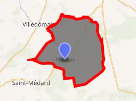
| |
 Préaux  Préaux | |
| Coordinates: 47°01′19″N 1°17′36″E | |
| Country | France |
| Region | Centre-Val de Loire |
| Department | Indre |
| Arrondissement | Châteauroux |
| Canton | Valençay |
| Intercommunality | Pays d'Écueillé |
| Government | |
| • Mayor (2008–2014) | Christian Simon |
| Area 1 | 32.54 km2 (12.56 sq mi) |
| Population (2017-01-01)[1] | 161 |
| • Density | 4.9/km2 (13/sq mi) |
| Time zone | UTC+01:00 (CET) |
| • Summer (DST) | UTC+02:00 (CEST) |
| INSEE/Postal code | 36166 /36240 |
| Elevation | 124–194 m (407–636 ft) (avg. 146 m or 479 ft) |
| 1 French Land Register data, which excludes lakes, ponds, glaciers > 1 km2 (0.386 sq mi or 247 acres) and river estuaries. | |
Geography
The village lies on the left bank of the Indrois, which flows northwest through the southern part of the commune and forms part of its western border.
Population
| Year | Pop. | ±% |
|---|---|---|
| 1793 | 442 | — |
| 1800 | 453 | +2.5% |
| 1806 | 477 | +5.3% |
| 1821 | 496 | +4.0% |
| 1831 | 497 | +0.2% |
| 1836 | 511 | +2.8% |
| 1841 | 475 | −7.0% |
| 1846 | 510 | +7.4% |
| 1851 | 538 | +5.5% |
| 1856 | 581 | +8.0% |
| 1861 | 596 | +2.6% |
| 1866 | 600 | +0.7% |
| 1872 | 648 | +8.0% |
| 1876 | 705 | +8.8% |
| 1881 | 649 | −7.9% |
| 1886 | 646 | −0.5% |
| 1891 | 712 | +10.2% |
| 1896 | 706 | −0.8% |
| 1901 | 690 | −2.3% |
| 1906 | 660 | −4.3% |
| 1911 | 689 | +4.4% |
| 1921 | 627 | −9.0% |
| 1926 | 602 | −4.0% |
| 1931 | 573 | −4.8% |
| 1936 | 578 | +0.9% |
| 1946 | 521 | −9.9% |
| 1954 | 501 | −3.8% |
| 1962 | 427 | −14.8% |
| 1968 | 378 | −11.5% |
| 1975 | 332 | −12.2% |
| 1982 | 249 | −25.0% |
| 1990 | 227 | −8.8% |
| 1999 | 184 | −18.9% |
| 2009 | 163 | −11.4% |
See also
References
- "Populations légales 2017". INSEE. Retrieved 6 January 2020.
| Wikimedia Commons has media related to Préaux (Indre). |
| Authority control |
|---|
This article is issued from Wikipedia. The text is licensed under Creative Commons - Attribution - Sharealike. Additional terms may apply for the media files.