Sainte-Lizaigne
Sainte-Lizaigne is a commune in the Indre department in central France.
Sainte-Lizaigne | |
|---|---|
.jpg.webp) The Church of Notre-Dame-de-Lourdes, in Sainte-Lizaigne | |
.svg.png.webp) Coat of arms | |
Location of Sainte-Lizaigne 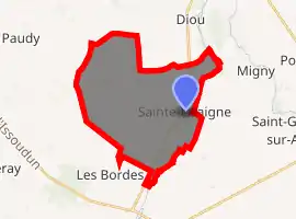
| |
 Sainte-Lizaigne  Sainte-Lizaigne | |
| Coordinates: 47°00′28″N 2°01′25″E | |
| Country | France |
| Region | Centre-Val de Loire |
| Department | Indre |
| Arrondissement | Issoudun |
| Canton | Levroux |
| Intercommunality | CC Pays d'Issoudun |
| Government | |
| • Mayor (2008–2014) | Pascal Pauvrehomme |
| Area 1 | 26.36 km2 (10.18 sq mi) |
| Population (2017-01-01)[1] | 1,176 |
| • Density | 45/km2 (120/sq mi) |
| Time zone | UTC+01:00 (CET) |
| • Summer (DST) | UTC+02:00 (CEST) |
| INSEE/Postal code | 36199 /36260 |
| Elevation | 115–171 m (377–561 ft) (avg. 128 m or 420 ft) |
| 1 French Land Register data, which excludes lakes, ponds, glaciers > 1 km2 (0.386 sq mi or 247 acres) and river estuaries. | |
Population
| Year | Pop. | ±% |
|---|---|---|
| 1793 | 720 | — |
| 1800 | 820 | +13.9% |
| 1806 | 786 | −4.1% |
| 1821 | 960 | +22.1% |
| 1831 | 1,016 | +5.8% |
| 1836 | 1,070 | +5.3% |
| 1841 | 1,133 | +5.9% |
| 1846 | 1,249 | +10.2% |
| 1851 | 1,216 | −2.6% |
| 1856 | 1,182 | −2.8% |
| 1861 | 1,155 | −2.3% |
| 1866 | 1,258 | +8.9% |
| 1872 | 1,246 | −1.0% |
| 1876 | 1,260 | +1.1% |
| 1881 | 1,340 | +6.3% |
| 1886 | 1,261 | −5.9% |
| 1891 | 1,125 | −10.8% |
| 1896 | 1,076 | −4.4% |
| 1901 | 1,061 | −1.4% |
| 1906 | 1,090 | +2.7% |
| 1911 | 1,194 | +9.5% |
| 1921 | 1,014 | −15.1% |
| 1926 | 1,007 | −0.7% |
| 1931 | 1,001 | −0.6% |
| 1936 | 939 | −6.2% |
| 1946 | 863 | −8.1% |
| 1954 | 875 | +1.4% |
| 1962 | 895 | +2.3% |
| 1968 | 821 | −8.3% |
| 1975 | 816 | −0.6% |
| 1982 | 1,002 | +22.8% |
| 1990 | 1,109 | +10.7% |
| 1999 | 1,160 | +4.6% |
| 2006 | 1,212 | +4.5% |
| 2009 | 1,230 | +1.5% |
See also
References
- "Populations légales 2017". INSEE. Retrieved 6 January 2020.
| Wikimedia Commons has media related to Sainte-Lizaigne. |
| Authority control |
|
|---|
This article is issued from Wikipedia. The text is licensed under Creative Commons - Attribution - Sharealike. Additional terms may apply for the media files.