Bonneuil, Indre
Bonneuil is a commune in the Indre department in central France. The small village boasts a Manor House or fortified house built in the 15th century and is called La Fortilesse. Jean-Baptiste Rougier de la Bergerie, à Baron of Napoleon’s empire, was born in that house on the 4th September 1757. He authored a number of books on agriculture. Today the building is privately owned and has been for sale for a couple of years.
Bonneuil | |
|---|---|
.jpg.webp) The town hall in Bonneuil | |
Location of Bonneuil 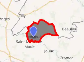
| |
 Bonneuil  Bonneuil | |
| Coordinates: 46°22′30″N 1°13′37″E | |
| Country | France |
| Region | Centre-Val de Loire |
| Department | Indre |
| Arrondissement | Le Blanc |
| Canton | Saint-Gaultier |
| Government | |
| • Mayor (2008–2014) | Joël Amfreville |
| Area 1 | 11.41 km2 (4.41 sq mi) |
| Population (2017-01-01)[1] | 79 |
| • Density | 6.9/km2 (18/sq mi) |
| Time zone | UTC+01:00 (CET) |
| • Summer (DST) | UTC+02:00 (CEST) |
| INSEE/Postal code | 36020 /36310 |
| Elevation | 160–234 m (525–768 ft) (avg. 210 m or 690 ft) |
| 1 French Land Register data, which excludes lakes, ponds, glaciers > 1 km2 (0.386 sq mi or 247 acres) and river estuaries. | |
Geography
The river Benaize forms most of the commune's southern border.
Population
| Year | Pop. | ±% |
|---|---|---|
| 1793 | 295 | — |
| 1800 | 252 | −14.6% |
| 1806 | 220 | −12.7% |
| 1821 | 279 | +26.8% |
| 1831 | 281 | +0.7% |
| 1836 | 268 | −4.6% |
| 1841 | 250 | −6.7% |
| 1846 | 279 | +11.6% |
| 1851 | 307 | +10.0% |
| 1856 | 308 | +0.3% |
| 1861 | 304 | −1.3% |
| 1866 | 297 | −2.3% |
| 1872 | 288 | −3.0% |
| 1876 | 268 | −6.9% |
| 1881 | 278 | +3.7% |
| 1886 | 279 | +0.4% |
| 1891 | 305 | +9.3% |
| 1896 | 305 | +0.0% |
| 1901 | 312 | +2.3% |
| 1906 | 313 | +0.3% |
| 1911 | 277 | −11.5% |
| 1921 | 257 | −7.2% |
| 1926 | 232 | −9.7% |
| 1931 | 240 | +3.4% |
| 1936 | 211 | −12.1% |
| 1946 | 197 | −6.6% |
| 1954 | 200 | +1.5% |
| 1962 | 202 | +1.0% |
| 1968 | 201 | −0.5% |
| 1975 | 176 | −12.4% |
| 1982 | 173 | −1.7% |
| 1990 | 101 | −41.6% |
| 1999 | 83 | −17.8% |
| 2009 | 94 | +13.3% |
See also
References
- "Populations légales 2017". INSEE. Retrieved 6 January 2020.
| Wikimedia Commons has media related to Bonneuil (Indre). |
| Authority control |
|---|
This article is issued from Wikipedia. The text is licensed under Creative Commons - Attribution - Sharealike. Additional terms may apply for the media files.