Cluis
Cluis is a commune in the Indre department of the Centre-Val de Loire region of central France.
Cluis | |
|---|---|
 The church of Saint-Paxent, in Cluis | |
.svg.png.webp) Coat of arms | |
Location of Cluis 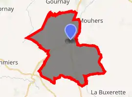
| |
 Cluis  Cluis | |
| Coordinates: 46°32′45″N 1°44′57″E | |
| Country | France |
| Region | Centre-Val de Loire |
| Department | Indre |
| Arrondissement | La Châtre |
| Canton | Neuvy-Saint-Sépulchre |
| Government | |
| • Mayor (2008–2014) | Michel Gorges |
| Area 1 | 35.32 km2 (13.64 sq mi) |
| Population (2017-01-01)[1] | 996 |
| • Density | 28/km2 (73/sq mi) |
| Time zone | UTC+01:00 (CET) |
| • Summer (DST) | UTC+02:00 (CEST) |
| INSEE/Postal code | 36056 /36340 |
| Elevation | 188–340 m (617–1,115 ft) (avg. 283 m or 928 ft) |
| 1 French Land Register data, which excludes lakes, ponds, glaciers > 1 km2 (0.386 sq mi or 247 acres) and river estuaries. | |
Geography
The commune is traversed by the river Bouzanne.
Population
|
|
See also
References
- "Populations légales 2017". INSEE. Retrieved 6 January 2020.
| Wikimedia Commons has media related to Cluis. |
| Authority control |
|---|
This article is issued from Wikipedia. The text is licensed under Creative Commons - Attribution - Sharealike. Additional terms may apply for the media files.
