Saint-Plantaire
Saint-Plantaire is a commune in the Indre department in central France.
Saint-Plantaire | |
|---|---|
.JPG.webp) The church in Saint-Plantaire | |
Location of Saint-Plantaire 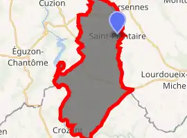
| |
 Saint-Plantaire  Saint-Plantaire | |
| Coordinates: 46°27′29″N 1°40′16″E | |
| Country | France |
| Region | Centre-Val de Loire |
| Department | Indre |
| Arrondissement | La Châtre |
| Canton | Neuvy-Saint-Sépulchre |
| Government | |
| • Mayor (2008–2014) | Daniel Calame |
| Area 1 | 34.07 km2 (13.15 sq mi) |
| Population (2017-01-01)[1] | 616 |
| • Density | 18/km2 (47/sq mi) |
| Time zone | UTC+01:00 (CET) |
| • Summer (DST) | UTC+02:00 (CEST) |
| INSEE/Postal code | 36207 /36190 |
| Elevation | 197–371 m (646–1,217 ft) (avg. 320 m or 1,050 ft) |
| 1 French Land Register data, which excludes lakes, ponds, glaciers > 1 km2 (0.386 sq mi or 247 acres) and river estuaries. | |
Population
| Year | Pop. | ±% |
|---|---|---|
| 1793 | 1,263 | — |
| 1800 | 1,135 | −10.1% |
| 1806 | 1,013 | −10.7% |
| 1821 | 1,211 | +19.5% |
| 1831 | 1,330 | +9.8% |
| 1836 | 1,413 | +6.2% |
| 1841 | 1,417 | +0.3% |
| 1846 | 1,466 | +3.5% |
| 1851 | 1,454 | −0.8% |
| 1856 | 1,424 | −2.1% |
| 1861 | 1,401 | −1.6% |
| 1866 | 1,394 | −0.5% |
| 1872 | 1,403 | +0.6% |
| 1876 | 1,395 | −0.6% |
| 1881 | 1,511 | +8.3% |
| 1886 | 1,515 | +0.3% |
| 1891 | 1,528 | +0.9% |
| 1896 | 1,556 | +1.8% |
| 1901 | 1,533 | −1.5% |
| 1906 | 1,549 | +1.0% |
| 1911 | 1,505 | −2.8% |
| 1921 | 1,321 | −12.2% |
| 1926 | 1,326 | +0.4% |
| 1931 | 1,258 | −5.1% |
| 1936 | 1,274 | +1.3% |
| 1946 | 1,190 | −6.6% |
| 1954 | 1,067 | −10.3% |
| 1962 | 996 | −6.7% |
| 1968 | 891 | −10.5% |
| 1975 | 758 | −14.9% |
| 1982 | 680 | −10.3% |
| 1990 | 605 | −11.0% |
| 1999 | 550 | −9.1% |
| 2006 | 552 | +0.4% |
| 2007 | 552 | +0.0% |
| 2009 | 549 | −0.5% |
See also
References
- "Populations légales 2017". INSEE. Retrieved 6 January 2020.
| Wikimedia Commons has media related to Saint-Plantaire. |
| Authority control |
|---|
This article is issued from Wikipedia. The text is licensed under Creative Commons - Attribution - Sharealike. Additional terms may apply for the media files.