Parnac, Indre
Parnac is a commune in the Indre department in central France.
Parnac | |
|---|---|
_%C3%89glise_Saint-Martin_01.JPG.webp) The church of Saint-Martin, in Parnac | |
.svg.png.webp) Coat of arms | |
Location of Parnac 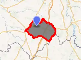
| |
 Parnac  Parnac | |
| Coordinates: 46°27′15″N 1°26′35″E | |
| Country | France |
| Region | Centre-Val de Loire |
| Department | Indre |
| Arrondissement | Le Blanc |
| Canton | Saint-Gaultier |
| Intercommunality | CC Marche Occitane - Val d'Anglin |
| Government | |
| • Mayor (2014–2020) | Christine Dejoie |
| Area 1 | 46.75 km2 (18.05 sq mi) |
| Population (2017-01-01)[1] | 501 |
| • Density | 11/km2 (28/sq mi) |
| Time zone | UTC+01:00 (CET) |
| • Summer (DST) | UTC+02:00 (CEST) |
| INSEE/Postal code | 36150 /36170 |
| Elevation | 182–317 m (597–1,040 ft) (avg. 244 m or 801 ft) |
| 1 French Land Register data, which excludes lakes, ponds, glaciers > 1 km2 (0.386 sq mi or 247 acres) and river estuaries. | |
Geography
The river Abloux forms all of the commune's northeastern border.
Population
| Year | Pop. | ±% |
|---|---|---|
| 1793 | 1,291 | — |
| 1800 | 1,260 | −2.4% |
| 1806 | 1,314 | +4.3% |
| 1821 | 1,340 | +2.0% |
| 1831 | 1,428 | +6.6% |
| 1836 | 1,508 | +5.6% |
| 1841 | 1,487 | −1.4% |
| 1846 | 1,468 | −1.3% |
| 1851 | 1,512 | +3.0% |
| 1856 | 1,463 | −3.2% |
| 1861 | 1,354 | −7.5% |
| 1866 | 1,404 | +3.7% |
| 1872 | 1,408 | +0.3% |
| 1876 | 1,400 | −0.6% |
| 1881 | 1,384 | −1.1% |
| 1886 | 1,450 | +4.8% |
| 1891 | 1,472 | +1.5% |
| 1896 | 1,417 | −3.7% |
| 1901 | 1,490 | +5.2% |
| 1906 | 1,532 | +2.8% |
| 1911 | 1,421 | −7.2% |
| 1921 | 1,262 | −11.2% |
| 1926 | 1,226 | −2.9% |
| 1931 | 1,151 | −6.1% |
| 1936 | 1,090 | −5.3% |
| 1946 | 1,003 | −8.0% |
| 1954 | 996 | −0.7% |
| 1962 | 1,009 | +1.3% |
| 1968 | 911 | −9.7% |
| 1975 | 769 | −15.6% |
| 1982 | 706 | −8.2% |
| 1990 | 650 | −7.9% |
| 1999 | 562 | −13.5% |
| 2009 | 518 | −7.8% |
See also
References
- "Populations légales 2017". INSEE. Retrieved 6 January 2020.
| Wikimedia Commons has media related to Parnac (Indre). |
| Authority control |
|---|
This article is issued from Wikipedia. The text is licensed under Creative Commons - Attribution - Sharealike. Additional terms may apply for the media files.