Mérigny
Mérigny is a commune in the Indre department in central France.
Mérigny | |
|---|---|
_-_Mairie.jpg.webp) The town hall in Mérigny | |
Location of Mérigny 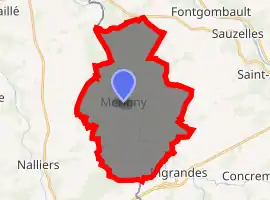
| |
 Mérigny  Mérigny | |
| Coordinates: 46°37′55″N 0°55′36″E | |
| Country | France |
| Region | Centre-Val de Loire |
| Department | Indre |
| Arrondissement | Le Blanc |
| Canton | Le Blanc |
| Intercommunality | Brenne Val de Creuse |
| Government | |
| • Mayor (2008–2014) | Michel Liaudois |
| Area 1 | 31.77 km2 (12.27 sq mi) |
| Population (2017-01-01)[1] | 537 |
| • Density | 17/km2 (44/sq mi) |
| Time zone | UTC+01:00 (CET) |
| • Summer (DST) | UTC+02:00 (CEST) |
| INSEE/Postal code | 36119 /36220 |
| Elevation | 67–136 m (220–446 ft) (avg. 76 m or 249 ft) |
| 1 French Land Register data, which excludes lakes, ponds, glaciers > 1 km2 (0.386 sq mi or 247 acres) and river estuaries. | |
Geography
The commune is located in the parc naturel régional de la Brenne.
The Anglin flows northwest through the middle of the commune, then forms its northwestern border.
Population
| Year | Pop. | ±% |
|---|---|---|
| 1793 | 1,072 | — |
| 1800 | 1,345 | +25.5% |
| 1806 | 666 | −50.5% |
| 1821 | 969 | +45.5% |
| 1831 | 988 | +2.0% |
| 1836 | 1,024 | +3.6% |
| 1841 | 1,030 | +0.6% |
| 1846 | 1,084 | +5.2% |
| 1851 | 1,088 | +0.4% |
| 1856 | 1,071 | −1.6% |
| 1861 | 1,002 | −6.4% |
| 1866 | 1,000 | −0.2% |
| 1872 | 1,006 | +0.6% |
| 1876 | 1,033 | +2.7% |
| 1881 | 1,015 | −1.7% |
| 1886 | 1,083 | +6.7% |
| 1891 | 1,014 | −6.4% |
| 1896 | 1,055 | +4.0% |
| 1901 | 1,006 | −4.6% |
| 1906 | 1,015 | +0.9% |
| 1911 | 1,032 | +1.7% |
| 1921 | 920 | −10.9% |
| 1926 | 842 | −8.5% |
| 1931 | 803 | −4.6% |
| 1936 | 826 | +2.9% |
| 1946 | 820 | −0.7% |
| 1954 | 817 | −0.4% |
| 1962 | 804 | −1.6% |
| 1968 | 767 | −4.6% |
| 1975 | 700 | −8.7% |
| 1982 | 570 | −18.6% |
| 1990 | 563 | −1.2% |
| 1999 | 572 | +1.6% |
| 2009 | 562 | −1.7% |
References
- "Populations légales 2017". INSEE. Retrieved 6 January 2020.
| Wikimedia Commons has media related to Mérigny. |
| Authority control |
|
|---|
This article is issued from Wikipedia. The text is licensed under Creative Commons - Attribution - Sharealike. Additional terms may apply for the media files.