Mouhers
Mouhers is a commune in the Indre department in central France.
Mouhers | |
|---|---|
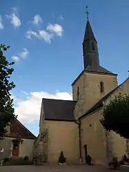 The church and the town hall in Mouhers | |
Location of Mouhers 
| |
 Mouhers  Mouhers | |
| Coordinates: 46°33′57″N 1°46′42″E | |
| Country | France |
| Region | Centre-Val de Loire |
| Department | Indre |
| Arrondissement | La Châtre |
| Canton | Neuvy-Saint-Sépulchre |
| Government | |
| • Mayor (2008–2014) | Barbara Nicolas |
| Area 1 | 17.89 km2 (6.91 sq mi) |
| Population (2017-01-01)[1] | 229 |
| • Density | 13/km2 (33/sq mi) |
| Time zone | UTC+01:00 (CET) |
| • Summer (DST) | UTC+02:00 (CEST) |
| INSEE/Postal code | 36133 /36340 |
| Elevation | 190–293 m (623–961 ft) (avg. 250 m or 820 ft) |
| 1 French Land Register data, which excludes lakes, ponds, glaciers > 1 km2 (0.386 sq mi or 247 acres) and river estuaries. | |
Geography
The Bouzanne forms the commune's southwestern border, then flows northeast through the western part of the commune.
Population
| Year | Pop. | ±% |
|---|---|---|
| 1793 | 700 | — |
| 1800 | 460 | −34.3% |
| 1806 | 493 | +7.2% |
| 1821 | 486 | −1.4% |
| 1831 | 489 | +0.6% |
| 1836 | 640 | +30.9% |
| 1841 | 662 | +3.4% |
| 1846 | 626 | −5.4% |
| 1851 | 611 | −2.4% |
| 1856 | 584 | −4.4% |
| 1861 | 587 | +0.5% |
| 1866 | 550 | −6.3% |
| 1872 | 549 | −0.2% |
| 1876 | 615 | +12.0% |
| 1881 | 591 | −3.9% |
| 1886 | 637 | +7.8% |
| 1891 | 617 | −3.1% |
| 1896 | 614 | −0.5% |
| 1901 | 633 | +3.1% |
| 1906 | 651 | +2.8% |
| 1911 | 634 | −2.6% |
| 1921 | 524 | −17.4% |
| 1926 | 529 | +1.0% |
| 1931 | 513 | −3.0% |
| 1936 | 484 | −5.7% |
| 1946 | 495 | +2.3% |
| 1954 | 468 | −5.5% |
| 1962 | 431 | −7.9% |
| 1968 | 370 | −14.2% |
| 1975 | 342 | −7.6% |
| 1982 | 301 | −12.0% |
| 1990 | 269 | −10.6% |
| 1999 | 250 | −7.1% |
| 2009 | 247 | −1.2% |
See also
References
- "Populations légales 2017". INSEE. Retrieved 6 January 2020.
| Wikimedia Commons has media related to Mouhers. |
| Authority control |
|---|
This article is issued from Wikipedia. The text is licensed under Creative Commons - Attribution - Sharealike. Additional terms may apply for the media files.