Meunet-Planches
Meunet-Planches is a commune in the Indre department in central France.
Meunet-Planches | |
|---|---|
Location of Meunet-Planches 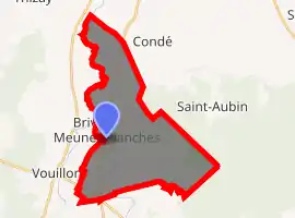
| |
 Meunet-Planches  Meunet-Planches | |
| Coordinates: 46°50′17″N 1°57′28″E | |
| Country | France |
| Region | Centre-Val de Loire |
| Department | Indre |
| Arrondissement | Issoudun |
| Canton | La Châtre |
| Intercommunality | Champagne berrichonne |
| Government | |
| • Mayor (2008–2014) | Laurent Thomas |
| Area 1 | 26.73 km2 (10.32 sq mi) |
| Population (2017-01-01)[1] | 174 |
| • Density | 6.5/km2 (17/sq mi) |
| Time zone | UTC+01:00 (CET) |
| • Summer (DST) | UTC+02:00 (CEST) |
| INSEE/Postal code | 36121 /36100 |
| Elevation | 132–174 m (433–571 ft) (avg. 145 m or 476 ft) |
| 1 French Land Register data, which excludes lakes, ponds, glaciers > 1 km2 (0.386 sq mi or 247 acres) and river estuaries. | |
Population
| Year | Pop. | ±% |
|---|---|---|
| 1793 | 324 | — |
| 1800 | 308 | −4.9% |
| 1806 | 296 | −3.9% |
| 1821 | 471 | +59.1% |
| 1831 | 527 | +11.9% |
| 1836 | 515 | −2.3% |
| 1841 | 508 | −1.4% |
| 1846 | 515 | +1.4% |
| 1851 | 541 | +5.0% |
| 1856 | 571 | +5.5% |
| 1861 | 558 | −2.3% |
| 1866 | 532 | −4.7% |
| 1872 | 502 | −5.6% |
| 1876 | 501 | −0.2% |
| 1881 | 482 | −3.8% |
| 1886 | 504 | +4.6% |
| 1891 | 491 | −2.6% |
| 1896 | 465 | −5.3% |
| 1901 | 420 | −9.7% |
| 1906 | 465 | +10.7% |
| 1911 | 467 | +0.4% |
| 1921 | 406 | −13.1% |
| 1926 | 372 | −8.4% |
| 1931 | 345 | −7.3% |
| 1936 | 328 | −4.9% |
| 1946 | 307 | −6.4% |
| 1954 | 312 | +1.6% |
| 1962 | 282 | −9.6% |
| 1968 | 233 | −17.4% |
| 1975 | 217 | −6.9% |
| 1982 | 162 | −25.3% |
| 1990 | 165 | +1.9% |
| 1999 | 140 | −15.2% |
| 2009 | 195 | +39.3% |
See also
References
- "Populations légales 2017". INSEE. Retrieved 6 January 2020.
| Wikimedia Commons has media related to Meunet-Planches. |
| Authority control |
|---|
This article is issued from Wikipedia. The text is licensed under Creative Commons - Attribution - Sharealike. Additional terms may apply for the media files.