Lourouer-Saint-Laurent
Lourouer-Saint-Laurent is a town and commune in the Indre department in central France.
Lourouer-Saint-Laurent | |
|---|---|
_-_Ancienne_mairie.jpg.webp) The old town hall in Lourouer-Saint-Laurent | |
Location of Lourouer-Saint-Laurent 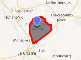
| |
 Lourouer-Saint-Laurent  Lourouer-Saint-Laurent | |
| Coordinates: 46°37′27″N 2°00′49″E | |
| Country | France |
| Region | Centre-Val de Loire |
| Department | Indre |
| Arrondissement | La Châtre |
| Canton | La Châtre |
| Government | |
| • Mayor (2008–2014) | Pascal Chéramy |
| Area 1 | 11.21 km2 (4.33 sq mi) |
| Population (2017-01-01)[1] | 270 |
| • Density | 24/km2 (62/sq mi) |
| Time zone | UTC+01:00 (CET) |
| • Summer (DST) | UTC+02:00 (CEST) |
| INSEE/Postal code | 36100 /36400 |
| Elevation | 194–246 m (636–807 ft) (avg. 217 m or 712 ft) |
| 1 French Land Register data, which excludes lakes, ponds, glaciers > 1 km2 (0.386 sq mi or 247 acres) and river estuaries. | |
Population
|
|
See also
References
- "Populations légales 2017". INSEE. Retrieved 6 January 2020.
| Wikimedia Commons has media related to Lourouer-Saint-Laurent. |
| Authority control |
|
|---|
This article is issued from Wikipedia. The text is licensed under Creative Commons - Attribution - Sharealike. Additional terms may apply for the media files.