Thenay, Indre
Thenay is a commune in the Indre department in central France.
Thenay | |
|---|---|
.jpg.webp) Town hall | |
Location of Thenay 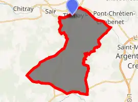
| |
 Thenay  Thenay | |
| Coordinates: 46°37′51″N 1°25′47″E | |
| Country | France |
| Region | Centre-Val de Loire |
| Department | Indre |
| Arrondissement | Le Blanc |
| Canton | Saint-Gaultier |
| Intercommunality | Brenne Val de Creuse |
| Government | |
| • Mayor (2008–2014) | Monique Mathe |
| Area 1 | 34.21 km2 (13.21 sq mi) |
| Population (2017-01-01)[1] | 891 |
| • Density | 26/km2 (67/sq mi) |
| Time zone | UTC+01:00 (CET) |
| • Summer (DST) | UTC+02:00 (CEST) |
| INSEE/Postal code | 36220 /36800 |
| Elevation | 93–187 m (305–614 ft) (avg. 101 m or 331 ft) |
| 1 French Land Register data, which excludes lakes, ponds, glaciers > 1 km2 (0.386 sq mi or 247 acres) and river estuaries. | |
Geography
The commune is located in the parc naturel régional de la Brenne.
Population
| Year | Pop. | ±% |
|---|---|---|
| 1793 | 820 | — |
| 1800 | 790 | −3.7% |
| 1806 | 713 | −9.7% |
| 1821 | 845 | +18.5% |
| 1831 | 864 | +2.2% |
| 1836 | 960 | +11.1% |
| 1841 | 816 | −15.0% |
| 1846 | 1,076 | +31.9% |
| 1851 | 1,107 | +2.9% |
| 1856 | 1,103 | −0.4% |
| 1861 | 1,142 | +3.5% |
| 1866 | 1,051 | −8.0% |
| 1872 | 1,111 | +5.7% |
| 1876 | 1,065 | −4.1% |
| 1881 | 1,100 | +3.3% |
| 1886 | 1,251 | +13.7% |
| 1891 | 1,103 | −11.8% |
| 1896 | 1,049 | −4.9% |
| 1901 | 1,044 | −0.5% |
| 1906 | 1,110 | +6.3% |
| 1911 | 1,168 | +5.2% |
| 1921 | 1,086 | −7.0% |
| 1926 | 1,051 | −3.2% |
| 1931 | 1,025 | −2.5% |
| 1936 | 982 | −4.2% |
| 1946 | 986 | +0.4% |
| 1954 | 947 | −4.0% |
| 1962 | 891 | −5.9% |
| 1968 | 890 | −0.1% |
| 1975 | 901 | +1.2% |
| 1982 | 826 | −8.3% |
| 1990 | 809 | −2.1% |
| 1999 | 827 | +2.2% |
| 2006 | 873 | +5.6% |
| 2009 | 887 | +1.6% |
See also
References
- "Populations légales 2017". INSEE. Retrieved 6 January 2020.
| Wikimedia Commons has media related to Thenay (Indre). |
| Authority control |
|---|
This article is issued from Wikipedia. The text is licensed under Creative Commons - Attribution - Sharealike. Additional terms may apply for the media files.