Montipouret
Montipouret is a commune in the Indre department in central France.
Montipouret | |
|---|---|
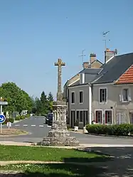 The cross in Montipouret | |
Location of Montipouret 
| |
 Montipouret  Montipouret | |
| Coordinates: 46°39′00″N 1°54′03″E | |
| Country | France |
| Region | Centre-Val de Loire |
| Department | Indre |
| Arrondissement | La Châtre |
| Canton | Neuvy-Saint-Sépulchre |
| Government | |
| • Mayor (2008–2014) | Roger Guerre |
| Area 1 | 27.89 km2 (10.77 sq mi) |
| Population (2017-01-01)[1] | 556 |
| • Density | 20/km2 (52/sq mi) |
| Time zone | UTC+01:00 (CET) |
| • Summer (DST) | UTC+02:00 (CEST) |
| INSEE/Postal code | 36129 /36230 |
| Elevation | 170–259 m (558–850 ft) (avg. 170 m or 560 ft) |
| 1 French Land Register data, which excludes lakes, ponds, glaciers > 1 km2 (0.386 sq mi or 247 acres) and river estuaries. | |
Population
| Year | Pop. | ±% |
|---|---|---|
| 1793 | 1,040 | — |
| 1800 | 1,003 | −3.6% |
| 1806 | 781 | −22.1% |
| 1821 | 1,036 | +32.7% |
| 1831 | 1,168 | +12.7% |
| 1836 | 1,100 | −5.8% |
| 1841 | 951 | −13.5% |
| 1846 | 1,006 | +5.8% |
| 1851 | 980 | −2.6% |
| 1856 | 1,009 | +3.0% |
| 1861 | 1,034 | +2.5% |
| 1866 | 1,118 | +8.1% |
| 1872 | 1,138 | +1.8% |
| 1876 | 1,176 | +3.3% |
| 1881 | 1,185 | +0.8% |
| 1886 | 1,181 | −0.3% |
| 1891 | 1,167 | −1.2% |
| 1896 | 1,145 | −1.9% |
| 1901 | 1,116 | −2.5% |
| 1906 | 1,150 | +3.0% |
| 1911 | 1,121 | −2.5% |
| 1921 | 963 | −14.1% |
| 1926 | 919 | −4.6% |
| 1931 | 861 | −6.3% |
| 1936 | 824 | −4.3% |
| 1946 | 811 | −1.6% |
| 1954 | 753 | −7.2% |
| 1962 | 667 | −11.4% |
| 1968 | 609 | −8.7% |
| 1975 | 533 | −12.5% |
| 1982 | 502 | −5.8% |
| 1990 | 514 | +2.4% |
| 1999 | 507 | −1.4% |
| 2009 | 568 | +12.0% |
See also
References
- "Populations légales 2017". INSEE. Retrieved 6 January 2020.
| Wikimedia Commons has media related to Montipouret. |
| Authority control |
|---|
This article is issued from Wikipedia. The text is licensed under Creative Commons - Attribution - Sharealike. Additional terms may apply for the media files.