Tendu, Indre
Tendu is a commune in the Indre department in central France.
Tendu | |
|---|---|
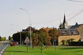 A general view of Tendu | |
Location of Tendu 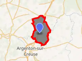
| |
 Tendu  Tendu | |
| Coordinates: 46°38′42″N 1°33′32″E | |
| Country | France |
| Region | Centre-Val de Loire |
| Department | Indre |
| Arrondissement | Châteauroux |
| Canton | Argenton-sur-Creuse |
| Government | |
| • Mayor (2008–2014) | Jean-Paul Cacitti |
| Area 1 | 42.17 km2 (16.28 sq mi) |
| Population (2017-01-01)[1] | 648 |
| • Density | 15/km2 (40/sq mi) |
| Time zone | UTC+01:00 (CET) |
| • Summer (DST) | UTC+02:00 (CEST) |
| INSEE/Postal code | 36219 /36200 |
| Elevation | 107–174 m (351–571 ft) (avg. 171 m or 561 ft) |
| 1 French Land Register data, which excludes lakes, ponds, glaciers > 1 km2 (0.386 sq mi or 247 acres) and river estuaries. | |
Geography
The commune is traversed by the river Bouzanne.
Population
| Year | Pop. | ±% |
|---|---|---|
| 1793 | 538 | — |
| 1800 | 569 | +5.8% |
| 1806 | 589 | +3.5% |
| 1821 | 527 | −10.5% |
| 1831 | 608 | +15.4% |
| 1836 | 639 | +5.1% |
| 1841 | 625 | −2.2% |
| 1846 | 674 | +7.8% |
| 1851 | 639 | −5.2% |
| 1856 | 660 | +3.3% |
| 1861 | 666 | +0.9% |
| 1866 | 662 | −0.6% |
| 1872 | 729 | +10.1% |
| 1876 | 714 | −2.1% |
| 1881 | 742 | +3.9% |
| 1886 | 741 | −0.1% |
| 1891 | 785 | +5.9% |
| 1896 | 766 | −2.4% |
| 1901 | 765 | −0.1% |
| 1906 | 771 | +0.8% |
| 1911 | 756 | −1.9% |
| 1921 | 699 | −7.5% |
| 1926 | 670 | −4.1% |
| 1931 | 600 | −10.4% |
| 1936 | 595 | −0.8% |
| 1946 | 570 | −4.2% |
| 1954 | 557 | −2.3% |
| 1962 | 504 | −9.5% |
| 1968 | 483 | −4.2% |
| 1975 | 417 | −13.7% |
| 1982 | 465 | +11.5% |
| 1990 | 446 | −4.1% |
| 1999 | 451 | +1.1% |
| 2006 | 541 | +20.0% |
| 2009 | 575 | +6.3% |
See also
References
| Wikimedia Commons has media related to Tendu. |
- "Populations légales 2017". INSEE. Retrieved 6 January 2020.
| Authority control |
|
|---|
This article is issued from Wikipedia. The text is licensed under Creative Commons - Attribution - Sharealike. Additional terms may apply for the media files.