Lurais
Lurais is a commune in the Indre department in central France.
Lurais | |
|---|---|
_-_Mairie.jpg.webp) The town hall in Lurais | |
Location of Lurais 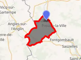
| |
 Lurais  Lurais | |
| Coordinates: 46°42′19″N 0°57′05″E | |
| Country | France |
| Region | Centre-Val de Loire |
| Department | Indre |
| Arrondissement | Le Blanc |
| Canton | Le Blanc |
| Intercommunality | Brenne Val de Creuse |
| Government | |
| • Mayor (2008–2014) | Alain Jacquet |
| Area 1 | 13.61 km2 (5.25 sq mi) |
| Population (2017-01-01)[1] | 249 |
| • Density | 18/km2 (47/sq mi) |
| Time zone | UTC+01:00 (CET) |
| • Summer (DST) | UTC+02:00 (CEST) |
| INSEE/Postal code | 36104 /36220 |
| Elevation | 67–134 m (220–440 ft) (avg. 80 m or 260 ft) |
| 1 French Land Register data, which excludes lakes, ponds, glaciers > 1 km2 (0.386 sq mi or 247 acres) and river estuaries. | |
Geography
The commune is located in the parc naturel régional de la Brenne.
Population
| Year | Pop. | ±% |
|---|---|---|
| 1793 | 422 | — |
| 1800 | 269 | −36.3% |
| 1806 | 272 | +1.1% |
| 1821 | 537 | +97.4% |
| 1831 | 558 | +3.9% |
| 1836 | 547 | −2.0% |
| 1841 | 557 | +1.8% |
| 1846 | 579 | +3.9% |
| 1851 | 569 | −1.7% |
| 1856 | 572 | +0.5% |
| 1861 | 575 | +0.5% |
| 1866 | 545 | −5.2% |
| 1872 | 506 | −7.2% |
| 1876 | 497 | −1.8% |
| 1881 | 530 | +6.6% |
| 1886 | 552 | +4.2% |
| 1891 | 514 | −6.9% |
| 1896 | 502 | −2.3% |
| 1901 | 507 | +1.0% |
| 1906 | 514 | +1.4% |
| 1911 | 518 | +0.8% |
| 1921 | 461 | −11.0% |
| 1926 | 427 | −7.4% |
| 1931 | 445 | +4.2% |
| 1936 | 439 | −1.3% |
| 1946 | 367 | −16.4% |
| 1954 | 350 | −4.6% |
| 1962 | 320 | −8.6% |
| 1968 | 303 | −5.3% |
| 1975 | 267 | −11.9% |
| 1982 | 250 | −6.4% |
| 1990 | 241 | −3.6% |
| 1999 | 237 | −1.7% |
| 2009 | 234 | −1.3% |
See also
References
- "Populations légales 2017". INSEE. Retrieved 6 January 2020.
| Wikimedia Commons has media related to Lurais. |
| Authority control |
|---|
This article is issued from Wikipedia. The text is licensed under Creative Commons - Attribution - Sharealike. Additional terms may apply for the media files.