Saint-Aigny
Saint-Aigny is a commune in the Indre department in central France.
Saint-Aigny | |
|---|---|
_-_Mairie.jpg.webp) The town hall in Saint-Aigny | |
Location of Saint-Aigny 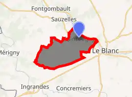
| |
 Saint-Aigny  Saint-Aigny | |
| Coordinates: 46°38′48″N 1°01′34″E | |
| Country | France |
| Region | Centre-Val de Loire |
| Department | Indre |
| Arrondissement | Le Blanc |
| Canton | Le Blanc |
| Government | |
| • Mayor (2008–2014) | Jean-Louis Chezeaux |
| Area 1 | 14.86 km2 (5.74 sq mi) |
| Population (2017-01-01)[1] | 282 |
| • Density | 19/km2 (49/sq mi) |
| Time zone | UTC+01:00 (CET) |
| • Summer (DST) | UTC+02:00 (CEST) |
| INSEE/Postal code | 36178 /36300 |
| Elevation | 72–141 m (236–463 ft) (avg. 90 m or 300 ft) |
| 1 French Land Register data, which excludes lakes, ponds, glaciers > 1 km2 (0.386 sq mi or 247 acres) and river estuaries. | |
Geography
The commune is located in the parc naturel régional de la Brenne.
Population
| Year | Pop. | ±% |
|---|---|---|
| 1793 | 480 | — |
| 1800 | 462 | −3.7% |
| 1806 | 405 | −12.3% |
| 1821 | 421 | +4.0% |
| 1831 | 428 | +1.7% |
| 1836 | 406 | −5.1% |
| 1841 | 414 | +2.0% |
| 1846 | 447 | +8.0% |
| 1851 | 481 | +7.6% |
| 1856 | 482 | +0.2% |
| 1861 | 457 | −5.2% |
| 1866 | 441 | −3.5% |
| 1872 | 452 | +2.5% |
| 1876 | 437 | −3.3% |
| 1881 | 434 | −0.7% |
| 1886 | 429 | −1.2% |
| 1891 | 413 | −3.7% |
| 1896 | 378 | −8.5% |
| 1901 | 363 | −4.0% |
| 1906 | 404 | +11.3% |
| 1911 | 375 | −7.2% |
| 1921 | 356 | −5.1% |
| 1926 | 339 | −4.8% |
| 1931 | 308 | −9.1% |
| 1936 | 303 | −1.6% |
| 1946 | 329 | +8.6% |
| 1954 | 313 | −4.9% |
| 1962 | 323 | +3.2% |
| 1968 | 254 | −21.4% |
| 1975 | 223 | −12.2% |
| 1982 | 235 | +5.4% |
| 1990 | 244 | +3.8% |
| 1999 | 256 | +4.9% |
| 2006 | 290 | +13.3% |
| 2009 | 296 | +2.1% |
See also
References
- "Populations légales 2017". INSEE. Retrieved 6 January 2020.
| Wikimedia Commons has media related to Saint-Aigny. |
| Authority control |
|---|
This article is issued from Wikipedia. The text is licensed under Creative Commons - Attribution - Sharealike. Additional terms may apply for the media files.