Dun-le-Poëlier
Dun-le-Poëlier is a commune in the Indre department in central France.
Dun-le-Poëlier | |
|---|---|
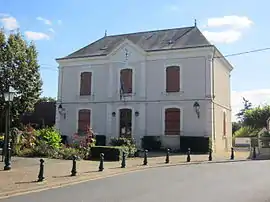 The town hall in Dun-le-Poëlier | |
Location of Dun-le-Poëlier 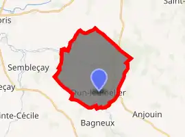
| |
 Dun-le-Poëlier  Dun-le-Poëlier | |
| Coordinates: 47°12′16″N 1°45′16″E | |
| Country | France |
| Region | Centre-Val de Loire |
| Department | Indre |
| Arrondissement | Issoudun |
| Canton | Valençay |
| Intercommunality | Pays de Bazelle |
| Government | |
| • Mayor (2008–2014) | Pierre Faucher |
| Area 1 | 22.56 km2 (8.71 sq mi) |
| Population (2017-01-01)[1] | 426 |
| • Density | 19/km2 (49/sq mi) |
| Time zone | UTC+01:00 (CET) |
| • Summer (DST) | UTC+02:00 (CEST) |
| INSEE/Postal code | 36068 /36210 |
| Elevation | 87–140 m (285–459 ft) |
| 1 French Land Register data, which excludes lakes, ponds, glaciers > 1 km2 (0.386 sq mi or 247 acres) and river estuaries. | |
History
During World War II, Dun-le-Poëlier was liberated by Free French troops in September 1944 following an engagement with the German Tiger Legion.
Population
| Year | Pop. | ±% |
|---|---|---|
| 1793 | 690 | — |
| 1800 | 683 | −1.0% |
| 1806 | 610 | −10.7% |
| 1821 | 737 | +20.8% |
| 1831 | 1,012 | +37.3% |
| 1836 | 1,106 | +9.3% |
| 1841 | 1,032 | −6.7% |
| 1846 | 1,080 | +4.7% |
| 1851 | 1,155 | +6.9% |
| 1856 | 1,202 | +4.1% |
| 1861 | 1,210 | +0.7% |
| 1866 | 1,209 | −0.1% |
| 1872 | 1,250 | +3.4% |
| 1876 | 1,290 | +3.2% |
| 1881 | 1,273 | −1.3% |
| 1886 | 1,302 | +2.3% |
| 1891 | 1,329 | +2.1% |
| 1896 | 1,302 | −2.0% |
| 1901 | 1,336 | +2.6% |
| 1906 | 1,280 | −4.2% |
| 1911 | 1,281 | +0.1% |
| 1921 | 1,104 | −13.8% |
| 1926 | 1,055 | −4.4% |
| 1931 | 1,027 | −2.7% |
| 1936 | 810 | −21.1% |
| 1946 | 784 | −3.2% |
| 1954 | 732 | −6.6% |
| 1962 | 676 | −7.7% |
| 1968 | 593 | −12.3% |
| 1975 | 576 | −2.9% |
| 1982 | 523 | −9.2% |
| 1990 | 496 | −5.2% |
| 1999 | 457 | −7.9% |
| 2009 | 476 | +4.2% |
See also
References
- "Populations légales 2017". INSEE. Retrieved 6 January 2020.
| Wikimedia Commons has media related to Dun-le-Poëlier. |
| Authority control |
|
|---|
This article is issued from Wikipedia. The text is licensed under Creative Commons - Attribution - Sharealike. Additional terms may apply for the media files.