La Pérouille
La Pérouille is a commune in the Indre department in central France.
La Pérouille | |
|---|---|
_-_Eglise.JPG.webp) The church of Saint-Martin, in La Pérouille | |
Location of La Pérouille 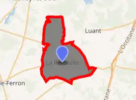
| |
 La Pérouille  La Pérouille | |
| Coordinates: 46°42′16″N 1°30′59″E | |
| Country | France |
| Region | Centre-Val de Loire |
| Department | Indre |
| Arrondissement | Le Blanc |
| Canton | Saint-Gaultier |
| Intercommunality | Brenne Val de Creuse |
| Government | |
| • Mayor (2008–2014) | Frédéric Stervinou |
| Area 1 | 21.54 km2 (8.32 sq mi) |
| Population (2017-01-01)[1] | 457 |
| • Density | 21/km2 (55/sq mi) |
| Time zone | UTC+01:00 (CET) |
| • Summer (DST) | UTC+02:00 (CEST) |
| INSEE/Postal code | 36157 /36350 |
| Elevation | 131–177 m (430–581 ft) (avg. 150 m or 490 ft) |
| 1 French Land Register data, which excludes lakes, ponds, glaciers > 1 km2 (0.386 sq mi or 247 acres) and river estuaries. | |
Geography
The commune is located in the parc naturel régional de la Brenne.
Population
| Year | Pop. | ±% |
|---|---|---|
| 1793 | 362 | — |
| 1800 | 322 | −11.0% |
| 1806 | 376 | +16.8% |
| 1821 | 450 | +19.7% |
| 1831 | 494 | +9.8% |
| 1836 | 579 | +17.2% |
| 1841 | 509 | −12.1% |
| 1846 | 535 | +5.1% |
| 1851 | 542 | +1.3% |
| 1856 | 547 | +0.9% |
| 1861 | 517 | −5.5% |
| 1866 | 527 | +1.9% |
| 1872 | 527 | +0.0% |
| 1876 | 554 | +5.1% |
| 1881 | 608 | +9.7% |
| 1886 | 593 | −2.5% |
| 1891 | 608 | +2.5% |
| 1896 | 620 | +2.0% |
| 1901 | 644 | +3.9% |
| 1906 | 602 | −6.5% |
| 1911 | 565 | −6.1% |
| 1921 | 521 | −7.8% |
| 1926 | 505 | −3.1% |
| 1931 | 467 | −7.5% |
| 1936 | 440 | −5.8% |
| 1946 | 405 | −8.0% |
| 1954 | 406 | +0.2% |
| 1962 | 411 | +1.2% |
| 1968 | 362 | −11.9% |
| 1975 | 334 | −7.7% |
| 1982 | 354 | +6.0% |
| 1990 | 336 | −5.1% |
| 1999 | 334 | −0.6% |
| 2009 | 419 | +25.4% |
See also
References
- "Populations légales 2017". INSEE. Retrieved 6 January 2020.
| Wikimedia Commons has media related to La Pérouille. |
| Authority control |
|---|
This article is issued from Wikipedia. The text is licensed under Creative Commons - Attribution - Sharealike. Additional terms may apply for the media files.