Saint-Christophe-en-Bazelle
Saint-Christophe-en-Bazelle is a commune in the Indre department in central France.
Saint-Christophe-en-Bazelle | |
|---|---|
 Coat of arms | |
Location of Saint-Christophe-en-Bazelle 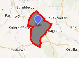
| |
 Saint-Christophe-en-Bazelle  Saint-Christophe-en-Bazelle | |
| Coordinates: 47°11′34″N 1°42′45″E | |
| Country | France |
| Region | Centre-Val de Loire |
| Department | Indre |
| Arrondissement | Issoudun |
| Canton | Valençay |
| Intercommunality | Pays de Bazelle |
| Government | |
| • Mayor (2008–2014) | Cécile Riolet |
| Area 1 | 13.94 km2 (5.38 sq mi) |
| Population (2017-01-01)[1] | 379 |
| • Density | 27/km2 (70/sq mi) |
| Time zone | UTC+01:00 (CET) |
| • Summer (DST) | UTC+02:00 (CEST) |
| INSEE/Postal code | 36185 /36210 |
| Elevation | 97–135 m (318–443 ft) (avg. 111 m or 364 ft) |
| 1 French Land Register data, which excludes lakes, ponds, glaciers > 1 km2 (0.386 sq mi or 247 acres) and river estuaries. | |
Population
| Year | Pop. | ±% |
|---|---|---|
| 1793 | 451 | — |
| 1800 | 455 | +0.9% |
| 1806 | 440 | −3.3% |
| 1821 | 466 | +5.9% |
| 1831 | 523 | +12.2% |
| 1836 | 577 | +10.3% |
| 1841 | 555 | −3.8% |
| 1846 | 616 | +11.0% |
| 1851 | 615 | −0.2% |
| 1856 | 690 | +12.2% |
| 1861 | 694 | +0.6% |
| 1866 | 758 | +9.2% |
| 1872 | 779 | +2.8% |
| 1876 | 833 | +6.9% |
| 1881 | 799 | −4.1% |
| 1886 | 827 | +3.5% |
| 1891 | 783 | −5.3% |
| 1896 | 773 | −1.3% |
| 1901 | 720 | −6.9% |
| 1906 | 707 | −1.8% |
| 1911 | 727 | +2.8% |
| 1921 | 621 | −14.6% |
| 1926 | 618 | −0.5% |
| 1931 | 608 | −1.6% |
| 1936 | 583 | −4.1% |
| 1946 | 582 | −0.2% |
| 1954 | 502 | −13.7% |
| 1962 | 474 | −5.6% |
| 1968 | 429 | −9.5% |
| 1975 | 382 | −11.0% |
| 1982 | 356 | −6.8% |
| 1990 | 348 | −2.2% |
| 1999 | 373 | +7.2% |
| 2006 | 378 | +1.3% |
| 2009 | 378 | +0.0% |
See also
References
- "Populations légales 2017". INSEE. Retrieved 6 January 2020.
| Wikimedia Commons has media related to Saint-Christophe-en-Bazelle. |
| Authority control |
|
|---|
This article is issued from Wikipedia. The text is licensed under Creative Commons - Attribution - Sharealike. Additional terms may apply for the media files.