Chazelet
Chazelet is a commune in the Indre department in central France.
Chazelet | |
|---|---|
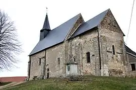 The Church of Saint-Jean-Baptiste, in Chazelet | |
Location of Chazelet 
| |
 Chazelet  Chazelet | |
| Coordinates: 46°30′33″N 1°26′34″E | |
| Country | France |
| Region | Centre-Val de Loire |
| Department | Indre |
| Arrondissement | Le Blanc |
| Canton | Saint-Gaultier |
| Intercommunality | Brenne Val de Creuse |
| Government | |
| • Mayor (2008–2014) | Pierre Morizet |
| Area 1 | 11.73 km2 (4.53 sq mi) |
| Population (2017-01-01)[1] | 122 |
| • Density | 10/km2 (27/sq mi) |
| Time zone | UTC+01:00 (CET) |
| • Summer (DST) | UTC+02:00 (CEST) |
| INSEE/Postal code | 36049 /36170 |
| Elevation | 141–237 m (463–778 ft) (avg. 215 m or 705 ft) |
| 1 French Land Register data, which excludes lakes, ponds, glaciers > 1 km2 (0.386 sq mi or 247 acres) and river estuaries. | |
Geography
The commune is located in the parc naturel régional de la Brenne.
The river Abloux flows west through the southern part of the commune.
Population
| Year | Pop. | ±% |
|---|---|---|
| 1793 | 500 | — |
| 1800 | 402 | −19.6% |
| 1806 | 411 | +2.2% |
| 1821 | 521 | +26.8% |
| 1831 | 480 | −7.9% |
| 1836 | 507 | +5.6% |
| 1841 | 501 | −1.2% |
| 1846 | 516 | +3.0% |
| 1851 | 527 | +2.1% |
| 1856 | 519 | −1.5% |
| 1861 | 545 | +5.0% |
| 1866 | 527 | −3.3% |
| 1872 | 493 | −6.5% |
| 1876 | 449 | −8.9% |
| 1881 | 506 | +12.7% |
| 1886 | 475 | −6.1% |
| 1891 | 458 | −3.6% |
| 1896 | 425 | −7.2% |
| 1901 | 472 | +11.1% |
| 1906 | 439 | −7.0% |
| 1911 | 444 | +1.1% |
| 1921 | 369 | −16.9% |
| 1926 | 316 | −14.4% |
| 1931 | 287 | −9.2% |
| 1936 | 281 | −2.1% |
| 1946 | 269 | −4.3% |
| 1954 | 227 | −15.6% |
| 1962 | 235 | +3.5% |
| 1968 | 189 | −19.6% |
| 1975 | 196 | +3.7% |
| 1982 | 150 | −23.5% |
| 1990 | 132 | −12.0% |
| 1999 | 146 | +10.6% |
| 2009 | 118 | −19.2% |
See also
References
- "Populations légales 2017". INSEE. Retrieved 6 January 2020.
| Wikimedia Commons has media related to Chazelet. |
| Authority control |
|---|
This article is issued from Wikipedia. The text is licensed under Creative Commons - Attribution - Sharealike. Additional terms may apply for the media files.