Château-Arnoux-Saint-Auban
Château-Arnoux-Saint-Auban is a commune in the department of Alpes-de-Haute-Provence in the region of Provence-Alpes-Côte d'Azur in southeastern France.
Château-Arnoux-Saint-Auban | |
|---|---|
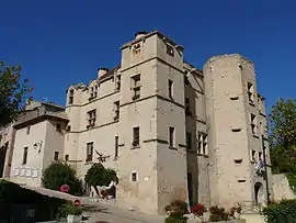 Chateau | |
 Coat of arms | |
Location of Château-Arnoux-Saint-Auban 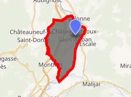
| |
 Château-Arnoux-Saint-Auban  Château-Arnoux-Saint-Auban | |
| Coordinates: 44°05′39″N 6°00′33″E | |
| Country | France |
| Region | Provence-Alpes-Côte d'Azur |
| Department | Alpes-de-Haute-Provence |
| Arrondissement | Digne-les-Bains |
| Canton | Château-Arnoux-Saint-Auban |
| Intercommunality | Moyenne Durance |
| Government | |
| • Mayor (2008–2014) | Patrick Martellini |
| Area 1 | 18.34 km2 (7.08 sq mi) |
| Population (2017-01-01)[1] | 5,139 |
| • Density | 280/km2 (730/sq mi) |
| Time zone | UTC+01:00 (CET) |
| • Summer (DST) | UTC+02:00 (CEST) |
| INSEE/Postal code | 04049 /04160 |
| Elevation | 403–742 m (1,322–2,434 ft) (avg. 440 m or 1,440 ft) |
| 1 French Land Register data, which excludes lakes, ponds, glaciers > 1 km2 (0.386 sq mi or 247 acres) and river estuaries. | |
History
Château-Arnoux-Saint-Auban is on the Route Napoléon, the route taken by Napoléon in 1815 on his return from Elba.
Geography
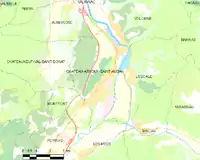
Château-Arnoux-Saint-Auban and surrounding districts
Château-Arnoux-Saint-Auban is on the River Durance.
Population
Its inhabitants are referred to as Jarlandins.
| Year | Pop. | ±% |
|---|---|---|
| 1962 | 5,785 | — |
| 1968 | 6,532 | +12.9% |
| 1975 | 6,240 | −4.5% |
| 1982 | 5,576 | −10.6% |
| 1990 | 5,109 | −8.4% |
| 1999 | 4,970 | −2.7% |
| 2008 | 5,270 | +6.0% |
Sights
Château-Arnoux-Saint-Auban has one of the French pacifist monuments to the dead, which reads: "war is a crime".
The airfield is "Le Centre National de Vol à Voile", the French national centre for the sport of gliding.
Education
A campus of the École nationale de l'aviation civile is located in the commune[2] · .[3]
References
- "Populations légales 2017". INSEE. Retrieved 6 January 2020.
- (in French) Enac / SEFA : La fusion opérationnelle pour le 1er janvier 2011
- (in French) Vie des campus
| Wikimedia Commons has media related to Château-Arnoux-Saint-Auban. |
| Authority control |
|---|
This article is issued from Wikipedia. The text is licensed under Creative Commons - Attribution - Sharealike. Additional terms may apply for the media files.