Mison
Mison is a commune in the Alpes-de-Haute-Provence department in southeastern France.
Mison | |
|---|---|
 A general view of the village of Mison and the castle | |
 Coat of arms | |
Location of Mison 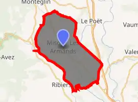
| |
 Mison  Mison | |
| Coordinates: 44°15′56″N 5°50′54″E | |
| Country | France |
| Region | Provence-Alpes-Côte d'Azur |
| Department | Alpes-de-Haute-Provence |
| Arrondissement | Forcalquier |
| Canton | Sisteron |
| Intercommunality | Sisteron |
| Government | |
| • Mayor (2008–2014) | Robert Gay |
| Area 1 | 31.72 km2 (12.25 sq mi) |
| Population (2017-01-01)[1] | 1,128 |
| • Density | 36/km2 (92/sq mi) |
| Time zone | UTC+01:00 (CET) |
| • Summer (DST) | UTC+02:00 (CEST) |
| INSEE/Postal code | 04123 /04200 |
| Elevation | 489–735 m (1,604–2,411 ft) (avg. 610 m or 2,000 ft) |
| 1 French Land Register data, which excludes lakes, ponds, glaciers > 1 km2 (0.386 sq mi or 247 acres) and river estuaries. | |
At the top of the hill in the village are the remains of a 13th-century castle built by the Mérvouillon family. The building is organised around a central courtyard and the four main buildings are flanked by square towers. There are two gates. The castle was abandoned by the end of the 18th century. Restorations have been undertaken since 2005.
Population
| Year | Pop. | ±% |
|---|---|---|
| 1765 | 897 | — |
| 1793 | 1,206 | +34.4% |
| 1800 | 1,329 | +10.2% |
| 1806 | 1,256 | −5.5% |
| 1821 | 1,249 | −0.6% |
| 1831 | 1,411 | +13.0% |
| 1836 | 1,411 | +0.0% |
| 1841 | 1,291 | −8.5% |
| 1846 | 1,398 | +8.3% |
| 1851 | 1,301 | −6.9% |
| 1856 | 1,204 | −7.5% |
| 1861 | 1,113 | −7.6% |
| 1866 | 1,095 | −1.6% |
| 1872 | 1,086 | −0.8% |
| 1876 | 1,027 | −5.4% |
| 1881 | 1,012 | −1.5% |
| 1886 | 1,006 | −0.6% |
| 1891 | 954 | −5.2% |
| 1896 | 939 | −1.6% |
| 1901 | 905 | −3.6% |
| 1906 | 864 | −4.5% |
| 1911 | 744 | −13.9% |
| 1921 | 700 | −5.9% |
| 1926 | 628 | −10.3% |
| 1931 | 648 | +3.2% |
| 1936 | 594 | −8.3% |
| 1946 | 583 | −1.9% |
| 1954 | 548 | −6.0% |
| 1962 | 549 | +0.2% |
| 1968 | 511 | −6.9% |
| 1975 | 566 | +10.8% |
| 1982 | 579 | +2.3% |
| 1990 | 764 | +32.0% |
| 1999 | 849 | +11.1% |
| 2008 | 985 | +16.0% |
References
- "Populations légales 2017". INSEE. Retrieved 6 January 2020.
| Wikimedia Commons has media related to Mison. |
This article is issued from Wikipedia. The text is licensed under Creative Commons - Attribution - Sharealike. Additional terms may apply for the media files.