Le Castellet, Alpes-de-Haute-Provence
Le Castellet is a commune in the Alpes-de-Haute-Provence department in southeastern France.
Le Castellet | |
|---|---|
.JPG.webp) The village of Le Castellet | |
 Coat of arms | |
Location of Le Castellet 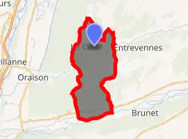
| |
 Le Castellet  Le Castellet | |
| Coordinates: 43°56′22″N 5°58′51″E | |
| Country | France |
| Region | Provence-Alpes-Côte d'Azur |
| Department | Alpes-de-Haute-Provence |
| Arrondissement | Forcalquier |
| Canton | Riez |
| Intercommunality | Val de Rancure |
| Government | |
| • Mayor (2008–2014) | Henri Garcia |
| Area 1 | 18.87 km2 (7.29 sq mi) |
| Population (2017-01-01)[1] | 293 |
| • Density | 16/km2 (40/sq mi) |
| Time zone | UTC+01:00 (CET) |
| • Summer (DST) | UTC+02:00 (CEST) |
| INSEE/Postal code | 04041 /04700 |
| Elevation | 362–665 m (1,188–2,182 ft) (avg. 480 m or 1,570 ft) |
| 1 French Land Register data, which excludes lakes, ponds, glaciers > 1 km2 (0.386 sq mi or 247 acres) and river estuaries. | |
Geography
The river Asse forms part of the commune's southern border.
Population
| Year | Pop. | ±% |
|---|---|---|
| 1765 | 357 | — |
| 1793 | 375 | +5.0% |
| 1806 | 346 | −7.7% |
| 1821 | 365 | +5.5% |
| 1831 | 338 | −7.4% |
| 1836 | 299 | −11.5% |
| 1841 | 261 | −12.7% |
| 1846 | 334 | +28.0% |
| 1851 | 319 | −4.5% |
| 1856 | 336 | +5.3% |
| 1861 | 282 | −16.1% |
| 1866 | 271 | −3.9% |
| 1872 | 247 | −8.9% |
| 1876 | 228 | −7.7% |
| 1881 | 246 | +7.9% |
| 1886 | 250 | +1.6% |
| 1891 | 220 | −12.0% |
| 1896 | 218 | −0.9% |
| 1901 | 206 | −5.5% |
| 1906 | 186 | −9.7% |
| 1911 | 198 | +6.5% |
| 1921 | 181 | −8.6% |
| 1926 | 177 | −2.2% |
| 1931 | 181 | +2.3% |
| 1936 | 133 | −26.5% |
| 1946 | 153 | +15.0% |
| 1954 | 131 | −14.4% |
| 1962 | 139 | +6.1% |
| 1968 | 125 | −10.1% |
| 1975 | 151 | +20.8% |
| 1982 | 186 | +23.2% |
| 1990 | 172 | −7.5% |
| 1999 | 202 | +17.4% |
| 2008 | 257 | +27.2% |
References
- "Populations légales 2017". INSEE. Retrieved 6 January 2020.
| Wikimedia Commons has media related to Le Castellet, Alpes-de-Haute-Provence. |
| Authority control |
|
|---|
This article is issued from Wikipedia. The text is licensed under Creative Commons - Attribution - Sharealike. Additional terms may apply for the media files.