La Javie
La Javie is a commune in the Alpes-de-Haute-Provence department in southeastern France.
La Javie | |
|---|---|
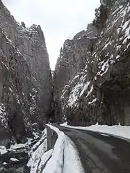 The Barles Gorge, in winter | |
 Coat of arms | |
Location of La Javie 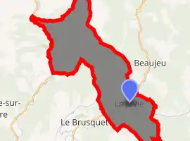
| |
 La Javie  La Javie | |
| Coordinates: 44°10′31″N 6°21′07″E | |
| Country | France |
| Region | Provence-Alpes-Côte d'Azur |
| Department | Alpes-de-Haute-Provence |
| Arrondissement | Digne-les-Bains |
| Canton | Seyne |
| Intercommunality | Haute Bléone |
| Government | |
| • Mayor (2008–2014) | Roger Carteron |
| Area 1 | 37.27 km2 (14.39 sq mi) |
| Population (2017-01-01)[1] | 404 |
| • Density | 11/km2 (28/sq mi) |
| Time zone | UTC+01:00 (CET) |
| • Summer (DST) | UTC+02:00 (CEST) |
| INSEE/Postal code | 04097 /04420 |
| Elevation | 752–2,186 m (2,467–7,172 ft) (avg. 800 m or 2,600 ft) |
| 1 French Land Register data, which excludes lakes, ponds, glaciers > 1 km2 (0.386 sq mi or 247 acres) and river estuaries. | |
Geography
The village lies on the right bank of the Bléone, which flows west through the southeastern part of the commune.
Population
| Year | Pop. | ±% |
|---|---|---|
| 1765 | 349 | — |
| 1793 | 331 | −5.2% |
| 1800 | 130 | −60.7% |
| 1806 | 311 | +139.2% |
| 1821 | 412 | +32.5% |
| 1831 | 428 | +3.9% |
| 1836 | 452 | +5.6% |
| 1841 | 472 | +4.4% |
| 1846 | 521 | +10.4% |
| 1851 | 479 | −8.1% |
| 1856 | 399 | −16.7% |
| 1861 | 386 | −3.3% |
| 1866 | 455 | +17.9% |
| 1872 | 457 | +0.4% |
| 1876 | 505 | +10.5% |
| 1881 | 506 | +0.2% |
| 1886 | 445 | −12.1% |
| 1891 | 466 | +4.7% |
| 1896 | 464 | −0.4% |
| 1901 | 431 | −7.1% |
| 1906 | 421 | −2.3% |
| 1911 | 413 | −1.9% |
| 1921 | 378 | −8.5% |
| 1926 | 367 | −2.9% |
| 1931 | 321 | −12.5% |
| 1936 | 338 | +5.3% |
| 1946 | 291 | −13.9% |
| 1954 | 296 | +1.7% |
| 1962 | 265 | −10.5% |
| 1968 | 257 | −3.0% |
| 1975 | 222 | −13.6% |
| 1982 | 251 | +13.1% |
| 1990 | 297 | +18.3% |
| 1999 | 335 | +12.8% |
| 2008 | 391 | +16.7% |
References
- "Populations légales 2017". INSEE. Retrieved 6 January 2020.
| Wikimedia Commons has media related to La Javie. |
This article is issued from Wikipedia. The text is licensed under Creative Commons - Attribution - Sharealike. Additional terms may apply for the media files.
