Le Brusquet
Le Brusquet is a commune in the Alpes-de-Haute-Provence department in southeastern France.
Le Brusquet | |
|---|---|
 Coat of arms | |
Location of Le Brusquet 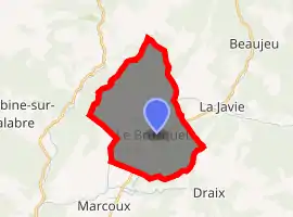
| |
 Le Brusquet  Le Brusquet | |
| Coordinates: 44°09′42″N 6°18′37″E | |
| Country | France |
| Region | Provence-Alpes-Côte d'Azur |
| Department | Alpes-de-Haute-Provence |
| Arrondissement | Digne-les-Bains |
| Canton | Seyne |
| Government | |
| • Mayor (2008–2014) | Jean-Yves Roux |
| Area 1 | 22.25 km2 (8.59 sq mi) |
| Population (2017-01-01)[1] | 958 |
| • Density | 43/km2 (110/sq mi) |
| Time zone | UTC+01:00 (CET) |
| • Summer (DST) | UTC+02:00 (CEST) |
| INSEE/Postal code | 04036 /04420 |
| Elevation | 694–1,550 m (2,277–5,085 ft) (avg. 775 m or 2,543 ft) |
| 1 French Land Register data, which excludes lakes, ponds, glaciers > 1 km2 (0.386 sq mi or 247 acres) and river estuaries. | |
Geography
The Bléone flows southwest through the middle of the commune and forms part of its southwestern border.
Population
|
|
References
- "Populations légales 2017". INSEE. Retrieved 6 January 2020.
| Wikimedia Commons has media related to Le Brusquet. |
| Authority control |
|
|---|
This article is issued from Wikipedia. The text is licensed under Creative Commons - Attribution - Sharealike. Additional terms may apply for the media files.