Salignac, Alpes-de-Haute-Provence
Salignac is a commune in the Alpes-de-Haute-Provence department in southeastern France.
Salignac | |
|---|---|
.JPG.webp) The church of Sainte-Thérèse of the Child Jesus, in Salignac | |
 Coat of arms | |
Location of Salignac 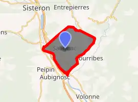
| |
 Salignac  Salignac | |
| Coordinates: 44°09′23″N 5°59′00″E | |
| Country | France |
| Region | Provence-Alpes-Côte d'Azur |
| Department | Alpes-de-Haute-Provence |
| Arrondissement | Forcalquier |
| Canton | Sisteron |
| Intercommunality | Lure-Vançon-Durance |
| Government | |
| • Mayor (2008–2014) | Michel Lauferon |
| Area 1 | 14.42 km2 (5.57 sq mi) |
| Population (2017-01-01)[1] | 634 |
| • Density | 44/km2 (110/sq mi) |
| Time zone | UTC+01:00 (CET) |
| • Summer (DST) | UTC+02:00 (CEST) |
| INSEE/Postal code | 04200 /04290 |
| Elevation | 431–802 m (1,414–2,631 ft) (avg. 438 m or 1,437 ft) |
| 1 French Land Register data, which excludes lakes, ponds, glaciers > 1 km2 (0.386 sq mi or 247 acres) and river estuaries. | |
Population
| Year | Pop. | ±% |
|---|---|---|
| 1765 | 513 | — |
| 1793 | 596 | +16.2% |
| 1800 | 576 | −3.4% |
| 1806 | 636 | +10.4% |
| 1821 | 644 | +1.3% |
| 1831 | 655 | +1.7% |
| 1836 | 655 | +0.0% |
| 1841 | 701 | +7.0% |
| 1846 | 654 | −6.7% |
| 1851 | 645 | −1.4% |
| 1856 | 624 | −3.3% |
| 1861 | 619 | −0.8% |
| 1866 | 561 | −9.4% |
| 1872 | 533 | −5.0% |
| 1876 | 503 | −5.6% |
| 1881 | 513 | +2.0% |
| 1886 | 457 | −10.9% |
| 1891 | 385 | −15.8% |
| 1896 | 363 | −5.7% |
| 1901 | 362 | −0.3% |
| 1906 | 342 | −5.5% |
| 1911 | 290 | −15.2% |
| 1921 | 214 | −26.2% |
| 1926 | 207 | −3.3% |
| 1931 | 174 | −15.9% |
| 1936 | 178 | +2.3% |
| 1946 | 163 | −8.4% |
| 1954 | 153 | −6.1% |
| 1962 | 143 | −6.5% |
| 1968 | 127 | −11.2% |
| 1975 | 169 | +33.1% |
| 1982 | 225 | +33.1% |
| 1990 | 310 | +37.8% |
| 1999 | 399 | +28.7% |
| 2008 | 518 | +29.8% |
References
- "Populations légales 2017". INSEE. Retrieved 6 January 2020.
| Wikimedia Commons has media related to Salignac, Alpes-de-Haute-Provence. |
| Authority control |
|---|
This article is issued from Wikipedia. The text is licensed under Creative Commons - Attribution - Sharealike. Additional terms may apply for the media files.