Pierrerue, Alpes-de-Haute-Provence
Pierrerue is a commune in the Alpes-de-Haute-Provence department in southeastern France.
Pierrerue | |
|---|---|
.jpg.webp) The bell tower of the Church of Pierrerue | |
 Coat of arms | |
Location of Pierrerue 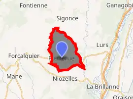
| |
 Pierrerue  Pierrerue | |
| Coordinates: 43°57′25″N 5°50′01″E | |
| Country | France |
| Region | Provence-Alpes-Côte d'Azur |
| Department | Alpes-de-Haute-Provence |
| Arrondissement | Forcalquier |
| Canton | Forcalquier |
| Intercommunality | Pays de Forcalquier et Montagne de Lure |
| Government | |
| • Mayor (2008–2014) | Éric Jean |
| Area 1 | 10.86 km2 (4.19 sq mi) |
| Population (2017-01-01)[1] | 493 |
| • Density | 45/km2 (120/sq mi) |
| Time zone | UTC+01:00 (CET) |
| • Summer (DST) | UTC+02:00 (CEST) |
| INSEE/Postal code | 04151 /04300 |
| Elevation | 379–621 m (1,243–2,037 ft) |
| 1 French Land Register data, which excludes lakes, ponds, glaciers > 1 km2 (0.386 sq mi or 247 acres) and river estuaries. | |
Population
| Year | Pop. | ±% |
|---|---|---|
| 1765 | 530 | — |
| 1793 | 603 | +13.8% |
| 1800 | 506 | −16.1% |
| 1806 | 604 | +19.4% |
| 1821 | 564 | −6.6% |
| 1831 | 621 | +10.1% |
| 1836 | 615 | −1.0% |
| 1841 | 655 | +6.5% |
| 1846 | 680 | +3.8% |
| 1851 | 683 | +0.4% |
| 1856 | 647 | −5.3% |
| 1861 | 691 | +6.8% |
| 1866 | 615 | −11.0% |
| 1872 | 620 | +0.8% |
| 1876 | 585 | −5.6% |
| 1881 | 568 | −2.9% |
| 1886 | 537 | −5.5% |
| 1891 | 529 | −1.5% |
| 1896 | 516 | −2.5% |
| 1901 | 507 | −1.7% |
| 1906 | 503 | −0.8% |
| 1911 | 453 | −9.9% |
| 1921 | 339 | −25.2% |
| 1926 | 338 | −0.3% |
| 1931 | 336 | −0.6% |
| 1936 | 306 | −8.9% |
| 1946 | 258 | −15.7% |
| 1954 | 255 | −1.2% |
| 1962 | 258 | +1.2% |
| 1968 | 245 | −5.0% |
| 1975 | 222 | −9.4% |
| 1982 | 275 | +23.9% |
| 1990 | 342 | +24.4% |
| 1999 | 404 | +18.1% |
| 2008 | 521 | +29.0% |
References
- "Populations légales 2017". INSEE. Retrieved 6 January 2020.
| Wikimedia Commons has media related to Pierrerue, Alpes-de-Haute-Provence. |
| Authority control |
|
|---|
This article is issued from Wikipedia. The text is licensed under Creative Commons - Attribution - Sharealike. Additional terms may apply for the media files.