Entrevennes
Entrevennes is a commune in the Alpes-de-Haute-Provence department in southeastern France. In French, its inhabitants are referred to with the demonym "Entrevennois".
Entrevennes | |
|---|---|
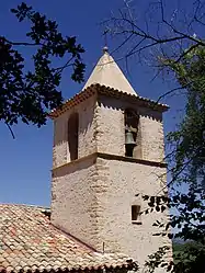 The bell tower of the church in Entrevennes | |
 Coat of arms | |
Location of Entrevennes 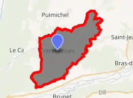
| |
 Entrevennes  Entrevennes | |
| Coordinates: 43°56′19″N 6°01′26″E | |
| Country | France |
| Region | Provence-Alpes-Côte d'Azur |
| Department | Alpes-de-Haute-Provence |
| Arrondissement | Forcalquier |
| Canton | Riez |
| Intercommunality | Val de Rancure |
| Government | |
| • Mayor (2008–2014) | Jacques Vanhems |
| Area 1 | 29.81 km2 (11.51 sq mi) |
| Population (2017-01-01)[1] | 168 |
| • Density | 5.6/km2 (15/sq mi) |
| Time zone | UTC+01:00 (CET) |
| • Summer (DST) | UTC+02:00 (CEST) |
| INSEE/Postal code | 04077 /04700 |
| Elevation | 451–800 m (1,480–2,625 ft) (avg. 600 m or 2,000 ft) |
| 1 French Land Register data, which excludes lakes, ponds, glaciers > 1 km2 (0.386 sq mi or 247 acres) and river estuaries. | |
Population
| Year | Pop. | ±% |
|---|---|---|
| 1765 | 646 | — |
| 1793 | 669 | +3.6% |
| 1806 | 587 | −12.3% |
| 1821 | 641 | +9.2% |
| 1831 | 524 | −18.3% |
| 1836 | 670 | +27.9% |
| 1841 | 673 | +0.4% |
| 1846 | 634 | −5.8% |
| 1851 | 612 | −3.5% |
| 1856 | 612 | +0.0% |
| 1861 | 596 | −2.6% |
| 1866 | 594 | −0.3% |
| 1872 | 552 | −7.1% |
| 1876 | 506 | −8.3% |
| 1881 | 521 | +3.0% |
| 1886 | 460 | −11.7% |
| 1891 | 421 | −8.5% |
| 1896 | 383 | −9.0% |
| 1901 | 321 | −16.2% |
| 1906 | 311 | −3.1% |
| 1911 | 279 | −10.3% |
| 1921 | 226 | −19.0% |
| 1926 | 237 | +4.9% |
| 1931 | 210 | −11.4% |
| 1936 | 182 | −13.3% |
| 1946 | 130 | −28.6% |
| 1954 | 121 | −6.9% |
| 1962 | 112 | −7.4% |
| 1968 | 104 | −7.1% |
| 1975 | 98 | −5.8% |
| 1982 | 109 | +11.2% |
| 1990 | 128 | +17.4% |
| 1999 | 163 | +27.3% |
| 2008 | 167 | +2.5% |
Personalities
The troubadour Isnart d'Entrevenas was lord of Entrevennes in the early thirteenth century.
References
- "Populations légales 2017". INSEE. Retrieved 6 January 2020.
| Wikimedia Commons has media related to Entrevennes. |
This article is issued from Wikipedia. The text is licensed under Creative Commons - Attribution - Sharealike. Additional terms may apply for the media files.
