Villeneuve, Alpes-de-Haute-Provence
Villeneuve is a commune in the Alpes-de-Haute-Provence department in southeastern France.
Villeneuve | |
|---|---|
.JPG.webp) The church and surrounding buildings in Villeneuve | |
 Coat of arms | |
Location of Villeneuve 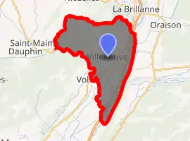
| |
 Villeneuve  Villeneuve | |
| Coordinates: 43°53′42″N 5°51′49″E | |
| Country | France |
| Region | Provence-Alpes-Côte d'Azur |
| Department | Alpes-de-Haute-Provence |
| Arrondissement | Forcalquier |
| Canton | Oraison |
| Intercommunality | Luberon Oriental |
| Government | |
| • Mayor (2008–2014) | Jacques Echalon |
| Area 1 | 25.55 km2 (9.86 sq mi) |
| Population (2017-01-01)[1] | 4,196 |
| • Density | 160/km2 (430/sq mi) |
| Time zone | UTC+01:00 (CET) |
| • Summer (DST) | UTC+02:00 (CEST) |
| INSEE/Postal code | 04242 /04180 |
| Elevation | 313–600 m (1,027–1,969 ft) (avg. 450 m or 1,480 ft) |
| 1 French Land Register data, which excludes lakes, ponds, glaciers > 1 km2 (0.386 sq mi or 247 acres) and river estuaries. | |
Villeneuve is located in Durance valley. This village, like many other villages in Provence, is built on the top of a hill to keep it protected from invaders. Villeneuve in French mean "New town" but was constructed in Middle Ages, originally further in the forest on the top of a high cliff. Only the little chapel remains on the rock to show where the original village was located.
Population
| Year | Pop. | ±% |
|---|---|---|
| 1765 | 575 | — |
| 1793 | 647 | +12.5% |
| 1800 | 720 | +11.3% |
| 1806 | 696 | −3.3% |
| 1821 | 806 | +15.8% |
| 1831 | 872 | +8.2% |
| 1836 | 846 | −3.0% |
| 1841 | 776 | −8.3% |
| 1846 | 783 | +0.9% |
| 1851 | 793 | +1.3% |
| 1856 | 778 | −1.9% |
| 1861 | 785 | +0.9% |
| 1866 | 731 | −6.9% |
| 1872 | 798 | +9.2% |
| 1876 | 745 | −6.6% |
| 1881 | 681 | −8.6% |
| 1886 | 600 | −11.9% |
| 1891 | 576 | −4.0% |
| 1896 | 577 | +0.2% |
| 1901 | 566 | −1.9% |
| 1906 | 1,143 | +101.9% |
| 1911 | 605 | −47.1% |
| 1921 | 591 | −2.3% |
| 1926 | 537 | −9.1% |
| 1931 | 496 | −7.6% |
| 1936 | 575 | +15.9% |
| 1946 | 586 | +1.9% |
| 1954 | 575 | −1.9% |
| 1962 | 639 | +11.1% |
| 1968 | 861 | +34.7% |
| 1975 | 1,144 | +32.9% |
| 1982 | 1,730 | +51.2% |
| 1990 | 2,516 | +45.4% |
| 1999 | 2,964 | +17.8% |
| 2008 | 3,444 | +16.2% |
See also
References
- "Populations légales 2017". INSEE. Retrieved 6 January 2020.
| Wikimedia Commons has media related to Villeneuve, Alpes-de-Haute-Provence. |
| Authority control |
|
|---|
This article is issued from Wikipedia. The text is licensed under Creative Commons - Attribution - Sharealike. Additional terms may apply for the media files.