Les Mées, Alpes-de-Haute-Provence
Les Mées (Occitan: Lei Mès) is a commune in the Alpes-de-Haute-Provence department in southeastern France.
Les Mées | |
|---|---|
.JPG.webp) The village of Les Mées, seen from the village of Peyruis | |
 Coat of arms | |
Location of Les Mées 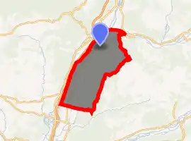
| |
 Les Mées  Les Mées | |
| Coordinates: 44°01′50″N 5°58′38″E | |
| Country | France |
| Region | Provence-Alpes-Côte d'Azur |
| Department | Alpes-de-Haute-Provence |
| Arrondissement | Digne-les-Bains |
| Canton | Oraison |
| Government | |
| • Mayor (2008–2014) | Raymond Philippe |
| Area 1 | 65.4 km2 (25.3 sq mi) |
| Population (2017-01-01)[1] | 3,735 |
| • Density | 57/km2 (150/sq mi) |
| Time zone | UTC+01:00 (CET) |
| • Summer (DST) | UTC+02:00 (CEST) |
| INSEE/Postal code | 04116 /04190 |
| Elevation | 348–824 m (1,142–2,703 ft) (avg. 410 m or 1,350 ft) |
| 1 French Land Register data, which excludes lakes, ponds, glaciers > 1 km2 (0.386 sq mi or 247 acres) and river estuaries. | |
Geography
The Bléone forms the commune's northern border, then flows into the Durance, which forms the commune's western border.
Population
| Year | Pop. | ±% |
|---|---|---|
| 1765 | 2,014 | — |
| 1793 | 1,805 | −10.4% |
| 1806 | 2,209 | +22.4% |
| 1821 | 2,146 | −2.9% |
| 1831 | 2,129 | −0.8% |
| 1836 | 2,082 | −2.2% |
| 1841 | 2,030 | −2.5% |
| 1846 | 1,950 | −3.9% |
| 1851 | 1,893 | −2.9% |
| 1856 | 1,964 | +3.8% |
| 1861 | 2,030 | +3.4% |
| 1866 | 2,116 | +4.2% |
| 1872 | 2,165 | +2.3% |
| 1876 | 2,214 | +2.3% |
| 1881 | 2,124 | −4.1% |
| 1886 | 2,034 | −4.2% |
| 1891 | 1,993 | −2.0% |
| 1896 | 1,922 | −3.6% |
| 1901 | 1,924 | +0.1% |
| 1906 | 1,753 | −8.9% |
| 1911 | 1,783 | +1.7% |
| 1921 | 1,491 | −16.4% |
| 1926 | 1,449 | −2.8% |
| 1931 | 1,451 | +0.1% |
| 1936 | 1,390 | −4.2% |
| 1946 | 1,542 | +10.9% |
| 1954 | 1,566 | +1.6% |
| 1962 | 2,370 | +51.3% |
| 1968 | 2,063 | −13.0% |
| 1975 | 2,128 | +3.2% |
| 1982 | 2,275 | +6.9% |
| 1990 | 2,601 | +14.3% |
| 1999 | 2,925 | +12.5% |
| 2008 | 3,591 | +22.8% |
References
- "Populations légales 2017". INSEE. Retrieved 6 January 2020.
| Wikimedia Commons has media related to Les Mées, Alpes-de-Haute-Provence. |
| Authority control |
|
|---|
This article is issued from Wikipedia. The text is licensed under Creative Commons - Attribution - Sharealike. Additional terms may apply for the media files.