Sainte-Croix-à-Lauze
Sainte-Croix-à-Lauze is a commune in the Alpes-de-Haute-Provence department in southeastern France.
Sainte-Croix-à-Lauze | |
|---|---|
 Gate of the chateau | |
 Coat of arms | |
Location of Sainte-Croix-à-Lauze 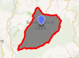
| |
 Sainte-Croix-à-Lauze  Sainte-Croix-à-Lauze | |
| Coordinates: 43°54′34″N 5°37′05″E | |
| Country | France |
| Region | Provence-Alpes-Côte d'Azur |
| Department | Alpes-de-Haute-Provence |
| Arrondissement | Forcalquier |
| Canton | Reillanne |
| Government | |
| • Mayor (2008–2014) | Marie-Christine Almeras |
| Area 1 | 8.65 km2 (3.34 sq mi) |
| Population (2017-01-01)[1] | 88 |
| • Density | 10/km2 (26/sq mi) |
| Time zone | UTC+01:00 (CET) |
| • Summer (DST) | UTC+02:00 (CEST) |
| INSEE/Postal code | 04175 /04110 |
| Elevation | 374–793 m (1,227–2,602 ft) (avg. 600 m or 2,000 ft) |
| 1 French Land Register data, which excludes lakes, ponds, glaciers > 1 km2 (0.386 sq mi or 247 acres) and river estuaries. | |
Population
| Year | Pop. | ±% |
|---|---|---|
| 1765 | 178 | — |
| 1793 | 197 | +10.7% |
| 1800 | 158 | −19.8% |
| 1806 | 214 | +35.4% |
| 1821 | 163 | −23.8% |
| 1831 | 174 | +6.7% |
| 1836 | 216 | +24.1% |
| 1841 | 233 | +7.9% |
| 1846 | 213 | −8.6% |
| 1851 | 207 | −2.8% |
| 1856 | 196 | −5.3% |
| 1861 | 185 | −5.6% |
| 1866 | 166 | −10.3% |
| 1872 | 176 | +6.0% |
| 1876 | 185 | +5.1% |
| 1881 | 176 | −4.9% |
| 1886 | 157 | −10.8% |
| 1891 | 154 | −1.9% |
| 1896 | 136 | −11.7% |
| 1901 | 120 | −11.8% |
| 1906 | 98 | −18.3% |
| 1911 | 87 | −11.2% |
| 1921 | 67 | −23.0% |
| 1926 | 67 | +0.0% |
| 1931 | 70 | +4.5% |
| 1936 | 69 | −1.4% |
| 1946 | 57 | −17.4% |
| 1954 | 49 | −14.0% |
| 1962 | 50 | +2.0% |
| 1968 | 35 | −30.0% |
| 1975 | 34 | −2.9% |
| 1982 | 65 | +91.2% |
| 1990 | 31 | −52.3% |
| 1999 | 72 | +132.3% |
| 2008 | 82 | +13.9% |
References
- "Populations légales 2017". INSEE. Retrieved 6 January 2020.
| Wikimedia Commons has media related to Sainte-Croix-à-Lauze. |
This article is issued from Wikipedia. The text is licensed under Creative Commons - Attribution - Sharealike. Additional terms may apply for the media files.