L'Escale
L'Escale is a commune in the Alpes-de-Haute-Provence department in southeastern France. It is located on the eastern bank of the Durance opposite Château-Arnoux-Saint-Auban.
L'Escale | |
|---|---|
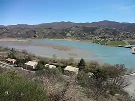 L'Escale Lake as viewed from Château-Arnoux-Saint-Auban. | |
 Coat of arms | |
Location of L'Escale 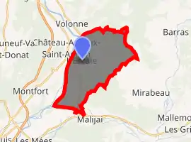
| |
 L'Escale  L'Escale | |
| Coordinates: 44°05′10″N 6°01′25″E | |
| Country | France |
| Region | Provence-Alpes-Côte d'Azur |
| Department | Alpes-de-Haute-Provence |
| Arrondissement | Digne-les-Bains |
| Canton | Château-Arnoux-Saint-Auban |
| Intercommunality | Provence-Alpes Agglomération |
| Government | |
| • Mayor (2014-2020) | Claude Fiaert |
| Area 1 | 20.36 km2 (7.86 sq mi) |
| Population (2017-01-01)[1] | 1,389 |
| • Density | 68/km2 (180/sq mi) |
| Time zone | UTC+01:00 (CET) |
| • Summer (DST) | UTC+02:00 (CEST) |
| INSEE/Postal code | 04079 /04160 |
| Elevation | 408–1,081 m (1,339–3,547 ft) (avg. 475 m or 1,558 ft) |
| 1 French Land Register data, which excludes lakes, ponds, glaciers > 1 km2 (0.386 sq mi or 247 acres) and river estuaries. | |
Geography
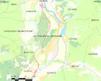
L'Escale and surrounding districts
The Bléone forms the commune's southern border, then flows into the Durance, which forms the commune's western border.
L'Escale Dam
Work began on the dam in 1959, which was completed in 1963.[2] With a height of 30ms it retains 15.70 hm³ of water.[2] It is 126 metres long with a road carriageway along which runs the Route Napoleon.[2] There is attached to the dam a power station whose three units produce a total of 170,000 KWs of electricity.[3]
Population
| Year | Pop. | ±% |
|---|---|---|
| 2006 | 1,235 | — |
| 2007 | 1,245 | +0.8% |
| 2008 | 1,255 | +0.8% |
| 2009 | 1,282 | +2.2% |
| 2010 | 1,311 | +2.3% |
| 2011 | 1,330 | +1.4% |
| 2012 | 1,349 | +1.4% |
| 2013 | 1,369 | +1.5% |
| 2014 | 1,384 | +1.1% |
| 2015 | 1,408 | +1.7% |
| 2016 | 1,399 | −0.6% |
References
- "Populations légales 2017". INSEE. Retrieved 6 January 2020.
- Janberg, Nicolas Janberg. "L'Escale Dam (L'Escale/Château-Arnoux-Saint-Auban, 1963) | Structurae". Structurae. Nicolas Janberg. Retrieved 2 May 2017.
- Plichon, J. N. (1968). Water for Peace: Volume 8 Planning and developing water programs. Washington: U.S. Government Printing Office. p. 394. Retrieved 2 May 2017.
| Wikimedia Commons has media related to L'Escale. |
This article is issued from Wikipedia. The text is licensed under Creative Commons - Attribution - Sharealike. Additional terms may apply for the media files.