Nuckolls County, Nebraska
Nuckolls County is a county located in the U.S. state of Nebraska. As of the 2010 United States Census, the population was 4,500.[1] Its county seat is Nelson.[2]
Nuckolls County | |
|---|---|
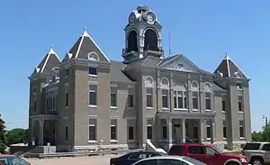 Nuckolls County Courthouse in Nelson | |
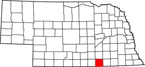 Location within the U.S. state of Nebraska | |
 Nebraska's location within the U.S. | |
| Coordinates: 40°11′N 98°03′W | |
| Country | |
| State | |
| Founded | 1860 (founded) 1871 (organized) |
| Named for | Stephen Friel Nuckolls |
| Seat | Nelson |
| Largest city | Superior |
| Area | |
| • Total | 576 sq mi (1,490 km2) |
| • Land | 575 sq mi (1,490 km2) |
| • Water | 0.7 sq mi (2 km2) 0.1%% |
| Population | |
| • Estimate (2017) | 4,275 |
| • Density | 7.43/sq mi (2.87/km2) |
| Time zone | UTC−6 (Central) |
| • Summer (DST) | UTC−5 (CDT) |
| Congressional district | 3rd |
| Website | www |
In the Nebraska license plate system, Nuckolls County is represented by the prefix 42 (it had the 42nd-largest number of vehicles registered in the county when the license plate system was established in 1922).
History
19th century
Nuckolls County was formed in 1860, and was organized in 1871.[3][4] It was named after Stephen F. Nuckolls, an early pioneer in this area.[5]
In 1887, Atchison, Topeka and Santa Fe Railway built a branch line from Neva, Kansas (3 miles west of Strong City) to Superior, Nebraska. At some point, the rails were removed from Neva, KS to Lost Springs, KS, but the right-of-way has not been abandoned. As of 2020, the BNSF Line from Superior, NE to Lost Springs, KS was active and carrying rail traffic to and from Superior. This branch line was originally called "Strong City and Superior line" but later the name was shortened to the "Strong City line". In 1996, the Atchison, Topeka and Santa Fe Railway merged with Burlington Northern Railroad, renamed to the current BNSF Railway. Most locals still refer to this railroad as the "Santa Fe".
Geography
Nuckolls County lies on the south line of Nebraska. Its south boundary line abuts the north boundary line of the state of Kansas. The Republican River flows southeastward through the SW corner of the county The upper county area is drained by two creeks, Elk Creek and Oxbow Creek, that flow northeastward to discharge into Crooked Creek, which then flows eastward into adjacent Thayer County. The Nuckolls County terrain consists of vegetation-covered rolling hills, sloped to the east. A portion of the area is dedicated to agriculture, especially in the northeast corner.[6]
Nuckolls county has a total area of 576 square miles (1,490 km2), of which 575 square miles (1,490 km2) is land and 0.7 square miles (1.8 km2) (0.1%) is water.[7]
Major Highways
Adjacent counties
- Clay County - north
- Fillmore County - northeast
- Thayer County - east
- Republic County, Kansas - southeast
- Jewell County, Kansas - southwest
- Webster County - west
Protected areas
- Smartweed Marsh State Wildlife Management Area[8]
Demographics
| Historical population | |||
|---|---|---|---|
| Census | Pop. | %± | |
| 1860 | 22 | — | |
| 1870 | 8 | −63.6% | |
| 1880 | 4,235 | 52,837.5% | |
| 1890 | 11,417 | 169.6% | |
| 1900 | 12,414 | 8.7% | |
| 1910 | 13,019 | 4.9% | |
| 1920 | 13,236 | 1.7% | |
| 1930 | 12,629 | −4.6% | |
| 1940 | 12,781 | 1.2% | |
| 1950 | 10,973 | −14.1% | |
| 1960 | 8,217 | −25.1% | |
| 1970 | 7,404 | −9.9% | |
| 1980 | 6,726 | −9.2% | |
| 1990 | 7,586 | 12.8% | |
| 2000 | 5,057 | −33.3% | |
| 2010 | 4,500 | −11.0% | |
| 2017 (est.) | 4,275 | [9] | −5.0% |
| US Decennial Census[10] 1790-1960[11] 1900-1990[12] 1990-2000[13] 2010-2013[1] | |||
As of the 2000 United States Census,[14] there were 5,057 people, 2,218 households, and 1,443 families in the county. The population density was 9 people per square mile (3/km2). There were 2,530 housing units at an average density of 4 per square mile (2/km2). The racial makeup of the county was 98.91% White, 0.02% Black or African American, 0.06% Native American, 0.16% Asian, 0.53% from other races, and 0.32% from two or more races. 1.01% of the population were Hispanic or Latino of any race.
There were 2,218 households, out of which 26.50% had children under the age of 18 living with them, 58.80% were married couples living together, 4.60% had a female householder with no husband present, and 34.90% were non-families. 32.30% of all households were made up of individuals, and 18.00% had someone living alone who was 65 years of age or older. The average household size was 2.26 and the average family size was 2.86.
The county population contained 23.40% under the age of 18, 5.40% from 18 to 24, 22.50% from 25 to 44, 24.30% from 45 to 64, and 24.40% who were 65 years of age or older. The median age was 44 years. For every 100 females there were 92.50 males. For every 100 females age 18 and over, there were 91.90 males.
The median income for a household in the county was $28,958, and the median income for a family was $35,018. Males had a median income of $24,533 versus $17,806 for females. The per capita income for the county was $15,608. About 6.50% of families and 11.20% of the population were below the poverty line, including 16.70% of those under age 18 and 8.90% of those age 65 or over.
Communities
Politics
Nuckolls County voters are reliably Republican. In only one national election since 1936 has the county selected the Democratic Party candidate (as of 2016).
| Year | Republican | Democratic | Third Parties |
|---|---|---|---|
| 2020 | 80.6% 1,857 | 17.7% 409 | 1.7% 39 |
| 2016 | 78.3% 1,726 | 16.0% 353 | 5.7% 126 |
| 2012 | 71.8% 1,574 | 25.9% 568 | 2.2% 49 |
| 2008 | 67.5% 1,498 | 29.6% 657 | 3.0% 66 |
| 2004 | 76.2% 1,884 | 21.9% 541 | 1.9% 46 |
| 2000 | 69.6% 1,701 | 26.4% 644 | 4.0% 98 |
| 1996 | 56.0% 1,383 | 30.7% 757 | 13.3% 329 |
| 1992 | 43.2% 1,277 | 28.2% 834 | 28.7% 848 |
| 1988 | 60.5% 1,750 | 38.5% 1,114 | 0.9% 27 |
| 1984 | 68.8% 2,132 | 30.6% 947 | 0.6% 19 |
| 1980 | 66.4% 2,180 | 27.4% 899 | 6.2% 203 |
| 1976 | 54.4% 1,753 | 44.2% 1,424 | 1.5% 47 |
| 1972 | 67.7% 2,089 | 32.4% 999 | |
| 1968 | 59.3% 1,894 | 35.3% 1,127 | 5.4% 172 |
| 1964 | 41.5% 1,546 | 58.5% 2,181 | |
| 1960 | 60.9% 2,441 | 39.1% 1,570 | |
| 1956 | 64.3% 2,672 | 35.7% 1,485 | |
| 1952 | 70.3% 3,251 | 29.7% 1,371 | |
| 1948 | 52.7% 2,036 | 47.3% 1,827 | |
| 1944 | 62.6% 2,685 | 37.4% 1,607 | |
| 1940 | 61.7% 3,017 | 38.3% 1,873 | |
| 1936 | 44.8% 2,317 | 53.7% 2,778 | 1.5% 76 |
| 1932 | 34.0% 1,812 | 64.1% 3,420 | 1.9% 101 |
| 1928 | 65.6% 3,299 | 33.5% 1,684 | 0.9% 44 |
| 1924 | 54.0% 2,595 | 33.2% 1,596 | 12.8% 613 |
| 1920 | 64.1% 2,637 | 32.5% 1,337 | 3.5% 142 |
| 1916 | 43.5% 1,411 | 53.4% 1,732 | 3.1% 100 |
| 1912 | 24.5% 738 | 43.5% 1,312 | 32.1% 967 |
| 1908 | 49.2% 1,519 | 49.3% 1,523 | 1.5% 46 |
| 1904 | 61.0% 1,615 | 22.1% 585 | 16.9% 448 |
| 1900 | 49.1% 1,471 | 49.4% 1,480 | 1.5% 46 |
References
- "State & County QuickFacts". United States Census Bureau. Archived from the original on June 7, 2011. Retrieved September 21, 2013.
- "Find a County". National Association of Counties. Retrieved 7 June 2011.
- Fitzpatrick, Lilian Linder (1925). Nebraska Place-Names. Lincoln: University of Nebraska Studies in Language, Literature, and Criticism. p. 107. Retrieved December 15, 2014.
- Andreas, A. T. (1882). "Andreas' History of the State of Nebraska". The Kansas Collection. Archived from the original on 2003-05-10. Retrieved December 15, 2014.
- "Nuckolls County". Nebraska Association of County Officials. Retrieved December 15, 2014.
- Nuckolls County NE Google Maps (accessed 25 January 2019)
- "2010 Census Gazetteer Files". US Census Bureau. August 22, 2012. Archived from the original on November 13, 2013. Retrieved December 9, 2014.
- Smartweed Marsh State Wildlife Management Area, Edgar NE Google Maps (accessed 25 January 2019)
- "Population and Housing Unit Estimates". Retrieved 21 January 2019.
- "US Decennial Census". US Census Bureau. Retrieved December 9, 2014.
- "Historical Census Browser". University of Virginia Library. Retrieved December 9, 2014.
- "Population of Counties by Decennial Census: 1900 to 1990". US Census Bureau. Retrieved December 9, 2014.
- "Census 2000 PHC-T-4. Ranking Tables for Counties: 1990 and 2000" (PDF). US Census Bureau. Retrieved December 9, 2014.
- "U.S. Census website". US Census Bureau. Retrieved 31 January 2008.
- Election Results
External links
| Wikimedia Commons has media related to Nuckolls County, Nebraska. |
Places adjacent to Nuckolls County, Nebraska | ||||||||||
|---|---|---|---|---|---|---|---|---|---|---|
| ||||||||||
Municipalities and communities of Nuckolls County, Nebraska, United States | ||
|---|---|---|
| Cities | Map of Nebraska highlighting Nuckolls County | |
| Villages | ||
| Unincorporated communities | ||
| Ghost town | ||
| ||

| Authority control |
|---|