Keya Paha County, Nebraska
Keya Paha County (/ˈkɪpəhɔː/ KIP-ə-haw)[1] is a county in the U.S. state of Nebraska. As of the 2010 United States Census, the population was 824.[2] Its county seat is Springview.[3]
Keya Paha County | |
|---|---|
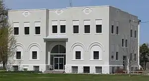 Keya Paha County Courthouse in Springview | |
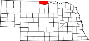 Location within the U.S. state of Nebraska | |
 Nebraska's location within the U.S. | |
| Coordinates: 42°53′N 99°43′W | |
| Country | |
| State | |
| Founded | 4 November 1884 |
| Seat | Springview |
| Largest village | Springview |
| Area | |
| • Total | 774 sq mi (2,000 km2) |
| • Land | 773 sq mi (2,000 km2) |
| • Water | 0.8 sq mi (2 km2) 0.1%% |
| Population | |
| • Estimate (2017) | 793 |
| • Density | 1.0/sq mi (0.4/km2) |
| Time zone | UTC−6 (Central) |
| • Summer (DST) | UTC−5 (CDT) |
| Congressional district | 3rd |
| Website | www |
In the Nebraska license plate system, Keya Paha County is represented by the prefix 82 (it had the 82nd-largest number of vehicles registered in the county when the license plate system was established in 1922).
History
The name "Keya Paha" is taken from the Dakota language; literally translated, it means "turtle hill". The Dakota name for a set of small hills was given to the county and to the Keya Paha River, which runs through it.[4]
All land north of the Keya Paha River (which includes a small portion of Keya Paha County and most of neighboring Boyd County) was not originally part of Nebraska at the time of statehood, but was transferred from Dakota Territory in 1882.
Keya Paha County was organized in 1884 of land partitioned from Brown County.[5]
Geography
Keya Paha County lies on the north line of Nebraska. Its north boundary line abuts the south boundary line of the state of South Dakota. The county's terrain consists of low rolling hills, whose level areas are used for agriculture, including center pivot irrigation. The Keya Paha River flows east-southeastward through the northeastern part of the county, while the Niobrara River flows eastward along the south county line. The county has a total area of 774 square miles (2,000 km2), of which 773 square miles (2,000 km2) is land and 0.8 square miles (2.1 km2) (0.1%) is water.[6]
Keya Paha County is located in Nebraska's Outback region.[7]
Major highways
 U.S. Highway 183
 Nebraska Highway 7
 Nebraska Highway 12
 Nebraska Highway 137
Adjacent counties
- Tripp County, South Dakota - north
- Gregory County, South Dakota - northeast
- Boyd County - east
- Holt County - southeast
- Rock County - south
- Brown County - south
- Cherry County - west
- Todd County, South Dakota - northwest
National protected area
Demographics
| Historical population | |||
|---|---|---|---|
| Census | Pop. | %± | |
| 1890 | 3,920 | — | |
| 1900 | 3,076 | −21.5% | |
| 1910 | 3,452 | 12.2% | |
| 1920 | 3,594 | 4.1% | |
| 1930 | 3,203 | −10.9% | |
| 1940 | 3,235 | 1.0% | |
| 1950 | 2,160 | −33.2% | |
| 1960 | 1,672 | −22.6% | |
| 1970 | 1,340 | −19.9% | |
| 1980 | 1,301 | −2.9% | |
| 1990 | 1,029 | −20.9% | |
| 2000 | 983 | −4.5% | |
| 2010 | 824 | −16.2% | |
| 2017 (est.) | 793 | [8] | −3.8% |
| US Decennial Census[9] 1790-1960[10] 1900-1990[11] 1990-2000[12] 2010-2013[2] | |||
As of the 2000 United States Census,[13] there were 983 people, 409 households, and 292 families in the county. The population density was 1.3 people per square mile (0.5/km2); there were 548 housing units at an average density of 0.7 per square mile (0.3/km2). The racial makeup of the county was 99.39% White, 0.20% Native American, and 0.41% from two or more races; 3.87% of the population were Hispanic or Latino of any race; 46.7% were of German, 10.6% English, 9.8% American, 7.0% Irish and 6.0% Swedish ancestry.
There were 409 households, out of which 24.90% had children under the age of 18 living with them, 64.30% were married couples living together, 4.40% had a female householder with no husband present, and 28.60% were non-families. 26.20% of all households were made up of individuals, and 13.90% had someone living alone who was 65 years of age or older. The average household size was 2.40 and the average family size was 2.91.
The county population contained 23.80% under the age of 18, 6.70% from 18 to 24, 23.40% from 25 to 44, 25.40% from 45 to 64, and 20.70% who were 65 years of age or older. The median age was 42 years. For every 100 females there were 101.40 males. For every 100 females age 18 and over, there were 101.90 males.
The median income for a household in the county was $24,911, and the median income for a family was $28,287. Males had a median income of $18,750 versus $19,107 for females. The per capita income for the county was $11,860. About 22.40% of families and 26.90% of the population were below the poverty line, including 34.30% of those under age 18 and 18.80% of those age 65 or over.
Politics
As of 2008, Keya Paha County was the most Republican of all the counties in Nebraska, with 82.7% of its 707 registered voters registered as Republicans.[14] The last Democratic Presidential candidate to win the county was Woodrow Wilson in 1916.[15] In 1994, Ben Nelson was the last Democratic gubernatorial candidate to carry the county.[16]
| Year | Republican | Democratic | Third Parties |
|---|---|---|---|
| 2020 | 89.9% 476 | 9.3% 49 | 0.8% 4 |
| 2016 | 88.6% 460 | 7.7% 40 | 3.7% 19 |
| 2012 | 81.2% 393 | 16.5% 80 | 2.3% 11 |
| 2008 | 76.7% 409 | 21.6% 115 | 1.7% 9 |
| 2004 | 80.5% 442 | 17.9% 98 | 1.6% 9 |
| 2000 | 82.3% 422 | 15.2% 78 | 2.5% 13 |
| 1996 | 72.1% 385 | 17.6% 94 | 10.3% 55 |
| 1992 | 58.3% 368 | 16.6% 105 | 25.0% 158 |
| 1988 | 75.0% 446 | 24.4% 145 | 0.7% 4 |
| 1984 | 79.8% 507 | 20.2% 128 | |
| 1980 | 76.5% 526 | 18.9% 130 | 4.7% 32 |
| 1976 | 60.7% 405 | 36.7% 245 | 2.6% 17 |
| 1972 | 79.4% 563 | 20.6% 146 | |
| 1968 | 77.0% 531 | 15.8% 109 | 7.3% 50 |
| 1964 | 61.3% 506 | 38.7% 320 | |
| 1960 | 72.8% 646 | 27.2% 241 | |
| 1956 | 70.7% 635 | 29.3% 263 | |
| 1952 | 79.1% 785 | 21.0% 208 | |
| 1948 | 57.5% 538 | 42.5% 397 | |
| 1944 | 70.0% 781 | 30.0% 334 | |
| 1940 | 66.7% 1,004 | 33.3% 502 | |
| 1936 | 59.6% 830 | 39.9% 556 | 0.5% 7 |
| 1932 | 50.5% 675 | 48.3% 645 | 1.2% 16 |
| 1928 | 79.8% 989 | 18.7% 232 | 1.5% 19 |
| 1924 | 41.5% 504 | 20.7% 251 | 37.9% 460 |
| 1920 | 64.7% 479 | 29.5% 218 | 5.8% 43 |
| 1916 | 39.8% 316 | 50.4% 401 | 9.8% 78 |
| 1912 | 32.1% 259 | 27.4% 221 | 40.5% 327[18] |
| 1908 | 50.1% 422 | 42.0% 354 | 8.0% 67 |
| 1904 | 62.1% 448 | 13.5% 97 | 24.4% 176 |
| 1900 | 49.7% 380 | 46.2% 353 | 4.1% 31 |
Communities
- Brocksburg
- Burton
- Jamison
- Meadville
- Mills
- Norden
- Riverview
- Springview (county seat)
References
- McNally, Hannah, and Diana Lambdin Meyer (1997). Nebraska: Off the Beaten Path. Morris Book Publishing LLC. p. 81.
- "State & County QuickFacts". US Census Bureau. Archived from the original on June 7, 2011. Retrieved September 21, 2013.
- "Find a County". National Association of Counties. Archived from the original on 31 May 2011. Retrieved 7 June 2011.
- Fitzpatrick, Lilian Linder (1925). "Nebraska Place-Names". Archived 7 February 2015 at the Wayback Machine University of Nebraska Department of English.
- Burr, George L.; Buck, O. O. (1921). History of Hamilton and Clay Counties, Nebraska. S.J. Clarke Pub. Co. p. 123.
- "2010 Census Gazetteer Files". US Census Bureau. August 22, 2012. Archived from the original on November 13, 2013. Retrieved December 8, 2014.
- "About" Archived 3 October 2008 at the Wayback Machine, North Central RC&D.
- "Population and Housing Unit Estimates". Retrieved 23 January 2019.
- "US Decennial Census". US Census Bureau. Retrieved December 8, 2014.
- "Historical Census Browser". University of Virginia Library. Archived from the original on August 11, 2012. Retrieved December 8, 2014.
- "Population of Counties by Decennial Census: 1900 to 1990". US Census Bureau. Archived from the original on April 27, 2015. Retrieved December 8, 2014.
- "Census 2000 PHC-T-4. Ranking Tables for Counties: 1990 and 2000" (PDF). US Census Bureau. Archived (PDF) from the original on December 18, 2014. Retrieved December 8, 2014.
- "U.S. Census website". United States Census Bureau. Retrieved 31 January 2008.
- "Final VR Report" (PDF). Archived from the original (PDF) on 2008-11-26. Retrieved 2009-05-23.
- Geographie Electorale
- David Leip Electoral Atlas (Maps for Nebraska gubernatorial races)
- Election Results
- The leading "other" candidate, Progressive Theodore Roosevelt, received 246 votes, while Socialist candidate Eugene Debs received 70 votes and Prohibition Eugene Chafin received 11 votes.
Places adjacent to Keya Paha County, Nebraska | ||||||||||
|---|---|---|---|---|---|---|---|---|---|---|
| ||||||||||
Municipalities and communities of Keya Paha County, Nebraska, United States | ||
|---|---|---|
| Villages | Map of Nebraska highlighting Keya Paha County | |
| Unincorporated communities | ||
| Ghost town | ||
| ||
