Antelope County, Nebraska
Antelope County is a county in the U.S. state of Nebraska. As of the 2010 United States Census, the population was 6,685.[1] Its county seat is Neligh.[2] The county was formed in 1871.[3] It received its name after a group of early settlers killed and ate several pronghorn.[4] Although these are not true antelope, they are colloquially known by that name.[5]
Antelope County | |
|---|---|
_from_W_2.JPG.webp) Antelope County Courthouse in Neligh | |
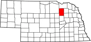 Location within the U.S. state of Nebraska | |
 Nebraska's location within the U.S. | |
| Coordinates: 42°11′N 98°04′W | |
| Country | |
| State | |
| Founded | 1871 |
| Named for | Pronghorn antelope |
| Seat | Neligh |
| Largest city | Neligh |
| Area | |
| • Total | 859 sq mi (2,220 km2) |
| • Land | 857 sq mi (2,220 km2) |
| • Water | 1.4 sq mi (4 km2) 0.2%% |
| Population | |
| • Estimate (2018) | 6,336 |
| • Density | 7.4/sq mi (2.9/km2) |
| Time zone | UTC−6 (Central) |
| • Summer (DST) | UTC−5 (CDT) |
| Congressional district | 3rd |
| Website | www |
The Ashfall Fossil Beds National Natural Landmark is located within the county.
In the Nebraska license plate system, Antelope County is represented by the prefix 26 (it had the 26th-largest number of vehicles registered in the state when the license plate system was established in 1922).
Geography
According to the US Census Bureau, the county has an area of 859 square miles (2,220 km2), of which 857 square miles (2,220 km2) is land and 1.4 square miles (3.6 km2) (0.2%) is water.[6]
Adjacent counties
- Pierce County – east
- Madison County – southeast
- Boone County – south
- Wheeler County – southwest
- Holt County – west
- Knox County – north
Major highways
Protected areas
Demographics
| Historical population | |||
|---|---|---|---|
| Census | Pop. | %± | |
| 1880 | 3,953 | — | |
| 1890 | 10,399 | 163.1% | |
| 1900 | 11,344 | 9.1% | |
| 1910 | 14,003 | 23.4% | |
| 1920 | 15,243 | 8.9% | |
| 1930 | 15,206 | −0.2% | |
| 1940 | 13,289 | −12.6% | |
| 1950 | 11,264 | −15.2% | |
| 1960 | 10,176 | −9.7% | |
| 1970 | 9,047 | −11.1% | |
| 1980 | 8,675 | −4.1% | |
| 1990 | 7,965 | −8.2% | |
| 2000 | 7,452 | −6.4% | |
| 2010 | 6,685 | −10.3% | |
| 2018 (est.) | 6,336 | [7] | −5.2% |
| US Decennial Census[8] 1790-1960[9] 1900-1990[10] 1990-2000[11] 2010-2013[1] | |||
As of the 2000 United States Census,[12] there were 7,452 people, 2,953 households, and 2,073 families in the county. The population density was 9 people per square mile (3/km2). There were 3,346 housing units at an average density of 4 per square mile (2/km2). The racial makeup of the county was 98.82% White, 0.05% Black or African American, 0.31% Native American, 0.05% Asian, 0.28% from other races, and 0.48% from two or more races. 0.70% of the population were Hispanic or Latino of any race. 57.9% were of German, 6.6% English, 6.6% American and 5.9% Irish ancestry.
There were 2,953 households, out of which 32.20% had children under the age of 18 living with them, 62.50% were married couples living together, 5.50% had a female householder with no husband present, and 29.80% were non-families. 27.80% of all households were made up of individuals, and 16.20% had someone living alone who was 65 years of age or older. The average household size was 2.49 and the average family size was 3.05.
The county population contained 27.50% under the age of 18, 6.20% from 18 to 24, 23.30% from 25 to 44, 23.20% from 45 to 64, and 19.90% who were 65 years of age or older. The median age was 41 years. For every 100 females there were 96.80 males. For every 100 females age 18 and over, there were 94.30 males.
The median income for a household in the county was $30,114, and the median income for a family was $36,240. Males had a median income of $26,288 versus $16,926 for females. The per capita income for the county was $14,601. About 10.30% of families and 13.60% of the population were below the poverty line, including 17.20% of those under age 18 and 11.90% of those age 65 or over.
Communities
Villages
Politics
Antelope County voters are strongly Republican. In only one national election since 1916 has the county selected the Democratic Party candidate.
| Year | Republican | Democratic | Third Parties |
|---|---|---|---|
| 2016 | 83.3% 2,732 | 11.7% 383 | 5.1% 166 |
| 2012 | 80.3% 2,596 | 17.7% 571 | 2.0% 65 |
| 2008 | 74.8% 2,383 | 23.8% 757 | 1.4% 45 |
| 2004 | 80.6% 2,761 | 17.9% 613 | 1.5% 50 |
| 2000 | 76.1% 2,562 | 20.1% 678 | 3.8% 128 |
| 1996 | 59.5% 2,005 | 26.2% 884 | 14.3% 481 |
| 1992 | 52.4% 1,979 | 17.2% 650 | 30.4% 1,147 |
| 1988 | 73.8% 2,626 | 26.2% 933 | |
| 1984 | 81.8% 3,222 | 17.7% 697 | 0.5% 20 |
| 1980 | 78.7% 3,192 | 16.2% 659 | 5.1% 206 |
| 1976 | 64.0% 2,488 | 34.1% 1,325 | 1.9% 74 |
| 1972 | 79.1% 3,228 | 20.9% 851 | |
| 1968 | 68.1% 2,805 | 23.1% 952 | 8.7% 360 |
| 1964 | 56.2% 2,566 | 43.9% 2,004 | |
| 1960 | 71.1% 3,617 | 28.9% 1,470 | |
| 1956 | 73.0% 3,607 | 27.0% 1,334 | |
| 1952 | 80.4% 4,377 | 19.6% 1,068 | |
| 1948 | 60.5% 2,868 | 39.5% 1,873 | |
| 1944 | 70.6% 3,888 | 29.4% 1,618 | |
| 1940 | 66.8% 4,331 | 33.2% 2,155 | |
| 1936 | 49.5% 3,304 | 47.4% 3,165 | 3.0% 203 |
| 1932 | 35.4% 2,270 | 63.2% 4,053 | 1.5% 93 |
| 1928 | 67.8% 4,277 | 32.0% 2,016 | 0.2% 15 |
| 1924 | 47.1% 2,598 | 20.9% 1,150 | 32.0% 1,765 |
| 1920 | 70.9% 3,322 | 24.6% 1,154 | 4.5% 209 |
| 1916 | 43.3% 1,495 | 54.5% 1,881 | 2.1% 74 |
| 1912 | 27.9% 877 | 39.4% 1,238 | 32.7% 1,028 |
| 1908 | 51.7% 1,658 | 45.4% 1,455 | 3.0% 95 |
| 1904 | 64.7% 1,813 | 12.6% 353 | 22.7% 635 |
| 1900 | 48.8% 1,342 | 49.3% 1,356 | 2.0% 55 |
References
- "State & County QuickFacts". US Census Bureau. Archived from the original on July 6, 2011. Retrieved September 17, 2013.
- "Find a County". National Association of Counties. Archived from the original on May 31, 2011. Retrieved June 7, 2011.
- "Archived copy". Archived from the original on August 19, 2008. Retrieved March 15, 2008.CS1 maint: archived copy as title (link) Retrieved March 14, 2008.
- Burr, George L. (1921). History of Hamilton and Clay Counties, Nebraska, Vol. 1. S.J. Clarke Pub. Co. p. 96.
- "Pronghorn". San Diego Zoo. Retrieved August 21, 2014.
- "2010 Census Gazetteer Files". US Census Bureau. August 22, 2012. Archived from the original on November 13, 2013. Retrieved December 3, 2014.
- "Population and Housing Unit Estimates". Retrieved December 28, 2019.
- "US Decennial Census". US Census Bureau. Retrieved December 3, 2014.
- "Historical Census Browser". University of Virginia Library. Retrieved December 3, 2014.
- "Population of Counties by Decennial Census: 1900 to 1990". US Census Bureau. Retrieved December 3, 2014.
- "Census 2000 PHC-T-4. Ranking Tables for Counties: 1990 and 2000" (PDF). US Census Bureau. Retrieved December 3, 2014.
- "U.S. Census website". US Census Bureau. Retrieved January 31, 2008.
- http://uselectionatlas.org/RESULTS
External links
| Wikimedia Commons has media related to Antelope County, Nebraska. |
Places adjacent to Antelope County, Nebraska | ||||||||||
|---|---|---|---|---|---|---|---|---|---|---|
| ||||||||||
Municipalities and communities of Antelope County, Nebraska, United States | ||
|---|---|---|
| Cities | Map of Nebraska highlighting Antelope County | |
| Villages | ||
| Townships | ||
| Footnotes | ‡This populated place also has portions in an adjacent county or counties | |
| ||

| Authority control |
|---|