Greeley County, Nebraska
Greeley County is a county in the U.S. state of Nebraska. As of the 2010 census, the population was 2,538.[1] Its county seat is Greeley.[2]
Greeley County | |
|---|---|
_from_W_1.JPG.webp) Greeley County Courthouse in Greeley | |
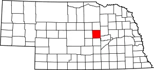 Location within the U.S. state of Nebraska | |
 Nebraska's location within the U.S. | |
| Coordinates: 41°34′N 98°31′W | |
| Country | |
| State | |
| Founded | 1871 (created) 1872 (organized) |
| Named for | Horace Greeley |
| Seat | Greeley |
| Largest village | Spalding |
| Area | |
| • Total | 571 sq mi (1,480 km2) |
| • Land | 570 sq mi (1,500 km2) |
| • Water | 0.8 sq mi (2 km2) 0.1%% |
| Population | |
| • Estimate (2017) | 2,374 |
| • Density | 4.2/sq mi (1.6/km2) |
| Time zone | UTC−6 (Central) |
| • Summer (DST) | UTC−5 (CDT) |
| Congressional district | 3rd |
| Website | www |
In the Nebraska license plate system, Greeley County is represented by the prefix 62 (it had the 62nd-largest number of vehicles registered in the county when the license plate system was established in 1922).
History
Greeley County was created in 1871 and organized in 1872.[3][4][5] It was named after Horace Greeley, a newspaper editor and politician of the mid-19th century. Greeley encouraged western settlement with the motto "Go West, young man".[6][7][8]
Geography
The Cedar River flows southeastward through the NE corner of Greeley County, and the North Loup River flows SSE through the SW corner of the county.
According to the US Census Bureau, the county has a total area of 571 square miles (1,480 km2), of which 570 square miles (1,500 km2) is land and 0.8 square miles (2.1 km2) (0.1%) is water.[9]
Major highways
 U.S. Highway 281
 Nebraska Highway 11
 Nebraska Highway 22
 Nebraska Highway 56
 Nebraska Highway 91
Adjacent counties
- Wheeler County (north)
- Boone County (northeast)
- Nance County (southeast)
- Howard County (south)
- Sherman County (southwest)
- Valley County (west)
Demographics
| Historical population | |||
|---|---|---|---|
| Census | Pop. | %± | |
| 1880 | 1,461 | — | |
| 1890 | 4,869 | 233.3% | |
| 1900 | 5,691 | 16.9% | |
| 1910 | 8,047 | 41.4% | |
| 1920 | 8,685 | 7.9% | |
| 1930 | 8,442 | −2.8% | |
| 1940 | 6,845 | −18.9% | |
| 1950 | 5,575 | −18.6% | |
| 1960 | 4,595 | −17.6% | |
| 1970 | 4,000 | −12.9% | |
| 1980 | 3,462 | −13.4% | |
| 1990 | 3,006 | −13.2% | |
| 2000 | 2,714 | −9.7% | |
| 2010 | 2,538 | −6.5% | |
| 2017 (est.) | 2,374 | [10] | −6.5% |
| US Decennial Census[11] 2012 Estimate[1] | |||
As of the 2000 United States Census,[12] there were 2,714 people, 1,077 households, and 734 families in the county. The population density was 5 people per square mile (2/km2). There were 1,199 housing units at an average density of 2 per square mile (1/km2). The racial makeup of the county was 97.94% White, 0.66% Black or African American, 0.07% Native American, 0.07% Asian, 0.77% from other races, and 0.48% from two or more races. 0.85% of the population were Hispanic or Latino of any race.
There were 1,077 households, out of which 29.30% had children under the age of 18 living with them, 59.00% were married couples living together, 6.40% had a female householder with no husband present, and 31.80% were non-families. 30.50% of all households were made up of individuals, and 18.80% had someone living alone who was 65 years of age or older. The average household size was 2.46 and the average family size was 3.08.
The county population contained 26.90% under the age of 18, 5.90% from 18 to 24, 21.60% from 25 to 44, 22.40% from 45 to 64, and 23.20% who were 65 years of age or older. The median age was 42 years. For every 100 females there were 97.10 males. For every 100 females age 18 and over, there were 92.20 males.
The median income for a household in the county was $28,375, and the median income for a family was $34,159. Males had a median income of $22,036 versus $17,056 for females. The per capita income for the county was $13,731. About 11.90% of families and 14.60% of the population were below the poverty line, including 22.10% of those under age 18 and 10.50% of those age 65 or over.
Communities
- Belfast
- Brayton
- Greeley Center (county seat)
- O'Connor
- Scotia
- Scotia Junction
- Spalding
- Wolbach
- Horace
Politics
Greeley County Residents tend to vote Republican. In only one national election since 1964 has the county selected the Democratic Party candidate.
| Year | Republican | Democratic | Third Parties |
|---|---|---|---|
| 2016 | 77.6% 912 | 17.9% 210 | 4.5% 53 |
| 2012 | 69.2% 820 | 28.7% 340 | 2.1% 25 |
| 2008 | 59.6% 715 | 38.2% 458 | 2.2% 26 |
| 2004 | 69.3% 865 | 28.9% 361 | 1.8% 22 |
| 2000 | 64.1% 839 | 31.8% 416 | 4.2% 55 |
| 1996 | 50.3% 642 | 37.0% 472 | 12.8% 163 |
| 1992 | 41.4% 588 | 30.7% 435 | 27.9% 396 |
| 1988 | 53.1% 763 | 46.6% 670 | 0.4% 5 |
| 1984 | 65.7% 948 | 33.6% 485 | 0.6% 9 |
| 1980 | 63.3% 1,028 | 30.5% 495 | 6.3% 102 |
| 1976 | 46.1% 787 | 51.3% 877 | 2.6% 45 |
| 1972 | 56.9% 1,005 | 43.1% 760 | |
| 1968 | 50.0% 882 | 41.9% 739 | 8.1% 142 |
| 1964 | 37.3% 775 | 62.7% 1,305 | |
| 1960 | 43.2% 960 | 56.8% 1,263 | |
| 1956 | 57.7% 1,240 | 42.3% 910 | |
| 1952 | 62.6% 1,543 | 37.5% 924 | |
| 1948 | 39.6% 829 | 60.4% 1,265 | |
| 1944 | 49.5% 1,242 | 50.5% 1,265 | |
| 1940 | 50.5% 1,530 | 49.5% 1,502 | |
| 1936 | 31.4% 1,107 | 56.4% 1,988 | 12.2% 430 |
| 1932 | 21.8% 817 | 75.7% 2,832 | 2.5% 94 |
| 1928 | 40.9% 1,457 | 58.9% 2,098 | 0.3% 9 |
| 1924 | 26.5% 773 | 41.8% 1,220 | 31.7% 926 |
| 1920 | 51.4% 1,345 | 45.1% 1,180 | 3.6% 93 |
| 1916 | 31.6% 627 | 65.0% 1,289 | 3.4% 68 |
| 1912 | 21.3% 371 | 52.3% 913 | 26.5% 462 |
| 1908 | 38.3% 691 | 59.4% 1,072 | 2.4% 43 |
| 1904 | 54.3% 836 | 29.0% 447 | 16.7% 258 |
| 1900 | 34.2% 463 | 64.9% 880 | 0.9% 12 |
References
- "State & County QuickFacts". United States Census Bureau. Archived from the original on June 7, 2011. Retrieved September 20, 2013.
- "Find a County". National Association of Counties. Archived from the original on 2011-05-31. Retrieved 2011-06-07.
- Burr, George L. (1921). History of Hamilton and Clay Counties, Nebraska, Vol. 1. S.J. Clarke Pub. Co. p. 115.
- Fitzpatrick, Lilian Linder (1925). Nebraska Place-Names. Lincoln: University of Nebraska Studies in Language, Literature, and Criticism. p. 69. Retrieved December 14, 2014.
- "Nebraska Historic Buildings Survey Reconnaissance Survey Final Report of Greeley County, Nebraska" (PDF). Nebraska State Historical Society. August 1, 1992. Retrieved December 14, 2014.
- Josiah Busnell Grinnell (1891). Men and Events of Forty Years. Boston: D. Lothrop. p. 87. Retrieved 13 February 2009.
- Gannett, Henry (1905). The Origin of Certain Place Names in the United States. Govt. Print. Off. p. 143.
- Greeley County. Archived 20 July 2008 at the Wayback Machine Nebraska Association of County Officials. Archived 5 June 2010 at the Wayback Machine Retrieved 14 March 2008.
- "2010 Census Gazetteer Files". US Census Bureau. August 22, 2012. Archived from the original on November 13, 2013. Retrieved December 7, 2014.
- "Population and Housing Unit Estimates". Retrieved 21 January 2019.
- "US Decennial Census". Census.gov. Retrieved September 20, 2013.
- "U.S. Census website". US Census Bureau. Retrieved 31 January 2008.
- Election Results
Places adjacent to Greeley County, Nebraska | ||||||||||
|---|---|---|---|---|---|---|---|---|---|---|
| ||||||||||
Municipalities and communities of Greeley County, Nebraska, United States | ||
|---|---|---|
| Villages | Map of Nebraska highlighting Greeley County | |
| Unincorporated communities | ||
| Footnotes | ‡This populated place also has portions in an adjacent county or counties | |
| ||

| Authority control |
|---|