Knox County, Nebraska
Knox County is a county in the U.S. state of Nebraska. As of the 2010 United States Census, the population was 8,701.[1] Its county seat is Center.[2] Knox County was named for Continental and U.S. Army Major General Henry Knox.[3][4]
Knox County | |
|---|---|
_from_SE_1.JPG.webp) Knox County Courthouse in Center | |
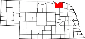 Location within the U.S. state of Nebraska | |
 Nebraska's location within the U.S. | |
| Coordinates: 42°38′N 97°53′W | |
| Country | |
| State | |
| Founded | 1857 |
| Named for | Henry Knox |
| Seat | Center |
| Largest city | Creighton |
| Area | |
| • Total | 1,140 sq mi (3,000 km2) |
| • Land | 1,108 sq mi (2,870 km2) |
| • Water | 31 sq mi (80 km2) 2.8%% |
| Population | |
| • Estimate (2018) | 8,419 |
| • Density | 7.6/sq mi (2.9/km2) |
| Time zone | UTC−6 (Central) |
| • Summer (DST) | UTC−5 (CDT) |
| Congressional district | 3rd |
| Website | www |
In the Nebraska license plate system, Knox County is represented by the prefix 12 (it had the 12th-largest number of vehicles registered in the county when the license plate system was established in 1922).
History
Knox County was organized by the Territorial Legislature in 1857, and named L'Eau Qui Court, that being the French name for the river named by the Ponca Niobrara—both names meaning, in English, Running Water. The name was changed to Knox by a statute passed February 21, 1873, which took effect April 1, 1873.[5][6]
Geography
Knox County lies along the north line of Nebraska. Its north boundary line abuts the south boundary line of the state of South Dakota. The terrain of the county consists of low rolling hills sloped to the northeast; most of the flat terrain is used for agriculture. The Missouri River flows eastward along the county's north boundary line. The Niobrara River enters the county's west boundary, flowing eastward then northward to drain into the Missouri River near the village of Niobrara. A smaller drainage, the Verdigris Creek, flows northward into the county through the western central part of the county, draining into the Niobrara River shortly upstream of that river's mouth.[7] The county has a total area of 1,140 square miles (3,000 km2), of which 1,108 square miles (2,870 km2) is land and 31 square miles (80 km2) (2.8%) is water.[8]
Major highways
Adjacent counties
- Bon Homme County, South Dakota - north
- Yankton County, South Dakota - northeast
- Cedar County - east
- Pierce County - southeast
- Antelope County - south
- Holt County - west
- Boyd County - northwest
- Charles Mix County, South Dakota - northwest
Protected areas
- Bazile Creek State Wildlife Management Area[9]
- Bloomfield Recreation Area
- Deep Water Recreation Area[10]
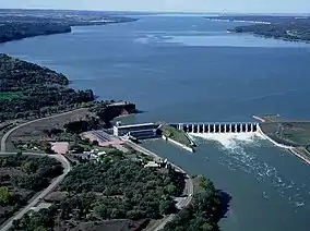
- Lewis and Clark Lake (part)
- Lewis and Clark State Recreation Area
- Miller Creek Recreation Area[11]
- Missouri National Recreational River (part)
- Niobrara State Park
- South Shore Recreation Area
Demographics
| Historical population | |||
|---|---|---|---|
| Census | Pop. | %± | |
| 1860 | 152 | — | |
| 1870 | 261 | 71.7% | |
| 1880 | 3,666 | 1,304.6% | |
| 1890 | 8,582 | 134.1% | |
| 1900 | 14,343 | 67.1% | |
| 1910 | 18,358 | 28.0% | |
| 1920 | 18,894 | 2.9% | |
| 1930 | 19,110 | 1.1% | |
| 1940 | 16,478 | −13.8% | |
| 1950 | 14,820 | −10.1% | |
| 1960 | 13,300 | −10.3% | |
| 1970 | 11,723 | −11.9% | |
| 1980 | 11,457 | −2.3% | |
| 1990 | 9,534 | −16.8% | |
| 2000 | 9,374 | −1.7% | |
| 2010 | 8,701 | −7.2% | |
| 2018 (est.) | 8,419 | [12] | −3.2% |
| US Decennial Census[13] 1790-1960[14] 1900-1990[15] 1990-2000[16] 2010-2013[1] | |||
As of the 2010 United States Census, there were 8,701 people, 3,647 households, and 2,368 families in the county. The population density was 7.9 people per square mile (2.95/km2). The racial makeup of the county was 87.2% White, 0.4% Black or African American, 10% Native American, 0.2% Asian, 0.0% Pacific Islander, and 1.8% from Two or More Races. 2.5% of the population were Hispanic or Latino of any race.
As of the 2000 United States Census,[17] there were 9,374 people, 3,811 households, and 2,595 families in the county. The population density was 8 people per square mile (3/km2). There were 4,773 housing units at an average density of 4 per square mile (2/km2). The racial makeup of the county was 91.63% White, 0.09% Black or African American, 7.12% Native American, 0.16% Asian, 0.04% Pacific Islander, 0.34% from other races, and 0.63% from two or more races. 0.91% of the population were Hispanic or Latino of any race.
There were 3,811 households, out of which 29.30% had children under the age of 18 living with them, 59.00% were married couples living together, 6.00% had a female householder with no husband present, and 31.90% were non-families. 29.90% of all households were made up of individuals, and 17.40% had someone living alone who was 65 years of age or older. The average household size was 2.40 and the average family size was 2.98.
The county population contained 25.50% under the age of 18, 5.50% from 18 to 24, 21.90% from 25 to 44, 23.90% from 45 to 64, and 23.10% who were 65 years of age or older. The median age was 43 years. For every 100 females there were 96.70 males. For every 100 females age 18 and over, there were 95.20 males.
The median income for a household in the county was $27,564, and the median income for a family was $34,073. Males had a median income of $23,373 versus $18,319 for females. The per capita income for the county was $13,971. About 12.50% of families and 15.60% of the population were below the poverty line, including 20.40% of those under age 18 and 13.50% of those age 65 or over.
| Racial composition | 2010[18] | 2000[19] |
|---|---|---|
| White | 87.2% | 92.2% |
| Non-Hispanic | 85.8% | 91.3% |
| Native American | 10% | 7.5% |
| Black or African American | 0.4% | 0.1% |
| Hispanic or Latino (of any race) | 2.5% | 0.9% |
| Asian | 0.5% | 0.2% |
| Two or More Races | 1.8% | 0.6% |
Communities
Cities
Census-designated place
Politics
Knox County voters are strongly Republican. In no national election since 1936 has the county selected the Democratic Party candidate.
| Year | Republican | Democratic | Third Parties |
|---|---|---|---|
| 2016 | 77.5% 3,188 | 17.5% 720 | 5.0% 207 |
| 2012 | 71.5% 2,885 | 26.2% 1,059 | 2.3% 92 |
| 2008 | 66.8% 2,728 | 30.7% 1,255 | 2.5% 101 |
| 2004 | 72.7% 3,062 | 25.8% 1,086 | 1.5% 65 |
| 2000 | 70.0% 2,784 | 26.1% 1,037 | 4.0% 157 |
| 1996 | 53.9% 2,123 | 32.2% 1,266 | 13.9% 549 |
| 1992 | 49.6% 2,113 | 22.7% 968 | 27.8% 1,183 |
| 1988 | 63.8% 2,644 | 35.6% 1,477 | 0.6% 26 |
| 1984 | 73.8% 3,364 | 25.2% 1,149 | 1.0% 47 |
| 1980 | 71.1% 3,404 | 22.1% 1,057 | 6.9% 328 |
| 1976 | 56.1% 2,610 | 41.3% 1,922 | 2.6% 122 |
| 1972 | 72.0% 3,318 | 28.0% 1,289 | |
| 1968 | 68.2% 3,129 | 24.7% 1,131 | 7.2% 328 |
| 1964 | 51.3% 2,752 | 48.7% 2,617 | |
| 1960 | 64.5% 3,847 | 35.6% 2,122 | |
| 1956 | 64.4% 3,814 | 35.6% 2,110 | |
| 1952 | 75.5% 4,840 | 24.5% 1,573 | |
| 1948 | 51.7% 2,778 | 48.3% 2,597 | |
| 1944 | 60.2% 3,762 | 39.8% 2,487 | |
| 1940 | 57.8% 4,352 | 42.2% 3,179 | |
| 1936 | 38.9% 2,949 | 58.7% 4,449 | 2.4% 185 |
| 1932 | 25.7% 1,830 | 73.4% 5,229 | 1.0% 69 |
| 1928 | 55.5% 3,668 | 44.1% 2,914 | 0.5% 32 |
| 1924 | 38.6% 2,405 | 24.6% 1,532 | 36.8% 2,289 |
| 1920 | 69.9% 3,678 | 27.9% 1,470 | 2.2% 116 |
| 1916 | 44.1% 1,910 | 53.8% 2,329 | 2.1% 91 |
| 1912 | 26.6% 1,028 | 46.6% 1,803 | 26.8% 1,037 |
| 1908 | 45.7% 1,871 | 51.4% 2,106 | 2.9% 120 |
| 1904 | 61.5% 2,163 | 24.6% 864 | 13.9% 490 |
| 1900 | 47.8% 1,600 | 48.7% 1,630 | 3.5% 117 |
References
- "State & County QuickFacts". US Census Bureau. Archived from the original on June 7, 2011. Retrieved September 21, 2013.
- "Find a County". National Association of Counties. Archived from the original on 31 May 2011. Retrieved 7 June 2011.
- Gannett, Henry (1905). The Origin of Certain Place Names in the United States. Government Printing Office. p. 177.
- "Knox County". Nebraska Association of County Officials. Retrieved December 19, 2014.
- Fitzpatrick, Lilian Linder (1925). Nebraska Place-Names. Lincoln: University of Nebraska Studies in Language, Literature, and Criticism. p. 88. Retrieved December 19, 2014.
- "Nebraska Historic Buildings Survey Reconnaissance Survey Final Report of Knox County, Nebraska" (PDF). Nebraska State Historical Society. Retrieved December 19, 2014.
- Knox County NE Google Maps (accessed 23 January 2019)
- "2010 Census Gazetteer Files". US Census Bureau. August 22, 2012. Archived from the original on November 13, 2013. Retrieved December 8, 2014.
- Bazile Creek State Wildlife Management Area, Niobrara NE Google Maps (accessed 23 January 2019)
- Deep Water Recreation Area, Crofton NE Google Maps (accessed 23 January 2019)
- Miller Creek Recreation Area, Knox County NE Google Maps (accessed 23 January 2019)
- "Population and Housing Unit Estimates". Retrieved December 26, 2019.
- "US Decennial Census". US Census Bureau. Retrieved December 8, 2014.
- "Historical Census Browser". University of Virginia Library. Retrieved December 8, 2014.
- "Population of Counties by Decennial Census: 1900 to 1990". US Census Bureau. Retrieved December 8, 2014.
- "Census 2000 PHC-T-4. Ranking Tables for Counties: 1990 and 2000" (PDF). US Census Bureau. Retrieved December 8, 2014.
- "U.S. Census website". US Census Bureau. Retrieved 31 January 2008.
- "Knox County NE". State & County QuickFacts. US Census Bureau.
- "U.S. Census website". US Census Bureau. Retrieved November 23, 2018.
- Election Results
External links
Places adjacent to Knox County, Nebraska | |
|---|---|
Municipalities and communities of Knox County, Nebraska, United States | ||
|---|---|---|
| Cities | Map of Nebraska highlighting Knox County | |
| Villages | ||
| Townships | ||
| CDP | ||
| Unincorporated communities | ||
| Indian reservations | ||
| ||
