Bouligneux
Bouligneux is a commune in the Ain department in eastern France, in Dombes, within the Auvergne-Rhône-Alpes region.
Bouligneux | |
|---|---|
.JPG.webp) Chateau | |
 Coat of arms | |
Location of Bouligneux 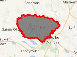
| |
 Bouligneux  Bouligneux | |
| Coordinates: 46°01′23″N 4°59′28″E | |
| Country | France |
| Region | Auvergne-Rhône-Alpes |
| Department | Ain |
| Arrondissement | Bourg-en-Bresse |
| Canton | Villars-les-Dombes |
| Intercommunality | Dombes |
| Government | |
| • Mayor (2014-2020) | Laurent Comtet |
| Area 1 | 26.09 km2 (10.07 sq mi) |
| Population (2017-01-01)[1] | 328 |
| • Density | 13/km2 (33/sq mi) |
| Time zone | UTC+01:00 (CET) |
| • Summer (DST) | UTC+02:00 (CEST) |
| INSEE/Postal code | 01052 /01330 |
| Elevation | 264–301 m (866–988 ft) (avg. 280 m or 920 ft) |
| 1 French Land Register data, which excludes lakes, ponds, glaciers > 1 km2 (0.386 sq mi or 247 acres) and river estuaries. | |
Geography
The Chalaronne forms most of the commune's eastern border.
History
Bouligneux first appears as vicus Beliniacum in 885, in a document of Charles III.
On March 28, 944, Hugues, son or Bermund, lord of Bouligneux and Gisèle, signed a document renouncing any claims on Thoissey, in favor of Adémar, Viscount of Lyon.[2]
In 1280, it belonged to Vaucher de Commarin, who sold it to Henri de Villars in 1290.
In 1402, Bouligneux was part of Bresse Savoyarde.
In the 17th century, Bouligneux was a county.
Population
| Year | Pop. | ±% |
|---|---|---|
| 2006 | 302 | — |
| 2007 | 304 | +0.7% |
| 2008 | 303 | −0.3% |
| 2009 | 308 | +1.7% |
| 2010 | 309 | +0.3% |
| 2011 | 309 | +0.0% |
| 2012 | 310 | +0.3% |
| 2013 | 304 | −1.9% |
| 2014 | 300 | −1.3% |
| 2015 | 309 | +3.0% |
| 2016 | 319 | +3.2% |
See also
References
- "Populations légales 2017". INSEE. Retrieved 6 January 2020.
- Auguste Bernard and Alexandre Bruel, Recueil des chartes de l'abbaye de Cluny [Compendium of Charters from Cluny Abbey]: 6 volumes, vol. 1, Paris, 1876-1903
External links
| Wikimedia Commons has media related to Bouligneux. |
| Authority control |
|
|---|
This article is issued from Wikipedia. The text is licensed under Creative Commons - Attribution - Sharealike. Additional terms may apply for the media files.