Châtenay, Ain
Châtenay is a commune in the Ain department in eastern France.
Châtenay | |
|---|---|
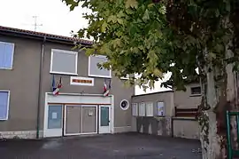 The town hall in Châtenay | |
Location of Châtenay 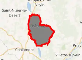
| |
 Châtenay  Châtenay | |
| Coordinates: 46°02′03″N 5°12′07″E | |
| Country | France |
| Region | Auvergne-Rhône-Alpes |
| Department | Ain |
| Arrondissement | Bourg-en-Bresse |
| Canton | Ceyzériat |
| Intercommunality | Dombes |
| Government | |
| • Mayor (2014-2020) | Cyrille Chaffard |
| Area 1 | 14.95 km2 (5.77 sq mi) |
| Population (2017-01-01)[1] | 341 |
| • Density | 23/km2 (59/sq mi) |
| Time zone | UTC+01:00 (CET) |
| • Summer (DST) | UTC+02:00 (CEST) |
| INSEE/Postal code | 01090 /01320 |
| Elevation | 272–317 m (892–1,040 ft) (avg. 300 m or 980 ft) |
| 1 French Land Register data, which excludes lakes, ponds, glaciers > 1 km2 (0.386 sq mi or 247 acres) and river estuaries. | |
Geography
The Veyle flows north through the middle of the commune and forms part of its northern border.
Population
| Year | Pop. | ±% |
|---|---|---|
| 2004 | 335 | — |
| 2006 | 335 | +0.0% |
| 2007 | 336 | +0.3% |
| 2008 | 337 | +0.3% |
| 2009 | 338 | +0.3% |
| 2010 | 352 | +4.1% |
| 2011 | 352 | +0.0% |
| 2012 | 346 | −1.7% |
| 2013 | 339 | −2.0% |
| 2014 | 332 | −2.1% |
| 2015 | 334 | +0.6% |
| 2016 | 333 | −0.3% |
See also
References
- "Populations légales 2017". INSEE. Retrieved 6 January 2020.
External links
| Wikimedia Commons has media related to Châtenay (Ain). |
This article is issued from Wikipedia. The text is licensed under Creative Commons - Attribution - Sharealike. Additional terms may apply for the media files.