Saint-Julien-sur-Reyssouze
Saint-Julien-sur-Reyssouze is a commune in the Ain department in eastern France.
Saint-Julien-sur-Reyssouze | |
|---|---|
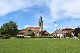 The church in Saint-Julien-sur-Reyssouze | |
Location of Saint-Julien-sur-Reyssouze 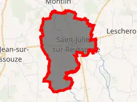
| |
 Saint-Julien-sur-Reyssouze  Saint-Julien-sur-Reyssouze | |
| Coordinates: 46°24′09″N 5°06′43″E | |
| Country | France |
| Region | Auvergne-Rhône-Alpes |
| Department | Ain |
| Arrondissement | Bourg-en-Bresse |
| Canton | Replonges |
| Intercommunality | CA Bassin de Bourg-en-Bresse |
| Government | |
| • Mayor (2020–2026) | Nathalie Ligeron |
| Area 1 | 7.52 km2 (2.90 sq mi) |
| Population (2017-01-01)[1] | 749 |
| • Density | 100/km2 (260/sq mi) |
| Time zone | UTC+01:00 (CET) |
| • Summer (DST) | UTC+02:00 (CEST) |
| INSEE/Postal code | 01367 /01560 |
| Elevation | 182–218 m (597–715 ft) (avg. 192 m or 630 ft) |
| 1 French Land Register data, which excludes lakes, ponds, glaciers > 1 km2 (0.386 sq mi or 247 acres) and river estuaries. | |
Population
|
|
See also
References
- "Populations légales 2017". INSEE. Retrieved 6 January 2020.
| Wikimedia Commons has media related to Saint-Julien-sur-Reyssouze. |
| Authority control |
|
|---|
This article is issued from Wikipedia. The text is licensed under Creative Commons - Attribution - Sharealike. Additional terms may apply for the media files.