Curtafond
Curtafond is a commune in the Ain department in eastern France.
Curtafond | |
|---|---|
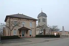 The town hall and church in Curtafond | |
Location of Curtafond 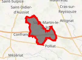
| |
 Curtafond  Curtafond | |
| Coordinates: 46°16′24″N 5°05′22″E | |
| Country | France |
| Region | Auvergne-Rhône-Alpes |
| Department | Ain |
| Arrondissement | Bourg-en-Bresse |
| Canton | Attignat |
| Intercommunality | CA Bassin de Bourg-en-Bresse |
| Government | |
| • Mayor (2008–2014) | Gérard Gallet |
| Area 1 | 12.41 km2 (4.79 sq mi) |
| Population (2017-01-01)[1] | 770 |
| • Density | 62/km2 (160/sq mi) |
| Time zone | UTC+01:00 (CET) |
| • Summer (DST) | UTC+02:00 (CEST) |
| INSEE/Postal code | 01140 /01310 |
| Elevation | 199–227 m (653–745 ft) |
| 1 French Land Register data, which excludes lakes, ponds, glaciers > 1 km2 (0.386 sq mi or 247 acres) and river estuaries. | |
Population
| Year | Pop. | ±% |
|---|---|---|
| 1793 | 604 | — |
| 1800 | 545 | −9.8% |
| 1806 | 626 | +14.9% |
| 1821 | 680 | +8.6% |
| 1831 | 635 | −6.6% |
| 1836 | 682 | +7.4% |
| 1841 | 707 | +3.7% |
| 1846 | 727 | +2.8% |
| 1851 | 760 | +4.5% |
| 1856 | 700 | −7.9% |
| 1861 | 679 | −3.0% |
| 1866 | 687 | +1.2% |
| 1872 | 700 | +1.9% |
| 1876 | 710 | +1.4% |
| 1881 | 707 | −0.4% |
| 1886 | 710 | +0.4% |
| 1891 | 694 | −2.3% |
| 1896 | 647 | −6.8% |
| 1901 | 617 | −4.6% |
| 1906 | 614 | −0.5% |
| 1911 | 613 | −0.2% |
| 1921 | 571 | −6.9% |
| 1926 | 538 | −5.8% |
| 1931 | 554 | +3.0% |
| 1936 | 519 | −6.3% |
| 1946 | 529 | +1.9% |
| 1954 | 469 | −11.3% |
| 1962 | 460 | −1.9% |
| 1968 | 409 | −11.1% |
| 1975 | 382 | −6.6% |
| 1982 | 427 | +11.8% |
| 1990 | 422 | −1.2% |
| 1999 | 590 | +39.8% |
| 2008 | 663 | +12.4% |
See also
References
- "Populations légales 2017". INSEE. Retrieved 6 January 2020.
External links
| Wikimedia Commons has media related to Curtafond. |
This article is issued from Wikipedia. The text is licensed under Creative Commons - Attribution - Sharealike. Additional terms may apply for the media files.
