Saint-Martin-du-Frêne
Saint-Martin-du-Frêne is a commune in the Ain department in eastern France.
Saint-Martin-du-Frêne | |
|---|---|
 Town hall | |
Location of Saint-Martin-du-Frêne 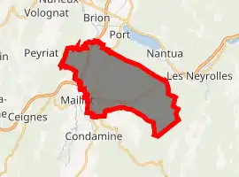
| |
 Saint-Martin-du-Frêne  Saint-Martin-du-Frêne | |
| Coordinates: 46°08′22″N 5°33′11″E | |
| Country | France |
| Region | Auvergne-Rhône-Alpes |
| Department | Ain |
| Arrondissement | Nantua |
| Canton | Nantua |
| Intercommunality | Lac de Nantua |
| Government | |
| • Mayor (2020–2026) | Dominique Turc |
| Area 1 | 19.14 km2 (7.39 sq mi) |
| Population (2017-01-01)[1] | 1,049 |
| • Density | 55/km2 (140/sq mi) |
| Time zone | UTC+01:00 (CET) |
| • Summer (DST) | UTC+02:00 (CEST) |
| INSEE/Postal code | 01373 /01430 |
| Elevation | 476–1,125 m (1,562–3,691 ft) (avg. 516 m or 1,693 ft) |
| 1 French Land Register data, which excludes lakes, ponds, glaciers > 1 km2 (0.386 sq mi or 247 acres) and river estuaries. | |
Population
|
|
See also
References
- "Populations légales 2017". INSEE. Retrieved 6 January 2020.
| Wikimedia Commons has media related to Saint-Martin-du-Frêne. |
| Authority control |
|
|---|
This article is issued from Wikipedia. The text is licensed under Creative Commons - Attribution - Sharealike. Additional terms may apply for the media files.