Poncin
Poncin is a commune in the Ain department in eastern France. It lies on the banks of the river Ain.
Poncin | |
|---|---|
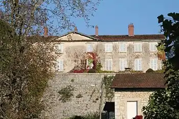 Château de Poncin | |
.svg.png.webp) Coat of arms | |
Location of Poncin 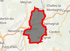
| |
 Poncin  Poncin | |
| Coordinates: 46°05′00″N 5°24′00″E | |
| Country | France |
| Region | Auvergne-Rhône-Alpes |
| Department | Ain |
| Arrondissement | Nantua |
| Canton | Pont-d'Ain |
| Intercommunality | Rives de l'Ain - Pays du Cerdon |
| Government | |
| • Mayor (2020–2026) | Jean-Michel Giroux |
| Area 1 | 19.77 km2 (7.63 sq mi) |
| Population (2017-01-01)[1] | 1,703 |
| • Density | 86/km2 (220/sq mi) |
| Time zone | UTC+01:00 (CET) |
| • Summer (DST) | UTC+02:00 (CEST) |
| INSEE/Postal code | 01303 /01450 |
| Elevation | 240–540 m (790–1,770 ft) (avg. 265 m or 869 ft) |
| 1 French Land Register data, which excludes lakes, ponds, glaciers > 1 km2 (0.386 sq mi or 247 acres) and river estuaries. | |
History
Of strategic importance during medieval times, Poncin is surrounded by city walls that are still in perfect shape despite their age. The village was originally intended to receive the same patronage as Pérouges but the plan never reached fruition.
Population
|
|
See also
References
- "Populations légales 2017". INSEE. Retrieved 6 January 2020.
| Wikimedia Commons has media related to Poncin. |
This article is issued from Wikipedia. The text is licensed under Creative Commons - Attribution - Sharealike. Additional terms may apply for the media files.
