Villeneuve, Ain
Villeneuve is a commune in the Ain department in eastern France.
Villeneuve | |
|---|---|
_-339.jpg.webp) The church in Villeneuve | |
 Coat of arms | |
Location of Villeneuve 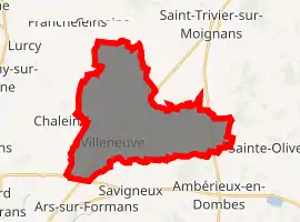
| |
 Villeneuve  Villeneuve | |
| Coordinates: 46°01′19″N 4°50′15″E | |
| Country | France |
| Region | Auvergne-Rhône-Alpes |
| Department | Ain |
| Arrondissement | Bourg-en-Bresse |
| Canton | Villars-les-Dombes |
| Intercommunality | Dombes-Saône-Vallée |
| Government | |
| • Mayor (2020–2026) | David Pommier |
| Area 1 | 26.79 km2 (10.34 sq mi) |
| Population (2017-01-01)[1] | 1,501 |
| • Density | 56/km2 (150/sq mi) |
| Time zone | UTC+01:00 (CET) |
| • Summer (DST) | UTC+02:00 (CEST) |
| INSEE/Postal code | 01446 /01480 |
| Elevation | 230–287 m (755–942 ft) (avg. 264 m or 866 ft) |
| 1 French Land Register data, which excludes lakes, ponds, glaciers > 1 km2 (0.386 sq mi or 247 acres) and river estuaries. | |
Population
|
|
See also
References
- "Populations légales 2017". INSEE. Retrieved 6 January 2020.
| Wikimedia Commons has media related to Villeneuve, Ain. |
This article is issued from Wikipedia. The text is licensed under Creative Commons - Attribution - Sharealike. Additional terms may apply for the media files.