Curciat-Dongalon
Curciat-Dongalon is a commune in the Ain department in eastern France.
Curciat-Dongalon | |
|---|---|
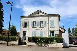 The town hall in Curciat-Dongalon | |
Location of Curciat-Dongalon 
| |
 Curciat-Dongalon  Curciat-Dongalon | |
| Coordinates: 46°28′32″N 5°09′30″E | |
| Country | France |
| Region | Auvergne-Rhône-Alpes |
| Department | Ain |
| Arrondissement | Bourg-en-Bresse |
| Canton | Replonges |
| Intercommunality | CA Bassin de Bourg-en-Bresse |
| Government | |
| • Mayor (2008–2014) | Marie-Laure Cappaz |
| Area 1 | 23.94 km2 (9.24 sq mi) |
| Population (2017-01-01)[1] | 440 |
| • Density | 18/km2 (48/sq mi) |
| Time zone | UTC+01:00 (CET) |
| • Summer (DST) | UTC+02:00 (CEST) |
| INSEE/Postal code | 01139 /01560 |
| Elevation | 187–218 m (614–715 ft) (avg. 216 m or 709 ft) |
| 1 French Land Register data, which excludes lakes, ponds, glaciers > 1 km2 (0.386 sq mi or 247 acres) and river estuaries. | |
Geography
The Sâne Morte forms part of the commune's north-eastern border. The Sâne Vive flows northward through the middle of the commune.
Population
| Year | Pop. | ±% |
|---|---|---|
| 1962 | 773 | — |
| 1968 | 725 | −6.2% |
| 1975 | 575 | −20.7% |
| 1982 | 512 | −11.0% |
| 1990 | 449 | −12.3% |
| 1999 | 404 | −10.0% |
| 2008 | 437 | +8.2% |
See also
References
- "Populations légales 2017". INSEE. Retrieved 6 January 2020.
| Wikimedia Commons has media related to Curciat-Dongalon. |
This article is issued from Wikipedia. The text is licensed under Creative Commons - Attribution - Sharealike. Additional terms may apply for the media files.