Chalamont
Chalamont is a commune in the Ain department in eastern France.
Chalamont | |
|---|---|
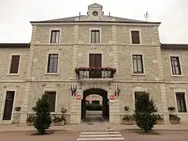 The town hall in Chalamont | |
.svg.png.webp) Coat of arms | |
Location of Chalamont 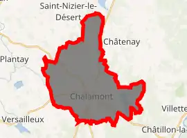
| |
 Chalamont  Chalamont | |
| Coordinates: 45°59′47″N 5°10′19″E | |
| Country | France |
| Region | Auvergne-Rhône-Alpes |
| Department | Ain |
| Arrondissement | Bourg-en-Bresse |
| Canton | Ceyzériat |
| Intercommunality | Dombes |
| Government | |
| • Mayor (2014-2020) | Ali Benmedjahed |
| Area 1 | 32.88 km2 (12.70 sq mi) |
| Population (2017-01-01)[1] | 2,451 |
| • Density | 75/km2 (190/sq mi) |
| Time zone | UTC+01:00 (CET) |
| • Summer (DST) | UTC+02:00 (CEST) |
| INSEE/Postal code | 01074 /01320 |
| Elevation | 269–330 m (883–1,083 ft) (avg. 285 m or 935 ft) |
| 1 French Land Register data, which excludes lakes, ponds, glaciers > 1 km2 (0.386 sq mi or 247 acres) and river estuaries. | |
Geography
Chalamont is located in the Dombes, 10 kilometres (6 mi) north of Meximieux, and occupies the highest point on the Dombes plateau.
The Veyle has its source in the western part of the commune, in the Magnenet pond.
Population
| Year | Pop. | ±% |
|---|---|---|
| 2006 | 2,012 | — |
| 2007 | 2,093 | +4.0% |
| 2008 | 2,236 | +6.8% |
| 2009 | 2,279 | +1.9% |
| 2010 | 2,322 | +1.9% |
| 2011 | 2,365 | +1.9% |
| 2012 | 2,402 | +1.6% |
| 2013 | 2,409 | +0.3% |
| 2014 | 2,408 | −0.0% |
| 2015 | 2,407 | −0.0% |
| 2016 | 2,406 | −0.0% |
See also
References
- "Populations légales 2017". INSEE. Retrieved 6 January 2020.
External links
| Wikimedia Commons has media related to Chalamont. |
| Authority control |
|---|
This article is issued from Wikipedia. The text is licensed under Creative Commons - Attribution - Sharealike. Additional terms may apply for the media files.
